Curated OER
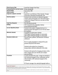
Land Use Change Over Time
Students use historical aerial photographs and current aerial photographs to compare the change over time to the land. For this land changing lesson plan, students analyze, compare, contrast, and list the land change in their own community.
Curated OER
Introducing Topographic Maps: Guiding Students from Concrete Models to Graphic Representations
Young scholars interpret topographic maps and infer human activity as it is influenced by the landscape.
Curated OER
Oil: The Problem or Solution to the World's Economic Future
Young scholars map the major oil producing and consuming countries and regions. They identify current and future topographic and political problems that could affect the production and transportation of oil.
Alabama Learning Exchange
The Sun and the Earth
Third graders study and diagram the positions of the Earth and sun during the four seasons. They predict weather for cities in the northern and southern hemispheres.
Curated OER
Wolves: Friend or Foe?
Students study wolves and their habitat in Yellowstone. For this environment and behavior lesson students create an interactive map of wolves in Yellowstone.
Curated OER
Topographic Connections: Earth's Surface Shapes Streams; Streams Sculpt the Earth
Students identify physical characteristics of developing streams and infer changes in the landscape by creating a river model.
Curated OER
Using Local Geography to Make Maps
Students research, create, and present a scale representation of the county in which they live.
Curated OER
Making Sense Of A Round World On A Flat Surface
Young scholars engage in a lesson that is concerned with the development of geography skills. They take part in a number of activities that center around finding and traveling to different locations. The lesson has resource links that...
Curated OER
Journey to Gettysburg
Students use latitude and longitude to map the path of the Battle of Gettysburg.
Curated OER
Solving the Puzzle
Students create a map showing the United States borders at a specific period in history and produce three questions to be answered by examining the map. They also write a productive paragraph explaining who, what, when, where, how/why a...
Curated OER
My Own Private Idaho; Using Social Studies to Explore Idaho
Students engage in several activities to explore Idaho and Social Studies themes. Using an variety of media, students become familiar with Idaho's geography and geology.
Curated OER
Mapping School Grounds
Learners map and analyze the natural and cultural environment of the school grounds. In small groups, they sketch the natural and cultural features of each side of the school building, create a map, participate in a class discussion,...
Curated OER
Geography And The Revolutionary War
Students gain a deeper understanding of both geography and the Revolutionary War. They practice using on line research in examining historical events and using political, physical, and topographic maps.
Curated OER
Child Labor in the Carolinas
Fifth graders explore child labor and how children were exploited and used in the work place. In this Industrial Revolution lesson, 5th graders research child labor by reading, looking at photographs and drawing conclusions then sharing...
Curated OER
Bob Dylan: No Direction Home
Students hold panel discussions on selected topics about the 1960s and their impact on modern-day events. As visual reinforcement, they watch the film about Bob Dylan and research the music of the period as well as his musical...
Curated OER
The Great MPA Debate
Students study the 'Marine Protected Areas' process. In this ocean lesson students work in groups, conduct research and present it to the class.
Curated OER
How would an oil spill affect a Marine Sanctuary?
Students explore the concept of environmental stewardship. For this science lesson, students discover how scientists assess damages to the environment following oil spills. Students conduct a simulation of a public meeting in order to...
Curated OER
A Powerpoint Presentation On Sustainability
Young scholars are introduced to the important geography concept of sustainability by looking at the Roseau River floods of 2002. They discuss the impact of humans on the environment. They explain how sustainability relates to everyday...
Curated OER
Fractile vs. Equal
Students compare and contrast methods of categorizing data. In this data collection instructional activity, students complete worksheet activities that require them to note the differences between equal and fractile intervals. Students...
Curated OER
Scarcity of Land Throughout the World and in Hawaii
Students discuss the importance of "land." They review the four types of land classification--urban, rural, agricultural and conservation--and participate in an activity involving an apple that demonstrates the use of land in Hawaii....
Curated OER
Theobroma - Food of the Gods
Students discuss the history of cacao and its use in the production of chocolate. They analyze actual cacao pods and record their observations. Finally they create a five minute contour drawing of the cacao pod and seeds.
Curated OER
Trembling, Spewing Earth: Impacts on Human Activity
Seventh graders study to identify patterns in earthquake activity and impacts on human behavior. They also develop plans to cope with such natural disasters.
Curated OER
The Magic of Cranberries
Students research climatic and soil conditions for growing cranberries and illustrate how cranberries grow. They research how cranberries are used past and present and create an a-b-c book on cranberries.
Other popular searches
- Gis Data
- Gis Map
- Gis Software
- Gis Environment
- Gis and Gps Technology
- Gis Gps
- Gis and Remote Sensing
- Gis Data Map
- Geography, Gis
- Gis Lesson Plans
- Gps/gis
- Gis Water


