Curated OER
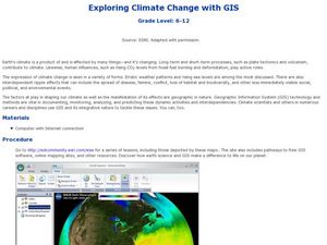
Exploring Climate Change with GIS
Students investigate climatological changes that are occurring to the Earth. In this climate change lesson, students access an assigned web site to view maps and lessons that show how climate change makes a difference to life on Earth.
Curated OER
Stream Gages and GIS
students interpret recent regional-scale climate events based on current stream flow, monitor changes in time, and to consider additional interpretations that could be derived if other data were in map form.
Curated OER
Exploring Folk Traditions and Folk Beliefs
Ninth graders work together to brainstorm an idea to focus on the similiarties and differences between various cultures. Individually, they interview family members using questions they created based on their topic. They use their...
Curated OER
Central America and the Caribbean
Use the library or Internet to find resources on a chosen topic. The class will comprehend the collected information, structure the information with texts and graphics for a presentation. Each presentation focuses on Hispanic culture and...
Arizona Cooperative Extension
Geocaching
Using GPS units, small groups participate in a scavenger hunt to find an object that you have hidden. They use coordinates for stopping points along a pre-planned path to get to the final cache. This is a terrific activity to include in...
Curated OER
Exploring Earthquakes in Space and Time Through the Internet and a Geographic Information System
Students examine the frequency and distribution of earthquake epicenters and compare these epicenters to the distribution of plate boundaries and cities.
Curated OER
Comparing Kwakiutl, Cheyenne and Navajo tribes
Third graders study the difference between the Kwakiutl, Cheyenne and Navajo tribes. They identify the people, resources, lifestyle and beliefs of the Kwakiutl, Cheyenne, and Navajo Indians. Afterward, they present their projects on each...
Curated OER
Indiana Tornado Project
Students become aware of the number of tornadoes that impact Indiana. They explore basic facts about tornadoes. Students use the GIS for research. They explore that natural phenomena in Indiana. Students become familiar with...
Curated OER
Me on the Map Lesson 1
Students use maps, globes, geographic information systems and other
sources of information to analyze the nature of places at a variety of scales. They identify on a map and determine the population
of the city, county, state, country...
Curated OER
Do You Want to Risk it?
Learners investigate the history of natural disaster events for a given county, discuss the impact of population and the risk from natural disaster events. For this hurricane lesson students use a geographic information system to...
Curated OER
Space Age Technology Comes to Earth
Young scholars explore eight career and technical areas and make connections with business, family and consumers, and technology. They examine and describe how agriculture and natural resources impact our quality of life. They explore...
Curated OER
The Inuit Family: A study of its history, beliefs, and images
Students study the Inuit in terms of their geographic location and its influence on their way of life. They investigate Inuit imagery as a reflection of their belief system and focus on the objects of the Inuit to introduce...
Curated OER
Names in the Field: A Simple GPS Field Exercise
Students explore basic methods of GPS data collection, uploading the data to a computer, and making simple maps of their data using GIS software. They create a map of the data using GIS software (or Excel)
Curated OER
GI's, Gals & Gardens
Learners, in groups, design a war participation campaign for a specific audience during WWII. They design posters and prepare an oral presentation for the class.
Curated OER
Absolute Location Using GPS Technology
GPS is great for identifying your position, but is it finding your relative or absolute location? Ninth graders explore the difference between absolute and relative location, use the standard grid system coordinate system, and use GPS to...
Peace Corps
Community
What is a community? Find out with a lesson that sheds light onto the different types of communities—school, local, and global. Scholars read informational text detailing the life of a young girl from Cape Verde and take part in a...
School Improvement in Maryland
Smart Growth
New roads, new businesses, new developments, new mass transit systems. All growth has both positive and negative effects on communities. Government classes investigate the principles of Maryland's 1997 Smart Growth program and the...
Space Awareness
Where on Earth Am I?
Almost every phone has GPS installed, but a large number of teens don't know how the technology works. An initial activity illustrates how GPS determines a location on Earth. Scholars then apply trilateration procedures to a...
Pulitzer Center
The Crisis in the Ivory Coast
Through reading a variety of news articles and other informational texts, learners discover the political turmoil and intense ethnic and religious tensions that envelop the Ivory Coast today. Class members research the historical...
Curated OER
Overland Trails To The West
Consider the political, physical, and geographical factors that led to and marked the Westward Expansion. Learners will track the various routes developed during the 1800's. They create a first person journal describing what they see,...
Curated OER
Re-Presenting Race in the Digital Age
Teen-aged scientists analyze a graphic organizer of how trash is removed from New York City and then answer standard questions about a graph and a diagram. Resources are mentioned, but there are no links to these resources, so you will...
Curated OER
The Mountain Community: Why Flagstaff?
Students identify geographical features that hindered or promoted settlement in the city of Flagstaff, Arizona. For this settlement lesson plan, students write a summary of what they learned and identify geographical features on a map.
Curated OER
Operation Genesis
Students, while working in groups under the Operation Genesis project involve fictional elements of role playing to grasp geographic concepts concerning human/environment interaction. They create the physical features of a fictional...
Curated OER
Wreck Detectives
Junior archaeologists examine types of artifacts from the Bronze Age on the internet. In collaborative groups, they create a story about a ship from this period and then construct a model of the ocean floor after their ship has sunk....
Other popular searches
- Gis Data
- Gis Map
- Gis Software
- Gis Environment
- Gis and Gps Technology
- Gis Gps
- Gis and Remote Sensing
- Gis Data Map
- Geography, Gis
- Gis Lesson Plans
- Gps/gis
- Gis Water


