Curated OER
Comparative Stream Quality
Students examine water quality on a nearby stream. They collect water samples and test for various factors, including any contamination from the treatment plant, and present their information in a Powerpoint presentation.
Curated OER
What's Driving Us?
Learners determine what the people in their community are driving. Using traffic flow information, they develop recommendations on how to achieve sustainability. They calculate the carbon dioxide emission index for various sites and...
Curated OER
The Arctic and Taiga Ecozone of Canada
Young scholars examine the various sub-regions of the Arctic and Taiga zones in Canada. Using the online Canadian Atlas, they locate and describe the characteristics of each zone. They organize their information into a chart and share...
Curated OER
Mapping My Community
Ninth graders are introduced to GPS technology. They complete fieldwork as they visit a specific area of their community to identify and map types of land use in the surveyed area. They use the collected data to create a digital map.
Curated OER
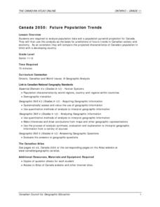
Canada 2050: Future Population Trends
Students analyze population data and a population pyramid projection for Canada. Using this information, they predict what the future trends in the population might be and its effect on Canadian society as a whole. They compare and...
Curated OER
What Can Be Done to Improve Ha'iku Town Shopping Areas?
Second graders examine different areas to determine how they can be improved. They observe and collect data concerning different problems and use a map to record their information. After analyzing the data, they develop possible...
Curated OER
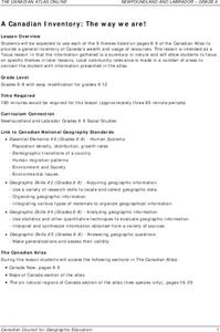
A Canadian Inventory: The Way We Are!
Students use the Canadian Atlas to discover an inventory of Canada's wealth and usage of resources. Using charts and graphs, they produce a wall of selected data of importance to the country and identify one issue of sustainability. ...
Curated OER
When is Dinner Served? Predicting the Spring Phytoplankton Bloom in the Gulf of Maine (College Level)
Students are able to explain the ecological importance of phytoplankton. They describe the components that influence a phytoplankton bloom. Students interpret satellite images in order to correlate buoy data.
Curated OER
Geography, Energy, and the Twenty-First Century
Students examine the past and present effects of energy sources on geography in the 21st century. They compare/contrast energy consumption and production in the U.S. and the world, make predictions for future energy consumption, and...
Curated OER
Where Has It Been? Tracking the Ivory-Billed Woodpecker
By studying the assumed extinction, and subsequent rediscovery of the Ivory-billed Woodpecker, learners use maps and come up with a scenario for the rediscovery of the bird. This incredibly thorough lesson plan is chock-full of...
Curated OER
The Growth of Islam
Seventh graders gain insight into the daily lives of Muslims and to develop empathy for them by studying the Islamic world and creating presentations.
Curated OER
Introduction to World Religions - Christianity
Sixth graders explore Christianity. In this world religions lesson, 6th graders listen to a lecture about the attributes of the religion and then listen to and then conduct independent research on Christianity. Students also complete a...
Curated OER
Regions: Meet the Experts Presentation
Students gather information and create a web site on prairies and plains using a variety of resources, including the internet.
Curated OER
Ideas and Commodities Cross Cultural Regions
Students compare and contrast how commodities native to certain countries have impacted the economies of other nations. After gathering information regarding how commodities are grown and traded, students use their information to...
Curated OER
Yaks, Yurts, and Yogurt: A Look at China's Autonomous Regions
Students are introduced to five Chinese geographical areas. They, in groups, research these areas and develop presentations including information on the physical characteristics, climate, elevation, agriculture and language.
Curated OER
Crossing China By Sampan
Sixth graders determine the geographic features that facilitate and prevent communication and commerce between parts of China. They recognize a sampan, the traditional flat-bottomed boat used in Southeast Asia.
Curated OER
The Aral Sea: A Time for Change
Ninth graders investigate the physical changes in the Aral Sea from the year of 1960. They conduct research to find information. Students compare and contrast the changes caused by human activity over the years. They create their own...
Curated OER
Problems Encountered by Surveyors of Arkansas
Fifth graders examine the six geographic regions of Arkansas by examining the problems encountered by surveyors in Arkansas after the Louisiana Purchase. They conduct Internet research, create a chart, and write an essay comparing two...
Curated OER
China
Students explore the geography, culture and history of China. As a class, they discuss historical contributions to China, Confucius, and geographic features of the country. Pupils use the internet to answer questions about China.
Curated OER
Where In The World?
Students review the proper terms for maps and various geographical features. In groups, they create a topographical map and label all geographic features in a given area. They present this material to the class and answer any questions...
Curated OER
Who We Are: To Know the Characteristics of a Population Within Certain Domains
Learners, through research, discover the characteristics of the population of Quebec and compare them to those of Canada as a whole. They create a class presentation about information they found.
Curated OER
Introduce Others to a Woman Who Changed the World
Students research an important woman and share her story with others. The report can serve as a public service announcement to be read over the school public address system, or a short, informative speech delivered in one of your classes.
Curated OER
Upholding Community Values Leadership, Government and Kings
Learners analyze political systems of African cultures. In this political systems lesson, students compare and contrast the political systems of African cultures by studying objects of art for the values of the governments. Learners...
Curated OER
From Home to School, GPS Style
Young scholars are introduced and increase proficiency in the use of the hand held GPS system. They explore the meaning of longitude and latitude lines, then identify the parts of the map.
Other popular searches
- Gis Data
- Gis Map
- Gis Software
- Gis Environment
- Gis and Gps Technology
- Gis Gps
- Gis and Remote Sensing
- Gis Data Map
- Geography, Gis
- Gis Lesson Plans
- Gps/gis
- Gis Water


