Curated OER
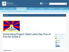
Dalai Lama
Sixth graders use skills and knowledge that they gained from their Tibet unit to formulate a final product of their Tibet journey. This study covers topics such as Tibet's geographical location, religious beliefs, customs, dress, and way...
Curated OER
What's Russia To Do?
Students watch a PowerPoint presentation on the Gulag system in Russia. In groups, they use the internet to create maps on climate and population pyramids for the country of Russia. They must use this information and develop a plan to...
Curated OER
Cruisin' the Counties: Learning Counties and Major Roads in Arizona
Students examine Arizona counties and use the themes of location and movement to develop an Arizona map.
Curated OER
Go West My Class
Students find data that can be mapped on the Factfinder Web page. They analyze the data from the web site and state recommendations on whether a person should live in Illinois or not based on their preferences.
Curated OER
What's Driving Us?
Learners determine what the people in their community are driving. Using traffic flow information, they develop recommendations on how to achieve sustainability. They calculate the carbon dioxide emission index for various sites and...
Curated OER
Wolves: Friend or Foe?
Students study wolves and their habitat in Yellowstone. For this environment and behavior lesson students create an interactive map of wolves in Yellowstone.
Curated OER
Treasure Hunters
High schoolers design an on campus treasure hunt to find various architectural vocabulary words which they then create definitions for on the blog page on the Environmental Design website.
Curated OER
What Can Be Done to Improve Ha'iku Town Shopping Areas?
Second graders examine different areas to determine how they can be improved. They observe and collect data concerning different problems and use a map to record their information. After analyzing the data, they develop possible...
Curated OER
Canada 2050: Future Population Trends
Students analyze population data and a population pyramid projection for Canada. Using this information, they predict what the future trends in the population might be and its effect on Canadian society as a whole. They compare and...
Curated OER
A Canadian Inventory: The Way We Are!
Students use the Canadian Atlas to discover an inventory of Canada's wealth and usage of resources. Using charts and graphs, they produce a wall of selected data of importance to the country and identify one issue of sustainability. ...
Curated OER
Who We Are
Learners analyze population data and trends in Canada over a given amount of time. As a class, they are introduced to the concept of dependency load and use a population pyramid to calculate the figure. Using the internet, they...
Curated OER
Agriculture, Weather, Economy and Indiana
Fourth graders, in groups, investigate the role of weather in Indiana's farming economy. They make a prediction as to weather and its effect on the economy of Indiana. They present their data using a media presentation of data...
Curated OER
So -- What's Happening Here? On this Old Christmas Tree Farm
Students take a field trip to an old Christmas tree farm near their school. In groups, they gather data at the site and analyze the data in an attempt to discover what happened to the area. They identify human activities that led to the...
Curated OER
City Bound
Fifth graders identify the reasons for people migrating to cities after the Civil War. Using population data, they discover why populations in cities rose while rural populations fell during 1860 to 1900. They discuss the impact a...
Curated OER
Making Sense Of A Round World On A Flat Surface
Young scholars engage in a lesson that is concerned with the development of geography skills. They take part in a number of activities that center around finding and traveling to different locations. The lesson has resource links that...
Curated OER
Microclimates of Our School
Students read the story "Weslandia" by Paul Fleischman, define the term microclimate, gather and record data in various places on school grounds to establish the presence of difference microclimates, analyze and compare microclimates,...
Curated OER
Land Use Over Time
Students view aerial photos and topographic maps of their local area. They compare and contrast major land use patterns over time by comparing these images to maps that are at least 50 years old. They analyze them using the four land use...
Curated OER
Where We Live
Students analyze Canada's population distribution. They access online information to gather demographic information about two Canadian cities. They compare and contrast the quality of life in the two cities and present their findings.
Curated OER
About the U.S.A.
Students research the United States and discover its different climate zones, geographical features, animal life, and various cultures. Students complete a research chart using books, encyclopedias and the internet and present their...
Curated OER
What is Climate?
Students explore the differences between climate and weather. In this introductory lesson of a climate unit, students discuss the vocabulary and concepts associated with weather and climate. They build their information base for the...
Curated OER
Our Native Americans
Students complete a unit of lessons on Native Americans. They label maps, list resources the Native Americans used in their daily lives, create an original short story, define key vocabulary, and develop a model of something that...
Curated OER
Site vs. Situation: Location! Location! Location!
Students examine places with a similar latitude to Alabama, and discuss the importance of a location's site versus its situation. They analyze maps, create a chart, and write a paragraph on the difference between site and situation.
Curated OER
Southern Agriculture and the Slave Trade
Students examine the relationship between agriculture and the slave trade during the 1860s. In groups, they research how two factors led to the explosion of slavery in the Southern United States. Using maps, they answer comprehension...


