Curated OER
Postcards from the Edge: Endangered Species
Students use the internet to identify the endangered species in their state. Using this information, they create a postcard with a picture of the animal along with facts. They discuss the main reasons to protect the endangered species...
Curated OER
About the U.S.A.
Students research the United States and discover its different climate zones, geographical features, animal life, and various cultures. Students complete a research chart using books, encyclopedias and the internet and present their...
Curated OER
Habitat Cards
Students discuss the relationship between a habitat and the environment. In groups, they use the internet to research the relationship between the animals and the habitat on their card. They present their information to the class to...
Curated OER
Volcanoes, Earthquakes, and Tsunamis
Students work in groups to research a tsunami, earthquake, or volcano. They use the internet to find information, and create a presentation. Each presentation should include a definition of their phenomenon, an illustration, three or...
Curated OER
Atlas Scavenger Hunt
Young scholars discover what type of information in an atlas by participating in a scavenger hunt. With a partner, they try to find the answers to many questions as possible. They exchange their papers with another partner group and...
Curated OER
Japan
Students locate Japan's absolute and relative location on a globe and various maps. They describe Japan's various regions and islands and their system of education, customs and religion. They assess Japan's impact on our society.
Curated OER
Welcome to New York State
Pupils choose one region of New York state, and create a travel brochure that includes information such as geographical features, tourist attractions, accesibility, economic features, and historical events that occured in that region.
Curated OER
Living Swamps, Bayous and Forests
Third graders explore interesting environments by exploring Louisiana. For this wetland lesson, 3rd graders utilize the web to research the State of Louisiana, the bayous in the area, and the Gulf of Mexico. Students write a journal...
Curated OER
Aboriginal Peoples And The Universals of Culture
Sixth graders research specific features of a province or territory of Canada. In this Canadian history lesson, 6th graders identify aboriginal culture areas on a map, identify cultural features represented in their region, and...
Curated OER
How Does Climate Affect Your Environment?
Students access the Global Sun Temperature Project website and research the relationship between the location and climate of a participating school to its building structure. They consider how climate affects the type of structures...
Curated OER
Creation Mythology
Students construct a map from geographic data and explain relationships found in the information. Students identify ancient beliefs and customs through Hawaiian creation myths while comparing similarities and differences and appreciating...
Curated OER
Destination New York City
High schoolers identify the physical characteristics of New York City and it's attraction to tourists from around the world. They recognize how the physical environment can affect the development of a city. They identify the major...
Curated OER
Bringing the Rain to Kapiti Plain
Students analyze the story Bringing the Rain to Kapiti Plain geographically, and explain the term climate and discuss its relevance in the story as well as to their own lives.
Curated OER
World Geography: Smart Cities
Students are able to analyze how a variety of cities both in the USA and abroad have worked to improve human health and environment. They combine their prior knowledge of previous lessons and apply that knowledge to compare how each...
Curated OER
Community Map of The Giver
Students read "The Giver" after finishing the unit on inventions and inventors. Using the information in the novel, they develop a geographic map illustrating the community in the story. They identify human and physical features and...
Curated OER
MAP GRIDS, CLIMATES AND HEMISPHERES
Students compare/contrast the grid and latitude/longitude system used on a globe. They describe the areas which are considered to be a tropical, temperate, and polar, based on knowledge of climates.
Curated OER
Antarctica
Third graders become familiar with Antarctica, the Earth's southernmost continent, by researching its environment and inhabitants. They reference maps, conduct Internet research, identify animals, create graphs and write reports.
Curated OER
Controlling the Flow of the Colorado River: A Study of Dams
Students research and map the Colorado River and its dams and predict the effects of a dam on an area. They suggest reasons a dam would be built and compare the Colorado River system with other major river systems within the US and...
Curated OER
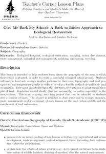
Give Me Back My School: A Back to Basics Approach to Ecological Restoration
Ninth graders research local geography to create successful, ecological school landscaping. They determine soil type, average weather patterns and temperature graphs and use the information to select ideal plants and plant maintenance...
Curated OER
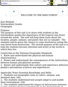
Welcome to the Rain Forest
Fourth graders become aware of the worlds rain forest and study the plants of the rain forest and the adaptations they have made to survive in the environment.
Curated OER
What is Climate?
Students explore the differences between climate and weather. In this introductory lesson of a climate unit, students discuss the vocabulary and concepts associated with weather and climate. They build their information base for the...
Curated OER
What Can Be Done to Improve Ha'iku Town Shopping Areas?
Second graders examine different areas to determine how they can be improved. They observe and collect data concerning different problems and use a map to record their information. After analyzing the data, they develop possible...
Curated OER
Terrestrial Ecozones, Population Density and Species at Risk
Tenth graders navigate and use the online Atlas of Canada. They explain the cause and effect relationship between human settlement and the natural environment and wildlife species. They utilize a worksheet imbedded in this plan.
Curated OER
The Arctic and Taiga Ecozone of Canada
Students examine the various sub-regions of the Arctic and Taiga zones in Canada. Using the online Canadian Atlas, they locate and describe the characteristics of each zone. They organize their information into a chart and share it with...


