Curated OER
The Hajj: Muslim Pilgrimage in a Geographic Perspective
Students read information on the Hajj. They discuss pilgrimage and ways it differs from going to a church, mosque or synagogue. Students discuss logistical problems that might be posed for the host country of a pilgrimage. Students do an...
Curated OER
Assessing and Making Maps
Students evaluate maps using the TODALSIGs basic map analysis system, explained on the worksheet. They create a map of Alaska using TODALSIGs. Students brainstorm the elements of maps.
Curated OER
Is the Hudson River Too Salty to Drink?
Students explore reasons for varied salinity in bodies of water. In this geographical inquiry lesson, students use a variety of visual and written information including maps, data tables, and graphs, to form a hypothesis as to why the...
Curated OER
Got Park? Or if you build it, they will come!
Students use GIS and GPS technology to evaluate, research, locate, and recommend where a new park should be located that benefit the community.
Curated OER
Teaching Modeling Water Quality
Students explore the basics of interpreting RUSS temperature and oxygen profile data. They are introduced to the Geographic Information Systems (GIS), particularly with respect to interpreting maps.
Curated OER
The American Trail System
Students research a trail system. They create a display board of the trail system, generate a map of the trail system, and develop a commercial advertising of the trail system. They design a display board featuring facts about the...
Curated OER
Using Local Geography to Make Maps
Students research, create, and present a scale representation of the county in which they live.
Curated OER
Donde en el mundo estas?
Students give & follow directions given in Spanish, using oral, written and graphics. They use maps, globes, atlases, and remote sensing, GIS, and GPS to acquire and process information about places.
Curated OER
Mapping the Halifax Explosion
Students research the Halifax Explosion using historical maps.
Curated OER
What in Our World Affects the Way People Live
Sixth graders study various maps that show geographical features and population. They compare the maps and make inferences about how various geographical features influence the population and human activities of an area.
Curated OER
MAP GRIDS, CLIMATES AND HEMISPHERES
Students compare/contrast the grid and latitude/longitude system used on a globe. They describe the areas which are considered to be a tropical, temperate, and polar, based on knowledge of climates.
Curated OER
Weather Pals
Students study maps of the United States to locate weather pals from a list of schools. They communicate with Weather Pal schools through the use of closed circuit TV. Using weather data collected in their area, they exchange the...
Arizona Cooperative Extension
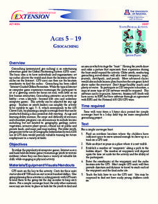
Geocaching
Using GPS units, small groups participate in a scavenger hunt to find an object that you have hidden. They use coordinates for stopping points along a pre-planned path to get to the final cache. This is a terrific activity to include in...
Curated OER
Solving the Puzzle
Students create a map showing the United States borders at a specific period in history and produce three questions to be answered by examining the map. They also write a productive paragraph explaining who, what, when, where, how/why a...
Teach Engineering
What's Wrong with the Coordinates at the North Pole?
Here is an activity that merges technology with life skills as individuals use Google Earth to explore the differences between coordinate systems and map projections. The self-guided worksheet is the fourth segment in a nine-part unit....
Curated OER
Park Problems
Students calculate park acreage and map the distribution of parks in Austin, TX using GIS. Students use a specific website to find the information.
Curated OER
Mapping Population Changes In The United States
Students create a choropleth map to illustrate the population growth rate of the United States. They explore how to construct a choropleth map, and discuss the impact of population changes for the future.
Curated OER
Is there a map in that story?
Eighth graders examine different pieces of literature from specific isolated Pacific islands. For this Geography lesson, 8th graders read and interpret a written selection. Students construct a map of the stories setting.
Curated OER
Map of the Ottawa Valley
Students locate Ottawa Valley on a map. They then answer questions in reference to the map such as: What was the first use of timber in the Ottawa Valley?, What occurred first in Gatineau?, and On the Ontario side of Ottawa River, how...
Curated OER
Journey to Gettysburg
Students use latitude and longitude to map the path of the Battle of Gettysburg.
Curated OER
Exploring Earthquakes in Space and Time Through the Internet and a Geographic Information System
Students examine the frequency and distribution of earthquake epicenters and compare these epicenters to the distribution of plate boundaries and cities.
Curated OER
Comparing Kwakiutl, Cheyenne and Navajo tribes
Third graders study the difference between the Kwakiutl, Cheyenne and Navajo tribes. They identify the people, resources, lifestyle and beliefs of the Kwakiutl, Cheyenne, and Navajo Indians. Afterward, they present their projects on each...
Curated OER
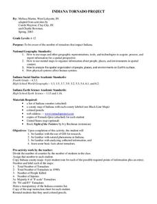
Indiana Tornado Project
Students become aware of the number of tornadoes that impact Indiana. They explore basic facts about tornadoes. Students use the GIS for research. They explore that natural phenomena in Indiana. Students become familiar with...
Curated OER
What do Maps Show?
Eighth graders practice the skill of reading maps. In this geography lesson, 8th graders participate in a classroom lecture on how to read a map.


