Curated OER
The American Trail System
Students research a trail system. They create a display board of the trail system, generate a map of the trail system, and develop a commercial advertising of the trail system. They design a display board featuring facts about the...
Curated OER
Using Local Geography to Make Maps
Students research, create, and present a scale representation of the county in which they live.
Curated OER
Donde en el mundo estas?
Students give & follow directions given in Spanish, using oral, written and graphics. They use maps, globes, atlases, and remote sensing, GIS, and GPS to acquire and process information about places.
Curated OER
Mapping the Halifax Explosion
Students research the Halifax Explosion using historical maps.
Curated OER
What in Our World Affects the Way People Live
Sixth graders study various maps that show geographical features and population. They compare the maps and make inferences about how various geographical features influence the population and human activities of an area.
Curated OER
MAP GRIDS, CLIMATES AND HEMISPHERES
Students compare/contrast the grid and latitude/longitude system used on a globe. They describe the areas which are considered to be a tropical, temperate, and polar, based on knowledge of climates.
Curated OER
Weather Pals
Students study maps of the United States to locate weather pals from a list of schools. They communicate with Weather Pal schools through the use of closed circuit TV. Using weather data collected in their area, they exchange the...
Arizona Cooperative Extension
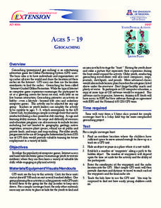
Geocaching
Using GPS units, small groups participate in a scavenger hunt to find an object that you have hidden. They use coordinates for stopping points along a pre-planned path to get to the final cache. This is a terrific activity to include in...
Curated OER
Solving the Puzzle
Students create a map showing the United States borders at a specific period in history and produce three questions to be answered by examining the map. They also write a productive paragraph explaining who, what, when, where, how/why a...
Curated OER
Park Problems
Students calculate park acreage and map the distribution of parks in Austin, TX using GIS. Students use a specific website to find the information.
Curated OER
Mapping Population Changes In The United States
Students create a choropleth map to illustrate the population growth rate of the United States. They explore how to construct a choropleth map, and discuss the impact of population changes for the future.
Curated OER
Is there a map in that story?
Eighth graders examine different pieces of literature from specific isolated Pacific islands. For this Geography lesson, 8th graders read and interpret a written selection. Students construct a map of the stories setting.
Curated OER
Map of the Ottawa Valley
Students locate Ottawa Valley on a map. They then answer questions in reference to the map such as: What was the first use of timber in the Ottawa Valley?, What occurred first in Gatineau?, and On the Ontario side of Ottawa River, how...
Curated OER
Journey to Gettysburg
Students use latitude and longitude to map the path of the Battle of Gettysburg.
Curated OER
Exploring Earthquakes in Space and Time Through the Internet and a Geographic Information System
Students examine the frequency and distribution of earthquake epicenters and compare these epicenters to the distribution of plate boundaries and cities.
Curated OER
Comparing Kwakiutl, Cheyenne and Navajo tribes
Third graders study the difference between the Kwakiutl, Cheyenne and Navajo tribes. They identify the people, resources, lifestyle and beliefs of the Kwakiutl, Cheyenne, and Navajo Indians. Afterward, they present their projects on each...
Curated OER
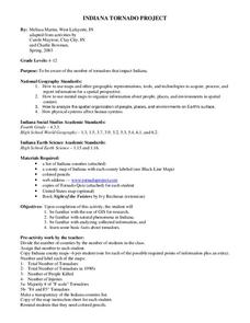
Indiana Tornado Project
Students become aware of the number of tornadoes that impact Indiana. They explore basic facts about tornadoes. Students use the GIS for research. They explore that natural phenomena in Indiana. Students become familiar with...
Curated OER
What do Maps Show?
Eighth graders practice the skill of reading maps. In this geography lesson, 8th graders participate in a classroom lecture on how to read a map.
Curated OER
Mapping Roxaboxen
Fourth graders read Roxaboxen and draw a map of the Roxaboxen community. In this language arts and geography lesson, 4th graders use specifications given, adding features to the map as described in the book and creating a legend.
Geophysical Institute
Latitude and Longitude with Google Earth
Travel the world from the comfort of your classroom with a lesson that features Google Earth. High schoolers follow a series of steps to locate places all over the earth with sets of coordinates. Additionally, they measure the distance...
Curated OER
Storm Clouds-- Fly over a Late Winter Storm onboard a NASA Earth Observing Satellite
Students study cloud data and weather maps to explore cloud activity. In this cloud data lesson plan students locate latitude and longitude coordinates and determine cloud cover percentages.
Curated OER
Where Am I, and How Do I Get Where I am Going?
Students describe geographical places through art, music, writing, and math. They compile information in booklets which may be published.
Curated OER
Names in the Field: A Simple GPS Field Exercise
Students explore basic methods of GPS data collection, uploading the data to a computer, and making simple maps of their data using GIS software. They create a map of the data using GIS software (or Excel)
Curated OER
Expanding Children's Geographic and Economic Worlds
Students learn their addresses and gain a sense of connection between their neighborhood and the rest of the world and the universe.


