Curated OER
What Is That Bubblin¿¿¿ In My Back Yard?
Students create a map plotting local sites the Environmental Protection Agency has on its EPA Regulated Sites list. They discuss the need for citizens to, at a minimum, be aware of potential pollution hazards in their community.
Curated OER
Different Perspectives of Oregon's Forest Economic Geography
Students map data on employment in wood products manufacturing in Oregon counties. In this Oregon forest instructional activity, students discover the percentage of people employed in the forest manufacturing industry. Students create a...
Curated OER
Treasure Hunt - Geography and Cultural Diversity along the Journey to the West
Pupils work in groups and use treasure cards and maps to go on a treasure hunt to several regions in China. They prepare a presentation on the geography and culture of the area that they are assigned to.
Curated OER
Land Use Over Time
Students view aerial photos and topographic maps of their local area. They compare and contrast major land use patterns over time by comparing these images to maps that are at least 50 years old. They analyze them using the four land use...
Curated OER
Marine Protected Areas
Students design a research project about a Marine Protected Area they chose. For this marine biology lesson, students gather fish count and catch data then graph them. They create an information poster about their findings.
Curated OER
From North to South...Quebec's Forest Regions
Middle schoolers identify and describe the different regions of Canada. With a focus on the forest regions, they use an atlas to locate the ecozones. They identify the characterstics of the climate and vegetation and the relationship...
Curated OER
Radiation Comparison Before and After 9-11
Using the NASA website, class members try to determine if changes could be detected in cloud cover, temperature, and/or radiation measurements due to the lack of contrails that resulted from the halt in air traffic after the attacks of...
Aurora Trust
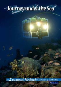
Journey Under the Sea
Discover the interesting world of maritime archaeology and explorations under the sea with this nice set of worksheets, which cover such topics as search tools and techniques of underwater archaeology, carbon dating, vessel types, and...
Curated OER
Where We Live
Students analyze Canada's population distribution. They access online information to gather demographic information about two Canadian cities. They compare and contrast the quality of life in the two cities and present their findings.
Curated OER
About the U.S.A.
Students research the United States and discover its different climate zones, geographical features, animal life, and various cultures. Students complete a research chart using books, encyclopedias and the internet and present their...
Curated OER
The Physical Geography of Australia, Oceania, and Antarctica
Pupils access information from the United States Geological Survey's Web site This Dynamic Earth to research the Ring of Fire. They answer four questions and then apply what they have learned to create a bulletin board display.
Curated OER
Atlas Scavenger Hunt
Students discover what type of information in an atlas by participating in a scavenger hunt. With a partner, they try to find the answers to many questions as possible. They exchange their papers with another partner group and check...
Curated OER
Volcanoes, Earthquakes, and Tsunamis
Middle schoolers work in groups to research a tsunami, earthquake, or volcano. They use the internet to find information, and create a presentation. Each presentation should include a definition of their phenomenon, an illustration,...
Curated OER
Habitat Cards
Students discuss the relationship between a habitat and the environment. In groups, they use the internet to research the relationship between the animals and the habitat on their card. They present their information to the class to...
Curated OER
Characteristics of Snakes and Turtles
Students compare and contrast snakes and turtles, then fill out an information sheet.
Curated OER
Welcome to New York State
Students choose one region of New York state, and create a travel brochure that includes information such as geographical features, tourist attractions, accesibility, economic features, and historical events that occured in that region.
Curated OER
Measuring Distance and Area in Satellite Images (College Level)
Students are able to download, install, and use Image J image analysis software to quantify change over time in satellite images. They access and download satellite images for specific locations and times. Students set a scale (spatial...
Curated OER
Japan
Students locate Japan's absolute and relative location on a globe and various maps. They describe Japan's various regions and islands and their system of education, customs and religion. They assess Japan's impact on our society.
Curated OER
Temperature and Daily Life: Mexico City and Indianapolis
Students compare the effect of temperature on daily life of a citizen in Mexico City, Mexico with that of a citizen of Indianapolis, Indiana.
Curated OER
MEDIEVAL SUB-SAHARAN AFRICA
Seventh graders examine the area of medieval Sub-Saharan Africa through eyes of travelers in the company of one of history's greatest travelers, Ibn Battuta. The project has been structured to include all the State standards for this unit.
Curated OER
Designing a Tropical Reserve System
Students explain the complexity of resource, land use, and conservation decisions.
Curated OER
"Where in the World is my School?"
Students learn new vocabulary and discuss what GPS is and does. They locate their school using the equipment.
Curated OER
Louisiana Purchase
Students use maps to locate and describe the area purchased by the Louisiana Purchase. In groups, they write a letter to Thomas Jefferson in which they evaluate the topography, climate and geography of the land. They determine the land's...


