Curated OER
Westward Ho: The Difficulties of Emigrants Moving West
Students research the journey west of 19th century emigrants. In this pioneer lesson, students read the letters and diaries of a fictitious family traveling on the Oregon Trail. They mark their route on a US map, create a chart showing...
Curated OER
Creation Mythology
Students construct a map from geographic data and explain relationships found in the information. Students identify ancient beliefs and customs through Hawaiian creation myths while comparing similarities and differences and appreciating...
Curated OER
Controlling the Flow of the Colorado River: A Study of Dams
Students research and map the Colorado River and its dams and predict the effects of a dam on an area. They suggest reasons a dam would be built and compare the Colorado River system with other major river systems within the US and...
Curated OER
Bringing the Rain to Kapiti Plain
Learners analyze the story Bringing the Rain to Kapiti Plain geographically, and explain the term climate and discuss its relevance in the story as well as to their own lives.
Curated OER
An Ancient Greek and Roman Festival
Third graders label a map of ancient Greek and Roman civilizations and do a written report on one element of these two cultures. They participate in discussions of food, farming, daily life and government (among others). Students use the...
Curated OER
Land Use in Australian Agriculture
Seventh graders research and map agricultural practices of Australia. They complete a worksheet about their research.
Curated OER
A Geography and Ecology Lesson for Grades 4-7
Students explore many of the unusual geographical features of the Amazon River region, and explain the importance of preserving the tropical rainforest.
Curated OER
Landmarks in Paris
Third graders create a map of France. They use computers to view an "in flight" movie about Paris. They research Paris using books and the internet. Students practice using the program "Comic Life." They import illustrations for each of...
Curated OER
Wet Water, Dry Land
Students observe and examine relationship between landforms and bodies of water, recognizing differences between them. Students then define island, peninsula, isthmus, archipelago, lake, bay, straight, system of lakes, and identify land...
Curated OER
Antarctica
Third graders become familiar with Antarctica, the Earth's southernmost continent, by researching its environment and inhabitants. They reference maps, conduct Internet research, identify animals, create graphs and write reports.
Curated OER
Macbeth Madness
Students participate in various social studies activities in correlation to William Shakespeare's Macbeth. In this Macbeth lesson plan, students study maps of Scotland, England, and Norway to identify locations mentioned in Macbeth....
Curated OER
How Can We Locate Specific Places On Earth?
Second graders discover how to use longitude and latitude to locate specific sites on Earth. They compare old and new ways of locating specific places, and discover how latitude and longitude coordinates are used to locate places on Earth.
Curated OER
What is Climate?
Students explore the differences between climate and weather. In this introductory lesson of a climate unit, students discuss the vocabulary and concepts associated with weather and climate. They build their information base for the...
Curated OER
The Russian Revolution
Students complete a matching game based on geographic features of Russia and label a map with these features. In this geography and politics lesson, students identify resources and populations in Russia and complete a T-Chart on a video...
Curated OER
Hurricanes and Climate
Students investigate maps and data to learn about the connections between hurricanes and climate. In this exploratory lesson students describe and graph the 6 regions where hurricanes happen and discuss how hurricanes have changed over...
Curated OER
Our Native Americans
Students complete a unit of lessons on Native Americans. They label maps, list resources the Native Americans used in their daily lives, create an original short story, define key vocabulary, and develop a model of something that...
Curated OER
Human Migration in the United States
Students investigate the factors involved in human migration in the United States. Students analyze maps of different regions in the United States to determine how a variety of factors influence human settlement and development.
Curated OER
Give Me Back My School: A Back to Basics Approach to Ecological Restoration
Ninth graders research local geography to create successful, ecological school landscaping. They determine soil type, average weather patterns and temperature graphs and use the information to select ideal plants and plant maintenance...
Curated OER
No Friends but the Mountains: A Simulation on Kurdistan
Students read background information on the people of Kurdistan and explore the geographical, political and ethnic history of the region. They participate in a debate where they role-play various points of view in the conflict.
Curated OER
Exploring Islamic Lands
Students explore the culture of the Middle East. In this Islamic culture lesson, students conduct research to create personal narratives that reveal what life is like in the Middle East for Islamic teens today.
Curated OER
Introduction to World Religions
Sixth graders compare and contrast the world religions. In this cultural practices instructional activity, 6th graders locate places in the world where Buddhism, Christianity, Judaism, Hinduism, and Islam are practiced.
Curated OER
Go West My Class
Students find data that can be mapped on the Factfinder Web page. They analyze the data from the web site and state recommendations on whether a person should live in Illinois or not based on their preferences.
Curated OER
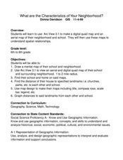
What Are The Characteristics of Your Neighborhood?
Students make a mental map of their neighborhood. Using a software program, they make an aerial and digital map of their school and locate their school on given maps. In groups, they calculate the distances to various locations and...
Curated OER
Site vs. Situation: Location! Location! Location!
Students examine places with a similar latitude to Alabama, and discuss the importance of a location's site versus its situation. They analyze maps, create a chart, and write a paragraph on the difference between site and situation.


