Curated OER
Colorado
Third graders complete a variety of activities to increase their knowledge of Colorado. They make leafprints, read and listen to stories, write fiction, make collages, participate in discussions and invite their parents to come and see...
Curated OER
Hawaii
Fourth graders become knowledgeable about Hawaii the state and Hawaii the island. They also work on reading maps of the islands. They come to know the customs, climates and other fun little facts. They also come to know the eight islands.
Curated OER
Native Americans and Topography at Rose Bay
Students visit a wetland ecosystem. While they are there, students explore how to read topography maps of Rose Bay.
Curated OER
Explore Three-Dimensional Shapes
Students are assigned to shape groups and explore three-dimensional shapes. They review math skills and two-dimensional shapes.
Curated OER
Walking that Line
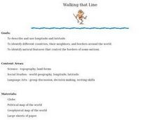
Students attempt to describe and use longitude and latitude. They will identify different countries, their neighbors, and borders around the world. Included in the lesson the students identify natural features that control the borders of...
Curated OER
Home: the Story of Maine "A Love for the Land": Where Are You? Who Are You?
Students investigate their neighborhood both as it is now and as it was 100 years ago. They take a walk around their neighborhood and fill out a worksheet before completing a worksheet.
Curated OER
Latitude
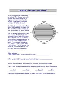
In this latitude worksheet, students answer questions about latitude that include absolute locations of countries and coordinates. Students complete 12 questions.
Curated OER
Locate and Name the bodies of water and the continents
Second graders locate the equator, bodies of water, and different continents on a globe. In this globe lesson plan, 2nd graders recall geographical information on a globe.
Alabama Learning Exchange
Coral Reefs
Study explore coral reefs. For this coral reef lesson, 4th graders examine the physical structure of coral reefs. Students consider why coral reefs need to be protected and ways to protect them.
Curated OER
Oceans of the World
Second graders demonstrate their ability to find the five oceans on a globe and on a world map and relate their knowledge of mountains and other physical characteristics of land masses to the physical characteristics of the ocean floor.
Curated OER
Water Quest
Students visit the Hydrology Study Site, conduct a visual survey to discover info about local land use and water quality, and document their findings by mapping the water body. They use this investigation to raise questions for further...
Curated OER
BIGGER AND BIGGER: (We Live in a family, a neighborhood, a city, and the United States)
Students discover that they are part of bigger and bigger groups. They begin with families and work up to belonging to North America as they initiate a study of the whole country.
Curated OER
Water Walk
Students follow the appropriate sampling protocol and take two measurements of a local water source. These measurements are Transparency and Temperature. This info about local land use and/or water chemistry issues may require further...
Curated OER
Rooster's Night Out
First graders complete interdisciplinary activities associated with a folktale from Cuba. In this Cuban folktale lesson, 1st graders read the Rooster's Night Out, before completing comprehension worksheets, make recipes, and...
Curated OER
Why Not Visit My Country?
Students research a country using the Travel Languages Web site. Using MS Publisher, they create a travel flyer about the country. Using Inspiration, they develop a concept map of what they learned about their country.
Curated OER
And the Rains Came Down: A South American Rainforest
Students examine the characteristics of a South American tropical rainforest. They analyze maps, develop graphs, listen to the book, The Great Kapok Tree, and create a rainforest mural.
Curated OER
Rosie's Walk
Students use maps and globes to locate and describe locations, directions and scale. Using the maps, they identify man made or natural features of different environments. They practice using geographical terms to describe a specific...
Curated OER
Community Cartography
Students use an inflatable globe which they wrap in plastic wrap. They use a permanent marker and outline the continents, and label major oceans and trace the equator. Students bring heir globes and use their projection for a discussion...
Curated OER
The Exploration and Settlement of North America
Learners locate place in Canada and explore highlights of early of early American exploration and settlement. In this North American history instructional activity, students locate provinces, major cities, and physical features of...
Curated OER
All Things Chinese-- Building a Classroom Museum
Learners explore China. In this introduction to Chinese culture lesson plan, students bring in items or pictures from home that represent Chinese culture. Learners create a "Chinese museum" by putting these labeled items on display,...
Curated OER
Thematic Unit on Cats
Students discover in which climates the cats of the world live in. They review the different climates of the world and use maps and globes to help them locate continents.
Curated OER
Antarctica
Third graders become familiar with Antarctica, the Earth's southernmost continent, by researching its environment and inhabitants. They reference maps, conduct Internet research, identify animals, create graphs and write reports.
Curated OER
Naviagational Tools
Fifth graders create a compass, with the help of written instructions and then write six sentences discussing how compasses work and why they are helpful. They discuss the different types of navigational tools and how they are helpful.
Curated OER
What Do We Know About Africa?
First graders explore Africa, its geography and climate. After completing a KWL chart, 1st graders locate Africa on a globe and discuss how its location on the earth affects its climate. Using the Internet and a given fact sheet,...


