Curated OER
Learning to Swim in Swaziland
Students explore everyday life in Swaziland and compare and contrast it to their own everyday life.
Curated OER
Children in the United States and Japan
Students locate Japan on a map or globe and describe the relative location of Japan. They use the Internet to investigate cultural characteristics of children in the United States and in Japan. They use a Venn Diagram as an...
Curated OER
Explorers of the Mighty North
Learners access the Internet to research the journey made by Rear Admiral Peary and Matthew Alexander Henson to the North Pole. They locate the North Pole on maps and globes. They present oral reports to classmates on their research.
Curated OER
Latitude
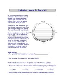
For this latitude worksheet, students answer questions about latitude that include absolute locations of countries and coordinates. Students complete 12 questions.
Curated OER
Math Fraction Hunt
What a fun way to practice fractions! Your class engages in a fraction hunt in which they use words to find clues to a treasure hidden in the classroom. The treasure, in this case is a Mars bar. However, it could be anything, including a...
Curated OER
Honing in on Hummingbirds
Students explore ruby-throated hummingbirds. In this cross-curricular hummingbirds lesson, students listen to the book The Mystery of the Missing Hummingbirds and choose related topics to research with a partner. Students draw or...
Curated OER
Using MY NASA DATA to Determine Volcanic Activity
Students explore how aerosols are used in science to indicate volcanic activity and how biomass burning affects global aerosol activity. Students access data and import into MS Excel using graphical data to make inferences and draw...
Montana State University
Meet Mount Everest
Learning about one landform might seem boring to some, but using the resource provided practically guarantees scholar interest. The second in a sequential series of eight covering the topic of Mount Everest includes activities such as a...
Curated OER
Weather/ Seasons Chart
After reviewing weather expressions with your Spanish scholars, have them do some research: what is the weather like in different parts of the world? They can choose up to four different cities to compare with the local weather of their...
Curated OER
Using 4 main directions in a classroom
Students use the four directions of a compass rose to locate classroom features. In this directions lesson plan, students locate the features by identifying directions.
Curated OER
Tear the Continents
Students tear paper into representative continent shapes and configure them with world oceans through relative location, direction and latitude and longitude starting points. They recognize the shape of the continents. Students recognize...
Curated OER
Let the Sun Shine In: Energy Conservation
Young scholars create a project applying their math skills as they discuss energy conservation. In this geometry lesson, students define vocabulary relating to the environment and energy conservation. They construct a building that allow...
Curated OER
The O Zone-Code Read Alert
What are the effects of an air quality alert? Expert groups receive one component of air quality information resources to study. Pupils then jigsaw into new groups and share their knowledge. Finally, they draft a statement of what they...
Howard Hughes Medical Institute
EarthViewer
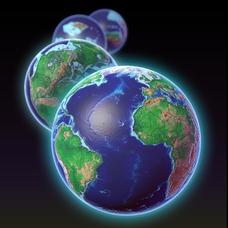
Can you imagine Washington DC and London as close neighbors occupying the same continent? Learners will be fascinated as they step back in time and discover the evolution of the earth's continents and oceans from 4.5 billion...
Curated OER
Transportation
Engage in an 8-day study of different modes of transportation. Your students explore the concept of location and define the physical characteristics of places, such as, land forms, bodies of water, natural resources, and weather.
Curated OER
A Comparison of Cloud Coverage Over Africa
Students use a NASA satellite data to contrast amounts of cloud coverage over different climate regions in Africa. They explore how Earth's major air circulations affect global weather patterns, and relate to local weather patterns.
Curated OER
Baseball Challenge - Basic Geography Skills
A fabulous presentation/activity based on geography. The author has designed a "baseball game" where batters advance to the next base if they correctly answer a multiple choice question about geography. Geographic terms are used, along...
Curated OER
Esperanza Rising - Anticipation Guide
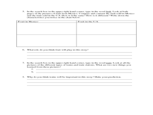
Learn about Mexican culture while simultaneously strengthening reading, writing and computer skills. In order to get the most out of Esperanza Rising, pupils should have prior knowledge of Mexican culture. Therefore, there are links to a...
Curated OER
The 1:1 Transition: What to Read Before You Implement
Capitalize on the wisdom, experience, and recommendations of those who have blazed the 1:1 trail.
Curated OER
It's All in the Pattern
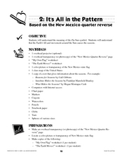
Here is a fantastic, nine-page, multi-session lesson plan on the Zia Sun Symbol (found on the New Mexico state flag), and the seasons of the Earth. Everything you need to implement the instructional activity is here, and the many...
Curated OER
Matthew Henson
Discuss the work of Matthew Henson, an African American who traveled to the North Pole with Robert Peary. After reading the story "Matthew Henson" by Maryann N. Weidt, learners answer questions by drawing inferences and conclusions,...
National Geographic
Measuring Elevation Past and Present
After viewing a short video about a climb up Mount Everest, high schoolers read about triangulation for measuring distant elevations. Have your class work in groups to construct an inclinometer and then use it to measure the height of...
Roy Rosenzweig Center for History and New Media
Continental Differences
Students break into groups and closely investigate primary sources associated with the seven different continents. After deciding which continent their primary sources relate to, representatives from each group present their...
August House
The Archer and the Sun
Reinforce reading comprehension with a instructional activity about The Archer and the Sun, a Chinese folktale. Kids learn some background information about Chinese culture before reading the story, and answer literacy...
Other popular searches
- Maps and Globes
- Comparing Maps and Globes
- Reading Maps and Globes
- Communities Maps and Globes
- Examining Maps and Globes
- Using Maps and Globes
- Free Maps and Globes
- Maps and Globes Activity
- Maps and Globes Migration
- Maps & Globes
- Maps, Globes and Atlases
- Maps Skills and Globes


