Curated OER
Garb and Grub Across the Globe
First graders discuss what part of the world their ancestors came from. They locate the locations on a map and discuss the differences and similarities of each continent and their people. They become familiar with the traditional...
Curated OER
Globe Game
Learners are arranged into groups and are given a map or globe. Students select a location on the map. Learners as yes and no questions to guess the specific place that was chosen.
Curated OER
Continents
Students investigate World Geography by researching the different continents. In this Asian Geography lesson, students discuss the continent of Pangaea and color a worksheet of the continents. Students locate China on the map worksheet...
Curated OER
Exploring Maps: Lesson 2 Guide: Navigation
Students explore and examine how maps have been used in navigation. They research how travelers collected observations to keep track of their positions and plotted information on maps. Each student then makes a Mercator projection...
World Maps Online
Introduction to the World Map
Students identify the differences between maps and globes. In this map skills instructional activity, students are shown a globe and a map and recognize the differences. Students use post-it notes to locate several locations on the world...
Curated OER
World Map and Globe - Lesson 15 (K-3)
Students discover mountain ranges and their locations in the world. In this physical map lesson, students locate and identify major mountain ranges of the world on a large physical map.
Curated OER
Welcome to My World!
Students use maps to locate information. They read the story, "It Looked Like Spilt Milk", view images of the continents and discuss the various continents. Afterward, they make their own Atlas to record information that they can later...
Curated OER
Where in the world is...
Pupils identify locations around the world. For this mapping lesson, students place tag board pieces with names of locations on a wall map of the world. Initially, pupils identify states, then cities, then continents, eventually adding...
Curated OER
World Map and Globe
Students locate and identify continents and countries. In this world map lesson, students locate and identify one country on each continent.
Curated OER
Globe Lesson 6 - Longitude - Grade 6+
In this longitude worksheet, students read a 3-paragraph review of longitude and respond to 13 short answer questions.
Curated OER
Exploring the World's Geography
Students discuss the seven continents of Earth and the diverse geography. After discussion, they create their own paper-mache globes which properly display all seven continents, the equator, and the prime meridian. They conduct research...
Curated OER
2nd Grade - Act. 22: The World Game
Second graders play World Game to become more familiar with continents, oceans, countries and states.
Curated OER
Exploring an Atlas
Students explore global geography by participating in an atlas activity. In this countries of the world lesson plan, students collaborate in small groups and analyze an atlas while researching continents, countries and demographics....
Curated OER
Around the World in 5 Days
Students explore continents, draw map, discuss cultures, use research to learn geography, and investigate cultures.
Curated OER
Geography Puzzles
Students study the continents of the world. In this Internet geography instructional activity, students connect to online mapping games. Students collaborate in order to develop their understanding of world geography, including countries...
Curated OER
Welcome to the Americas
Students research and map the North and South American continents. In this geography lesson on the Americas, students can locate North, Central and South American countries and states. Students choose a location to research and prepare a...
Curated OER
Cacao Tree Geography
Learners use a map to learn about where chocolate comes from. In this lesson on the cacao tree, students locate various regions where the cacao tree grows. They will discuss why the cacao tree grows more favorably in particular climates...
Curated OER
Mexico: One Land, Many Cultures
Students, through a variety of activities, discover the geography and culture of Mexico. They make maps, read folktales, write a journal, create pinatas and other artistic pieces, and review the history of Mexico.
Curated OER
Map Making
Students use a tennis ball and paper to construct a student-made globe. They sketch in continents and major map features and then compare a flat map to a globe.
Curated OER
Where in the World Is ...
Learners locate and place countries and continents on a large map using tag board and yarn. They locate a new geographic location on the map each morning.
Curated OER
Making a Globe
Students examine the mercator projection or nautical chart and observe how global maps do not have the same distance as flat maps. They design handmade globes using the meridians and equator as guides to draw in the land. They paint and...
Curated OER
Geography: Continents
First graders identify basic geographical facts about the world they live in and distinguish between land and water on a globe. They research the continents and information associated with each one focusing on building their map skills.
Curated OER
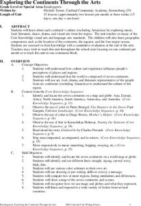
Exploring the Continents Through the Arts
Students examine the continents and explore geographic components in the fifteen lessons of this unit. The location of the continents, the equator, the four major oceans, and the music, food, literature, dance, and drama from each of the...
Curated OER
Mapping West Virginia
Fourth graders explore West Virginia. In this Unites States geography lesson, 4th graders discuss the type of land and the cities in West Virginia. Students create two overlays, with transparencies, that show the natural land and the...


