It's About Time
Volcanic Hazards: Airborne Debris
Pupils interpret maps and graph data related to volcanic ash. Then they analyze the importance of wind speed and the dangers of the ash to both life, air temperature, and technology.
Curated OER
Dark Skies: Volcanic Contribution to Climate Change
Students examine how volcanic eruptions affect global climate. They listen to first-hand accounts of the effects of a large volcanic eruption and illustrate a landscape to show understanding. They experiment with the loss of light and...
NASA
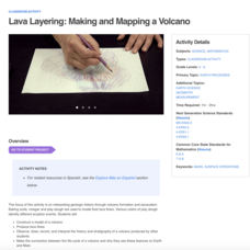
Lava Layering: Making and Mapping a Volcano
Looking for an out-of-this-world volcanic activity? Geologists study Earth's volcanic history and the neighboring planet Mars by modeling volcanic eruptions, lava flows, and building a shield volcano. Participants use graph paper and...
Curated OER
Regents High School Examination: Physical Setting Earth Science 2006
Test your class on earth science with this extensive resource. This test, created by The University of the State of New York Regents, is made up of 50 multiple choice questions and 32 short answer questions that cover the branches of...
Curated OER
Volcanic Activity in the U.S.
Young scholars locate and map ten volcanoes in United States, create chart comparing volcanoes by last eruption, type of volcano, location, and interesting fact, and create Powerpoint slide show describing basic
information about...
Curated OER
Using My Nasa Data To Determine Volcanic Activity
Students use NASA satellite data of optical depth as a tool to determine volcanic activity on Reunion Island during 2000-2001. They access the data and utilize Excel to create a graph that has optical depth as a function of time for the...
Curated OER
Shake, Rattle, and Roll: Mt. St. Helens - Lesson Plan 2
Students compile information on volcanic activity at Mount St. Helens. In this earth science activity, students use the information they gathered on Mount St. Helens to answer questions and create charts in Excel. Then...
Curated OER
Seismic Calendar
High schoolers discover how often earthquakes happen in a region of their choice. In this science lesson, students use online resouces to help them do their investigations. High schoolers make their own map of their region and show how...
Curated OER
The Little Ice Age - Understanding Climate and Climate Change
Fourth graders receive data about tree ring records, solar activity, and volcanic eruptions during the Little Ice Age (1350-1850). From this data, they draw conclusions about possible natural causes of climate change
Curated OER
Creeping
Students observe, measure, and graph a model of slow down slope movement representing soil creep. This task assesses students' abilities to collect, record, and organize data, set up graph axes, plot data points, draw line graphs, apply...
Curated OER
Ocean Botttom Profile
Young scholars interpret a graph of ocean depths and topographic features. This task assesses students' abilities to interpret figures, organize and represent data, apply knowledge of scale to a profile, and apply theoretical knowledge.
Scholastic
Hill of Fire Teaching Plan
Some books are perfect for drawing connections between multiple subjects. The book Hill of Fire becomes the hub for three very different, yet related activity ideas. First the class hones their oral language skills by creating an...
Curated OER
Show What You Know!
In this earthquakes worksheet, students create a brochure, poster, or other form of presentation to show what they know about earthquakes. Students complete 4 sections.
Curated OER
My Habitat Address
Sixth graders draw a habitat and write about what they would need to survive in the habitat. They define the input of items such as materials, energy, and information, and what goes out of the habitat. They play a "Habitat Address" game,...
Curated OER
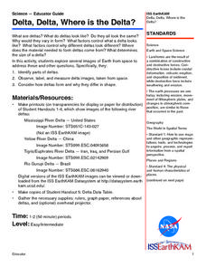
Delta, Delta, Where is the Delta?
Students explore several images of Earth from space. They identify parts of deltas. They observe, label, and measure delta images, taken from space. They consider how deltas form and why they differ in shape.
Curated OER
Probing Under the Surface
Eighth graders use a measuring stick to determine the shape of the inside of the bottom of a box, then apply their knowledge to an additional situation. This task assesses students' abilities to make simple observations, collect and...
Curated OER
Volcanoes, Earthquakes, and Tsunamis
Students work in groups to research a tsunami, earthquake, or volcano. They use the internet to find information, and create a presentation. Each presentation should include a definition of their phenomenon, an illustration, three or...
Curated OER
Down on the Ocean Floor
Learners build a map of the Atlantic Ocean floor and mark the different depths. In this ocean floor lesson plan students identify parts of the ocean floor that they created and discuss patterns that they see.
Climate Literacy
Clean: Mt. Pinatubo and the Atmosphere
This lesson explores the impact of volcanic eruptions on the atmosphere. Young scholars will analyze three types of visual information: a graph of aerosol optical depth v. global temperature, a global map with temperature anomalies, and...


