Curated OER
Maps Can Help Us
First graders explore the geography of Montana by analyzing geographic maps of the area. In this Native American reservation lesson plan, 1st graders discuss the similarities and differences between reservations in the state of Montana....
Curated OER
Introduction to the United States Map
Students explore the United States using a map. In this map lesson plan, students discover how to use a United States map and a globe to locate places.
Curated OER
Map Keys
Third graders examine maps and map keys. In this locating map features instructional activity, 3rd graders use crayons, markers and colored pencils to label maps. Students work in partners to read map keys and locate given places and...
Curated OER
Bell Live! The Great Lakes: A Superior Adventure
Students participate in a virtual field trip to Lake Superior. In groups, they perform experiments in which test the level of toxins and bacteria in the water. They also watch video segments life in the lake and discuss their observations.
Curated OER
Exploring Earth Through Maps and Technology
In this maps worksheet, students read 3 pages of detailed information about maps, latitude, longitude, topography, satellites and global positioning. Students then answer 10 questions. There is also a research project assignment available.
Curated OER
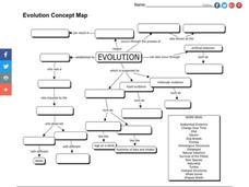
Evolution Concept Map
In this evolution concept map worksheet, 7th graders use the vocabulary terms related to evolution to complete the evolution concept map.
Curated OER
The Great Lakes Plain Regions
Fourth graders explore the Great Lakes Plain region of Indiana. They discuss the key differences in the three regions of Indiana. Students discuss the landmarks, resources and other attributes of the Great Lakes Plain region and they...
Curated OER
Michigan Cities Map Quiz
In this online interactive geography learning exercise, students examine a map of Michigan and identify the 14 noted cities on the map using a pull down menu within 3 minutes.
Curated OER
Introduction to the United States Map
Students identify the United States of America and it's states on a map. In this mapping lesson, students examine a globe and find the United States as well as a few land marks (Florida and the Great Lakes). Students then look at a...
Curated OER
North American Biomes
In this Science worksheet, students color a biome map of North America. Students color the map by solving the clues listed on a separate sheet of paper.
Curated OER
North America, Then and Now
Students identify ocean, lake, gulf, and continent on maps of North America from 1845 and the present, and identify Pacific and Atlantic Oceans, the Great Lakes, and the Gulf of Mexico on maps of North America from 1845 and the present.
Curated OER
The Aztecs - Mighty Warriors of Mexico
Upper elementary learners identify the Aztecs as the builders of a great city and rich civilization in what is now Mexico. They locate the Aztec Empire and its capital on a map and place the Aztecs in the chronology of American history....
American Physiological Society
Sticky Adaptations A Lesson on Natural Selection
Now you see it, now you don't! The stick bug exhibits the ability to disappear into a wooded environment. Why does this adaptation manifest in some species, but not in others? Life science learners explore animal adaptations in nature...
Curated OER
Navigation
Young scholars explain that globes are the best way to show positions of places, but flat maps are portable and can show great detail. They make a mercator projection of the route Lewis and Clark took on their journey.
Syracuse University
Erie Canal
While canals are not the way to travel today, in the first half of the nineteenth century, they were sometimes the best way to move goods and people. Scholars examine primary sources, including maps and pictures, to investigate the role...
Curated OER
Exploring Great Salt Lake Ecosystem
Fourth graders determine the Great Salt Lake is a unique, thriving, and diverse ecosystem. They engage in an actual or a virtual field trip. They record field trip, whether actual or virtual, in science lab book or journal and...
Curated OER
Reading a Map
Third graders become familiar with the vocabulary and skills related to mapping. In this guided reading lesson plan, 3rd graders find proper nouns on from the map. Students read Goldilocks. Students make...
Curated OER
Marquette and Joliet Explore the Mississippi in 1673
Students locate and name the St. Lawrence River, the five Great Lakes, and the Mississippi River on a modern map. They find Quebec, Michilimackinac, Wisconsin, and Chicago on that map. They find the same places on a 1681 map.
Curated OER
Students Slide to School on Air-Powered Sled
Students locate the Great Lakes on a US map, then read a news article about a sled being used as a wintertime school bus in Wisconsin. In this current events lesson, the teacher introduces the article with a map and vocabulary activity,...
Curated OER
Michigan Food: From Farm to You
Students recognize Michigan on a map and understand how its climate is affected by the Great Lakes. In this Michigan food lesson, students play a trivia game to identify the produce of Michigan. Students relate the climate in each part...
Curated OER
Summertime Travel
Third graders write about a summer event they participated in. In this paragraph writing lesson, the teacher models how to write about a place they have visited. Students then write their own paragraphs. Students will point out on...
Curated OER
An Early American Culture
Students identify the locations of the Hopewell culture. In this map skills instructional activity, students use a globe to mark several locations of the Hopewell culture.
Curated OER
A Coin Out of Water
Students examine the Michigan state quarter and identify land and water on the quarter. They locate the Great Lakes and other bodies of water on a map. They compare and contrast streams, rivers, ponds, lakes, and oceans.
Curated OER
Globe Skills Lesson 7 The Transcontinental Railroad
Students explore the Transcontinental Railroad. In this geography skills activity, students use map skills in order to locate legs of the Transcontinental Railroad on globes.


