Curated OER
Biome Map
In this biomes learning exercise, students color the map of North America according to the biome clues. Students then answer questions about the North American biomes.
Curated OER
Mystery State #5
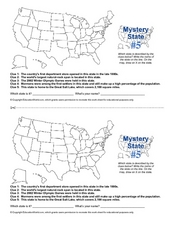
In this mystery state worksheet, students answer five clues to identify the state in question. They then locate that state on a map.
Curated OER
Asia Crossword
In this geography instructional activity, students complete a crossword puzzle on the continent of Asia. They answer 21 questions related to the type of government systems found, capital cities, deepest lake, and lowest population density.
Curated OER
Geography Worksheet
In this geography skills worksheet, students respond to 14 short answer questions by using maps and atlases. The maps and atlases are not included.
Curated OER
Marine Protection Areas
Students explain the importance of having Marine Protected Areas. In this ecology lesson, students research MPA's in any of the Great Lakes. They play a MPA simulation game and identify MPA's on the map.
Curated OER
A Sense of Location: The Mental Map
Learners consider the ways a mental maps of geographic landmarks can help migrating animals stay on the correct course.
Curated OER
Twelfth Night: Thrusting Greatness Upon the Television 1
Learners create skits based on pairs of words. In this Twelfth Night lesson, students create a cluster map in which they brainstorm a dialogue/scene based on their word pair. Learners perform and record their scenes and discuss...
Curated OER
Route Map Lesson Plan
Students read and make a route map by following step by step directions. They identify and make legends.
Curated OER
Regions of Utah - Mapping
Fourth graders draw a rudimentary map of the state of Utah, dividing it into the three regions: the Great Basin, the Colorado Plateau, and the Rocky Mountain Region.
Curated OER
The World's Last Great Wilderness (Antarctica)
It's a shame that there are no photographs in this presentation because the information is fascinating! Each identically fashioned slide contains bullet points of information about Antarctica that will enhance an earth science...
Michigan Sea Grant
Fish Habitat and Humans
Strict habitat requirements are needed for the survival of fish populations and fish variety in the Great Lakes. Young scientists become experts in the basic needs of fish and understand how survival necessities can vary with different...
Curated OER
The Geography of the United States
Full of bright maps and interesting information, this presentation details U.S. Geography. Slides include basic facts about size, regions, topography, and demographics, as well as fascinating trivia about the United States, including...
Curated OER
The Gender of Nouns
A great handout for middle-schoolers learning nouns and their genders, this resource is comprehensive and easy to read. Consider providing some practice opportunities for your learners while you review the information.
California Historical Society
Understanding California
Here is a beautiful handout through which learners can explore the history of California, from the earliest Europeans to visit the Golden State up through its experiences during the Great Depression and position in the modern...
Curated OER
The Wave - A Science Lesson Plan
Learners investigate the geography surrounding the Great Salt Lake and the three main benches in the area. For this Great Salt Lake lesson, students read a background for the areas geography and make their own beach to analyze wave...
Curated OER
Why Do Geese Fly South For the Winter?
Fifth graders examine migration by tracing animal migration routes on a map. In this animal life lesson, 5th graders observe a map of North America and read about the migration patterns of geese. Students trace the path most...
Curated OER
Path Map for the Lake Bonneville Flood
Students use a digital atlas of Idaho to explore the effects of the Lake Bonneville Flood. They become familiar with how floods shape our earth and change landscapes. Students graph a a timeline of the rise and fall of Lake Bonneville.
Curated OER
Soar to Salt Lake City
Pupils improve their cardio-respiratory fitness and to learn about our country. They move (skip, jog, walk, slide, gallop, etc.) for 2 minutes (approximately .2 mile). Fourth graders calculate our weekly mileage and are responsible for...
Curated OER
Mystery State # 5
Mystery state number five is none other than Utah! Quiz your kids on state knowledge while building deductive reasoning skills. They use each of the five clues to determine the name of the mystery state. A great warm up when studying...
Curated OER
The Four-Color Problem: Concept and Solution
Take a walk through time, 1852 to 1994, following the mathematical history and development of the Four-Color Theorem. Learners take on the role of cartographers to study an imaginary world of countries that need to be...
Curated OER
The 1927 Flood
Upper elementary and middle schoolers examine the Great Flood of 1927 in the state of Arkansas. They each prepare an oral report about this flood and the huge impact it had on the economics of that time. Additionally, learners research...
Curated OER
Splish Splash
Learners study drinking water. In this environment lesson, students draw the path of drinking water from the place of precipitation to the tap after researching a map and information from the United States Geological Survey water...
Curated OER
What if the Mormons had not come to Utah?
Fourth graders use critical thinking, evaluation, and geography skills to find alternative locations that Brigham Young could have taken the Mormons to settle.
Curated OER
Learning from Maps and Timelines Time Travel
Students create timelines depicting the important events in the lives of the groups that arrived at the Fort St. Louis. They include the fate of La Salle and the colonists.


