Curated OER
Everglades Forever
Learners complete pre reading, writing, during reading, and interdisciplinary activities for the book Everglades Forever. For this reading lesson plan, students complete journal entries, answer short answer questions, have discussions,...
Curated OER
Come On Over To Maya Place
Fifth graders analyze the Mayan culture. For this Mayan culture lesson, 5th graders study the Mayan culture noting similarities and differences between the Mayan culture and their own. Students examine hieroglyphic writing and the Mayan...
Curated OER
Graphin' and Glyphin' Utah Weather
Fourth graders use glyphs as a way to visually represent information about Utah weather. These nonverbal representations help students collect and interpret data in a visual format.
Curated OER
Why is the Ocean Salty?
For this ocean salt worksheet, learners read about the processes that have lead to the salt content in the ocean. Then students complete 5 short answer questions.
Curated OER
Utah's Biomes
Fourth graders discover what a biome is and study biomes that are native to Utah in this series of lessons. They examine how Utah's biomes have changed over time due to the influence of the Mormon pioneers and other human populations.
Curated OER
America the Beautiful
Students analyze the physical geography of the United States and how we have adapted to or altered the land to create the country we know today. Students complete maps with physical features, states and cities of interest.
Curated OER
The Impact of Acid Rain and the Greenhouse Effect on the Environment
Students study acid rain and complete several activities that show how it affects the environment. They role play members of the community involved in a major decision involving the protection of the environment.
Curated OER
Exploring Earth Through Maps and Technology
In this maps worksheet, students read 3 pages of detailed information about maps, latitude, longitude, topography, satellites and global positioning. Students then answer 10 questions. There is also a research project assignment available.
Curated OER
Extremophiles- Non-Fiction Reading Comprehension
In this extremophiles non-fiction reading worksheet, students read a two page selection that describes the organisms known as extremophiles. They answer 10 questions based on the selection which include true or false, short answer, and...
Curated OER
Route Map Lesson Plan
Students read and make a route map by following step by step directions. They identify and make legends.
Curated OER
Graphin' And Glyphin' Utah Weather
Fourth graders investigate the concepts of looking at sets of data. The focus of the study is upon the local weather of Utah. They study the weather found in the city and in the country and make comparisons based upon geographical location.
Curated OER
Strangers in Their Own Land
Students use interview techniques to explore the traditional wisdom of fishers, farmers, First Nations, and other peoples whose close relationship with nature gives them a deeper understanding of, and sensitivity toward, climatic cycles...
Curated OER
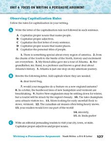
Observing Capitalization Rules
In this capitalization worksheet, students complete three activities that help them follow the rules for capitalization in their writing.
United Nations
United Nations: Cartographic Section: Great Lakes Region (Map 2) [Pdf]
This map of the Great Lakes region in Africa from the United Nations shows the large lakes, the countries the lakes touch, and rivers that flow into and out of the lakes.
United Nations
United Nations: Cartographic Section: Great Lakes Region (Map 1) [Pdf]
The United Nations offers this very clear map of part of the Great Lakes region in eastern Africa. The lakes, of course, are labeled, as are the rivers, major cities, and countries.
Other
Native Peoples of the Great Lakes Region
The Iroquois and Five Nations dominated the Great Lakes and forced other nations out.
Other
Glin: Habitats of the Great Lakes Region
This site profiles the elements of the Great Lakes' ecosystems and habitats.
Other
Environment Canada: Native Peoples Great Lakes Region
This site provides information on the Indians that inhabited the Great Lakes Region upon settlement by Europeans.
University of Wisconsin
University of Wisconsin: Paradise Lost?: Teaching Climate Change in the Great Lakes Region
This website is designed as a resource for high school and middle school teachers on the topic of climate change. The emphasis of this site is on providing hands-on activities. Includes activities that involve language arts, social...
PBS
Wnet: Thirteen: Africa: Explore the Regions: Great Lakes
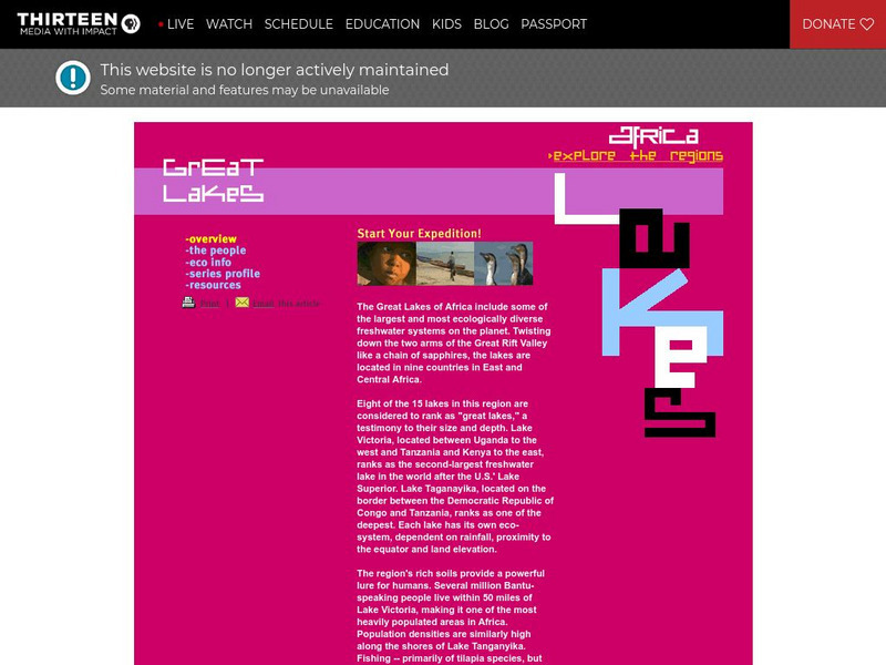
Explore the diverse and unique African Region of the Great Lakes. Within this region, you will learn about the countries, people, and economy. Uncover the beauty and diversity of this incredible region.
Other
Glfc: Sea Lamprey Control in the Great Lakes: A Remarkable Success!
Good article from the Great Lakes Fishery Commission about the ongoing battle with the sea lamprey, an invasive species, in the Great Lakes Region of the U.S.
TED Talks
Ted: Ted Ed: What's So Great About the Great Lakes?
The North American Great Lakes- Huron, Ontario, Michigan, Erie, and Superior- are so big that they border 8 states and contain 23 quadrillion liters of water. They span forest, grassland, and wetland habitats, supporting a region that's...
University of Michigan
University of Michigan: The Great Lakes: An Environmental History [Pdf]
The University of Michigan provides a PowerPoint presentation on the environmental history of the Great Lakes. Provides aerial shots of the Great Lakes from a satellite, various geographical maps over the Great Lake Region, and pictures...
Curated OER
Educational Technology Clearinghouse: Maps Etc: Great Lakes Region, 1906
A map from 1906 of the Great Lakes Region, showing major cities and ports, canals (including the Erie Canal), rivers, and steamship routes across the lakes, including routes of the St. Lawrence and Lake Champlain.







![United Nations: Cartographic Section: Great Lakes Region (Map 2) [Pdf] Graphic United Nations: Cartographic Section: Great Lakes Region (Map 2) [Pdf] Graphic](https://d15y2dacu3jp90.cloudfront.net/images/attachment_defaults/resource/large/FPO-knovation.png)
