Curated OER
One Plus One Makes New
Students discover the properties of matter and how they change when composite materials are produced. In this informative lesson students write up a question and procedure to an experiment then analyze and draw conclusions based on the...
Curated OER
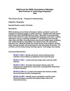
Eastern Europe: Passport to Understanding
Seventh graders explore Eastern Europe. They analyze data on select countries. Students prepare a short oral presentation on the country they researched. They locate their country using an interactive map.
Curated OER
Naviagational Tools
Fifth graders create a compass, with the help of written instructions and then write six sentences discussing how compasses work and why they are helpful. They discuss the different types of navigational tools and how they are helpful.
Curated OER
Understanding Zoning: Its use on the High Line in West Chelsea
Learners are introduced to zoning. Evaluating information and reading a land-use map is enclosed in this lesson. List new development projects that they could propose for a given area.
Curated OER
A Line Drive
Eleventh graders create a 100 year timeline centering on the life of their research subject and place them in the context of local and national history.
Curated OER
Text as Texture Collage
Students explore the concepts of rhythm, movement, contrast and texture. They practice using new vocabulary and work on creating a college after designing the arrangement. They self-evaluate their collage and critique their classmates...
Curated OER
Time Conceptualization
Students relate the number and length of generations in their living family members to the number of generations that have passed since specific events in recorded history. They then apply this time conceptualization to the number of...
Curated OER
Lesson plan: Archaeology - Its Methods and Use
Students study the field of archeology. In this archeology instructional activity, students participate in 12 activities that require them to examine archeology, garbology, artifacts, ethical issues, and field specific vocabulary.
Curated OER
Globe Skills Lesson 2: Paving the Way for Columbus
Students explore the expedition of Christopher Columbus. In this geography skills lesson, students consider the technological advances that made Columbus's expedition possible as they complete a latitude and longitude activity.
Curated OER
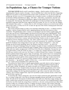
As Populations Age, a Chance for Younger Nations
In this geography skills worksheet, learners read a 4-page article titled "As Populations Age, a Chance for Younger Nations." Students then respond to 4 short answer questions based on the content of the article.
Curated OER
Immigration and Settlement of Ethnic Groups in the Pacific Northwest
Young scholars examine ethnic history of the Pacific Northwest in the period 1850-1950. They research documents and images in digital archives to explore immigration of various ethnic groups that settled in the region during this period.
Curated OER
Mexican-Americans: Yesterday, Today and Tomorrow
Students examine how the Mexican-American culture developed in Los Angeles. They explore the past, present and future of Mexican-Americans in LA and present their findings in a PowerPoint presentation.
Curated OER
Institution vs. Individuals
Students examine and evaluate how the U.S. government dealt with the Native American populations during westward expansion. They complete a class KWL chart, take notes during a teacher-led lecture. Students read about the Battle at...
Curated OER
WATTS UP?
Second graders research the Internet as they classify different forms of energy, investigate electrical energy and how to conserve energy.
Curated OER
Comparing Time Periods in U.S. History: The Ashford Project
Fifth graders use a "fact book" comparing periods in American history then students create a picture to illustrate their assigned periods. # # students use their pictures and concept maps to write expository paragraphs about their...
Curated OER
Confederation II : the Sequel
Students examine the dynamics and challenges of creating a system of government that meet the needs of a changing, diverse population, for a new country. This is a nice simulation/role play of the formation of government.
Curated OER
Exploring the Celestial Neighborhood
Ninth graders study the origin and organization of the solar system. They investigate the Earth's place in the system and how planetary motions explain natural phenomena observable from Earth.
Curated OER
Timeline of Yellowstone History
Students research important dates and events in the history and development of Yellowstone National Park. They create a timeline that denotes the events after watching the associated video clips.
Curated OER
Mirror, Mirror
Students examine portraits done by Robert Harris and discuss the technique he used to create them. With a partner, they paint a picture of each other using the techniques of Harris. They also make a drawing of themselves from a recent...
Other
National Physical Laboratory: The History of Length Measurement
This resource provides historic information on length measurement in the United Kingdom. Click on the topics on the left toolbar of the article to find out more information.
Vision Learning
Visionlearning: General Science: Metric System: Metric and Scientific Notation
Instructional module focusing on the metric system. Discussion includes the historical development of the system and an explanation of base units. Site also includes an interactive practice quiz and links relating to the topic.
Wikimedia
Wikipedia: Economy of the United States
This site from the encyclopedia Wikipedia gives the reader excellent insight into the United States economy. Includes historical references, the influence of technology, resources, and the role of government. Includes numerous charts and...
Curated OER
National Park Service: Statue of Liberty
This site provides history and information about the Statue, including information about visiting, the statistics and measurements of the Lady, and historical background of France/U.S. relations. Be sure to click on the "Handbook" link...
Curated OER
Etc: Maps Etc: Climate and Watersheds of the United States, 1868
A map from 1868 of the United States showing physical features, mean annual temperatures, rainfall distribution, watersheds, and principal products in the area. The average annual temperatures are shown by isotherms, with temperatures...


