Curated OER
Educational Technology Clearinghouse: Maps Etc: Italy, 1175 a.d.
A map of Italy in AD 1175 showing the lands of the Holy Roman Empire, States of the Church, lands of the Republic of Venice, the Kingdom of Hungary, the Kingdom of Sicily, and the lands of the Moors and Saracens.
Curated OER
Educational Technology Clearinghouse: Maps Etc: Europe, 1904
"Europe - Greece has the honor of being in the van of European civilization and power, but in the seventh century before Christ a rival sprang up in Italy, which in the course of time attained such vigor that Greece at last was humbled...
Curated OER
Educational Technology Clearinghouse: Maps Etc: France, 1904
"France - Four centuries after then invasion of Julius Caesar, which made ancient Gaul a Roman province, the country, being deserted by its conquerors, was invaded by the Franks, whose leader, Clovis, in the sixth century, established...
Other
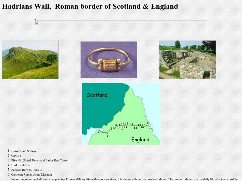
Hadrian's Wall, Details Along the Wall
This is a collection of pictures taken along Hadrian's Wall. It also includes a map showing exactly where the wall is in relation to present-day Britain and Scotland, with an explanation of each item along the wall.
Houghton Mifflin Harcourt
Harcourt: School Publishers: Unraveling Ancient Mysteries: Pompeii
Harcourt School reveals the background to the 79 C.E. eruption of Mt. Vesuvius and the destruction of the Roman city of Pompeii and nearby Herculaneum. Features include animations of the eruption, pictures, and information to explore.
Curated OER
Etc: Italy During the War With Naples , 1798 1799
Map of Italy in 1799, subtitled "The War with Naples 1798-9." The map shows Italy at the time when the Kingdom of Naples briefly became the French-supported Parthenopaean Republic from January to June, 1799. The map shows the territory...
Curated OER
Etc: Eastern Frontier of France, 1792 1795
A map of the eastern frontier of France during the National Convention period of the French Revolution, subtitled "Revolutionary Campaigns 1792-1795." This map is color-coded to show the territories of eastern France, the United...
Curated OER
Etc: Growth of Brandenburg Prussia, 1400 1806
A map of the growth of Brandenburg-Prussia from 1400, when the original Brandenburg was one of the seven electoral states of the Holy Roman Empire, to the annexation of Hanover and near-by territory in 1806. This map also shows the...
Curated OER
Etc: England During the Saxon Period, Ad 450 1066
A map of England, Wales, and southern Scotland during the Saxon Period from around AD 450 to the beginning of the Norman Conquest in 1066. This map shows major cities of the time, major river ways, topography, and is color-coded to show...
Curated OER
Etc: Germany Schmalkaldic War, 1547 1554
A map of Hesse-Thuringia and Saxony in Germany during the Schmalkaldic War (1547-1554) between the Holy Roman Empire under Charles V and the allied forces of Lutheran princes known as the Schmalkaldic League.


