Curated OER
A Flip of Life in the 13 Colonies
Fourth graders create a flip book illustrating the 13 original colonies. They study the growth and development of each of the three groups of the original colonies. They use maps to observe and interpret geographic information and...
Curated OER
Population Pyramid
Learners learn about demographic population pyramids. They then design and fictitious nation and draw its population pyramid.
Curated OER
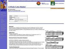
A Whole Lotta Shakin'
Students read first hand accounts of earthquake survivors in order to begin the describe the different types of earthquake waves and the order in which they arrive. They engage in using earthquake waves as a means to indirectly study the...
Curated OER
Louisiana's Indian Tribes At the Time of the Louisiana Purchase
Students research primary readings concerning first hand accounts of the Indian tribes living in and around Louisiana's River systems. They complete a brief character sketch of each tribe characterized in the digital readings. These...
Curated OER
Plants and Animals, Partners in Pollination
Students participate in multiple hands-on activities to explore reproduction and pollination. In groups, using a cotton swab and powder, students simulate being pollinators and plants. They name the parts of the flowers and the function...
Curated OER
Enduring Understanding
Fourth graders explore indigenous people of rainforest and examine their customs and ways of life. They discuss how rainforests should be protected not only for their plants and animals, but also for indigenous people who live in them,...
Curated OER
Rocks and Minerals
Students bring rocks and minerals from home to investigate in the classroom. In this rocks and minerals lesson plan, students observe all the rocks and minerals brought into the class and answer 7 questions about the features of the...
Curated OER
The Westward Movement
Students study the westward movement through examining stamps. In this westward movement lesson plan, students draw conclusions, determine cause and effect relationships and examine the westward movement of the United States by...
Curated OER
How Size Shapes Animals
Students investigate how size affects large and small animals differently. In this animal lesson plan, students determine how size affects different animals by constructing their own animal out of marshmallows. Once students create...
Curated OER
Fossils Footprints Across Time
Learners examine fossils to understand how they are formed and how they give information about geological history. In this fossil lesson plan, students research and write about fossils and make models of different fossil types.The PDF...
Curated OER
Going...going...gone? Tropical Rainforests-How They Work, What They Do for Us, What's Being Done to Them...
Sixth graders explore the Tropical Rainforest and come to understand what it is and how it affects the ecosystem. In this rainforests lesson, 6th graders write about the Tropical Rainforest, imagine they are in the Tropical Rainforest,...
Curated OER
Drought Threatens Huge Man-Made Lake
Students locate Lake Mead, then read a news article about Lake Mead drying up and how that would effect water and power supplies to the region. In this current events instructional activity, the teacher introduces the article with a map...
Curated OER
Exploring Neighborhoods through Art
Students explore neighborhoods. For this color and social studies cross-curriculum lesson, students listen to Harold and the Purple Crayon by Crockett Johnson, then compare and contrast neighborhoods. Students mix primary colors to make...
Curated OER
The Sahara: Home of the Tuareg
Students study inhabitants of the Sahara. In this Tuareg culture lesson, students explore the how the Tuareg people adapt to their environment as they research specific Internet sites.
Curated OER
Food Webs in the Barnegat Bay
Students investigate the food webs in the Barnegat Bay. In this organisms activity, students use a graphic organizer to illustrate the types of consumers in the bay. Students use reference books to continue to research the animals found...
Curated OER
Where In the World Am I?
Learners identify their location in the world after studying latitude, longitude, relative location, and absolute location. They use assigned web site to find information to make a flipbook that answers questions about their location in...
Curated OER
Climate Change
Students discuss global warming. In this global warming lesson, students read an article about global warming and list five things they learned. Students work in small groups to compare what they wrote. Students illustrate one of the...
Curated OER
A Capital Idea
Young scholars write a description of the spatial organization of the former and present location of New Hampshire's state capital. They analyze maps, participate in a class discussion, and calculate the distance of Concord from the...
Curated OER
Metropolitan Areas in the USA
Fifth graders explore why people live in certain regions of the United States. They investigate information on specific metropolitan areas such as temperature, population, natural resources, precipitation and landforms. In groups, 5th...
Curated OER
No Magic Borders: Haleakala Style
Students discuss borders and boundaries. They discuss pollution and the fact that boundaries cannot stop pollution and that pollution affects even protected wildlife and plants. They participate in an activity in which they must place...
Curated OER
Calculate Your Contribution
Students assess the environmental impact of their transportation choices. They keep a transportation journal and use a website to calculate vehicle emissions for themselves and their class. They evaluate their transportation choices.
Curated OER
Stratigraphy -- Layers of Time in the Earth
Students are introduced to the process of stratification. Using the internet, they read about the Richard Beene archeological site near San Antonio. Using a map, they color code the different layers present at this site and answer...
Curated OER
Getting to Know the Streets of Honolulu
Students practice identifying the streets names of Honolulu. Using a city map, they identify a main street and two intersecting streets. They research the origin of the name and complete a worksheet. They share their findings and...
Curated OER
Mapping the Village
Young scholars measure, weigh, and document the amount of trash and garbage generated by the school for one day. They brainstorm solutions for trash in the area and assist with the school-wide recycle program.


