Curated OER
Postcards from the Edge: Endangered Species
Students use the internet to identify the endangered species in their state. Using this information, they create a postcard with a picture of the animal along with facts. They discuss the main reasons to protect the endangered species...
Curated OER
Families and Neighborhoods
Students explore the concept of community. In this community lesson, students explore the cultural flavor of their neighborhoods as they discuss the history of their neighborhoods and draw pictures of their family and a building in their...
Curated OER
Rights for Indigenous People
Students consider how to fight poverty. In this global issues lesson, students define indigenous communities and participate in an activity that requires them to allocate funds to end poverty among the indigenous in Papua New Guinea.
Curated OER
Tooling Around Arizona: Reading Arizona Maps
Students research Arizona maps. In this map lesson, students discuss map titles, scales, directions, elevation, and symbols. The class will examine topography, landforms, and rivers found on an Arizona map.
Curated OER
Get to Know Your City
Third graders research the history of their home city and how it's development was influenced by different groups of people. They present their research information to the class.
Curated OER
Rivers of Change
Third graders examine rivers and how they affect the people living around them. They read a chapter in their science text, take a virtual river tour online, read a background information story, and in pairs describe the changes in the...
Curated OER
Take Me Out To the Ball Game
Students use a map to graph and locate major league teams of different sports. In groups, they analyze the population data of the United States and compare it with the amount and location of the major league teams. They share their...
Curated OER
Rising Tensions Over The Nile River Basin
Students analyze the concept of global commons dilemma. In this investigative lesson students read an article on the Middle East Media Research Institute and answer questions accordingly.
Curated OER
Strengthening Democracy In Latin America
Students consider how to strengthen democratic principles in Latin America. In this government systems lesson, students explore the challenges to democratic forms of government in Latin America as they examine primary sources. Students...
Curated OER
Watershed Model
Students view a presentation of water and land and how we need to protect our water resources. In this water lesson plan, students discuss how we rely on water, and complete activities in all subjects related to water.
Curated OER
FUN WITH MAPS
Second graders receive a general overview about how maps are made and used, how specific information can be derived from them, and how a student can gain personal information about their surroundings from examining them.
Curated OER
Views of the American West: True or False?
Young scholars explain that a landscape painting may or may not accurately represent a specific place. They identify techniques that create the illusion of three-dimensional space on a flat surface.
Curated OER
Community Journals
Students visit a multimedia online journal as a model for their research and journal about their own communities. They examine writing for themselves and writing for an audience as they study the community and present it in more than one...
Curated OER
Continents and Oceans
Students identify oceans and continents and their locations on a map. They color-code and label their own map of the world's continents and oceans. They play the game Continents and Oceans to identify specific areas.
Curated OER
Climb a Mountain, Raft a River on Your Own Land
Students are introduced to the characteristics of a map. As a class, they discuss the uses of public lands in their community and develop symbols for each feature. They use the symbols to create a map showing the recreational uses of...
Curated OER
Indiana Tornado Project
Learners become aware of the number of tornadoes that impact Indiana. They explore basic facts about tornadoes. Students use the GIS for research. They explore that natural phenomena in Indiana. Learners become familiar with...
Curated OER
India: Where Remarkable Differences Are Ordinary
Students research India and Indian culture. In this Indian research lesson plan, students research and report on the lives of Indian children. The report will be in the form of a mock interview between a journalist and an Indian child....
Curated OER
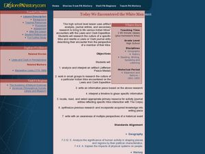
Today We Encountered the White Man
Young scholars analyze and interpret artifacts and a timeline to get specific information. In this timeline lesson plan students work in groups to research an Indian tribe and write an information piece of their research.
Curated OER
MAP GRIDS, CLIMATES AND HEMISPHERES
Students compare/contrast the grid and latitude/longitude system used on a globe. They describe the areas which are considered to be a tropical, temperate, and polar, based on knowledge of climates.
Curated OER
The Civil War: Through the Eyes of Hoosier Women-
Fourth graders explain and analyze changes and interactions of Hoosier women in major social and work roles during the Civil War. They recognize and compare the contributions of both women on the home and war fronts.
Curated OER
Maine: A Place Apart?
Students list phrase that describe Maine from both an insider's and outsider's point of view. They create an exhibit on Maine's history and write an essay about Maine's image as "a place apart."
Curated OER
Dark and Beautiful Caves
Students research how caves form. They describe the major stone formations in caves by taking notes. They construct a clay model of a cave and mark each formation making it easy to identify in the legend.
Curated OER
Uncharted Territory
Students examine what were preconceived perceptions of the areas Lewis and Clark explored. They compare and contrast past and modern maps of North America. They accurately place route and site information on the map.
Curated OER
Is A Nation Always A Region?
Students define the term, "nation," and analyze the boundaries established in Africa by colonial powers. In small groups, they participate in a simulated United Nations, develop a list of questions, analyze the nations of Africa, and...


