Curated OER
Corals and Coral Reefs
Students label the continents, oceans, and seas on a provided world map and use it to determine where they would expect most of the world's coral reefs to be found based on provided information the teacher has read to them.
Curated OER
Learning About Our World
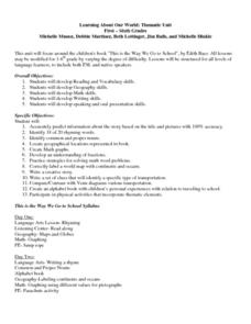
Learners explore their world using the book "This is the Way We Go to School." They predict information about the story based on the title and pictures. Students label a world map with the names of continents and oceans. They write a set...
Curated OER
Oceanography (Rivers and Streams)
Second graders examine the characteristics of streams and rivers. They identify the types of resources lakes, ponds and oceans provide. They ask questions to complete the lesson.
Curated OER
The Ocean: A Watery World
Learners discuss the proper clothing for the season. They make wind chimes to use as an indicator of movement of the air and observe and identify the various cloud formations. They determine the basic rules of storm safety and discuss...
Curated OER
Introduction to the Globe
Learners investigate how to use a globe. In this map skills lesson plan, students define what a globe is and locate the various continents on the globe. Learners are also asked to locate the four oceans on the globe.
Curated OER
Adjectives Of Quantity (How Much?)
In this on-line language arts worksheet, students complete 10 multiple choice questions where they identify the adjective of quantity in each sentence. Students can check their answers at the end of the worksheet.
Curated OER
Ocean Life
Students explore the types of plants and animals that can be found in the ocean. They browse books and/or magazines to identify and gain a knowledge base of plant and animal life found in the ocean, then create a collage.
Curated OER
The Pirates of the Caribbean
Third graders participate in a demonstration lesson that shows a map of the Caribbean Islands. They examine a natural resource that each island is known for. Next, they listen to a read aloud of Gail Gibbons, "Pirates: Robbers of the...
Curated OER
The Dynamic Earth
Young scholars participate in assessments related to the layers of the Earth. They read chapters of text, answer questions, watch videos, and identify and label continents and oceans on a map. They design posters, create vocabulary...
Curated OER
Traveling Through North America
Students identify places and landmarks in North America, specifically Canada and the United States, by using and constructing maps. Six lessons on one page; includes test.
Curated OER
Getting to Know My World
Students participate in hands-on activities using maps and globes to identify geographical features. Students use map legends to identify direction. Students locate oceans, continents, countries, states and cities. Handouts and...
Curated OER
Air and Water in the Environment
Second graders participate in a three part lesson in which they identify and describe forms of moisture in the environment. Part one of the lesson involves the three stages of the water cycle, part two focuses on creating humidity by...
Curated OER
Plate Tectonics
Middle schoolers identify that most of mountain ranges found on all major land masses and in the oceans are external reflections of tectonic movements within the earth. They identify that earthquakes and related phenomena are caused by...
Curated OER
Water, Water Everywhere
Middle schoolers recognize that all of the water on earth cannot be used for drinking and that the percentage of ground and surface water is a small percentage. In this water lesson students identify ways to conserve water.
Curated OER
Introduction to the United States Map
Students identify a map of the United States. In this United States map lesson, students study a map of the United States and find various locations on the map. Students then locate and list the state that touches their state.
Curated OER
Water Cycle Adventure
Students take an imaginary journey through the water cycle. In this water cycle lesson plan, students identify the various parts of the water cycle, listen while their teacher leads them on an imaginary journey through the water cycle,...
Curated OER
Octopus Legs
Students have oceans of fun transforming a wienie into an octopus they can eat! After counting, cutting halves and fourths, observing steam and the effects of heat, they mix colors as they create a yummy dipping sauce from mustard and...
Curated OER
Plates on the Move
Pupils explore how Africa appears to be tearing apart from Asia and tha the other continents are moving and oceans are changing size.
Curated OER
Displaying Sea Ice
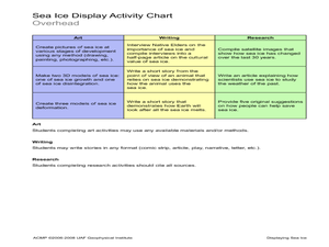
Students display their knowledge of sea ice. In this earth science lesson, students create displays reflecting their understanding of sea ice.Students research the development of sea ice on a variety of bodies of water, and use proper...
Curated OER
Continents of the Globe
Students identify the continents on the globe. In this map skills instructional activity, students define the term "continent" and identify the seven continents on the globe.
Curated OER
Continents and Critters
Students investigate and identify the continents of the world. They identify and locate the seven continents on a map, and label a coloring page of a world map. Students then conduct research on an assigned continent, and write and...
Curated OER
Lesson Plan on Latitude and Longitude
Sixth graders identify at least ten places on the world map using given longitude and latitude points. They identify the longitude and latitude of ten places on the world map.
Curated OER
Underwater Research
Students make transect and quadrat surveys using a provided worksheet in order to understand the techniques used to study coral reefs. Each type of survey is used to identify the species, diversity, and number of corals.
Curated OER
Earth System Science: Hydrosphere
Students identify the major Earth systems, and describe at least ten major uses of water on planet earth. They research major sources of earth's water, and describe general aspects of the hydrosphere.


