Curated OER
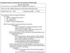
Multiple Intelligences and The Illinois & Michigan Canal
Third graders engage in a wide variety of cross-curricular activities designed to give them a thorough understanding of the history of the Illinois & Michigan Canal. There are a very nice set of activities included in this plan!
Curated OER
Exploring the Illinois and Michigan Canal
Seventh graders locate the Illinois & Michigan Canal and related landmarks on various maps. They explain the challenges associated with building a canal. They access websites imbedded in this plan and watch a video to aid their...
Curated OER
"Heritage" - "Hey, That's the Name of Our School!"
Seventh graders gain a better understanding of the canal period in U.S. History, and more specifically, discern the importance of the Illinois and Michigan Canal on the development of Illinois as a state and Chicago as a prominent city.
Curated OER
National expansion of the United States (1815 to 1850), and its connection to local Illinois history.
Students discuss the importance of establishing the I & M Canal water route. They watch a video about the canal's history. They collect and write a personal migration story by interviewing a family member. They analyze trends and...
Curated OER
Getting a Sense of Time
Students gain an appreciation for geologic and historic time. They gain a general amount of information of the development of hte Chicago area, with particular attention given to the role of the Chicago River. Students contruct a time...
Other
Illinois and Michigan Canal: A Corridor in Time
Online history of the Illinois and Michigan canal.
Curated OER
Educational Technology Clearinghouse: Maps Etc: Chicago and Vicinity, 1901
A city plan from 1901 of Chicago and vicinity showing the city limits, major streets, neighboring cities and towns, the Illinois and Michigan canal, parks, stock yards, and the shoreline of Lake Michigan.
Curated OER
Educational Technology Clearinghouse: Maps Etc: Illinois, 1920
A map from 1920 of Illinois showing the State capital of Springfield, counties and county seats, major cities and towns, railroads, canals, the shoreline of Lake Michigan, and the Mississippi and Ohio rivers. A grid reference in the...
Curated OER
Educational Technology Clearinghouse: Maps Etc: Illinois, 1891
A map from 1891 of Illinois showing the State capital of Springfield, major cities and towns, railroads, canals, the shoreline of Lake Michigan, and the Mississippi and Ohio rivers.
Curated OER
Educational Technology Clearinghouse: Maps Etc: Illinois, 1906
A map from 1906 of Illinois showing the State capital of Springfield, major cities and towns, railroads, canals, the shoreline of Lake Michigan, and the Mississippi and Ohio rivers.
Curated OER
Educational Technology Clearinghouse: Maps Etc: Illinois, 1909
A map from 1909 of Illinois showing the State capital of Springfield, major cities and towns, railroads, canals, the shoreline of Lake Michigan, and the Mississippi and Ohio rivers.
Curated OER
Educational Technology Clearinghouse: Maps Etc: Illinois, 1919
A map from 1919 of Illinois showing the State capital of Springfield, major cities and towns, railroads, canals, the shoreline of Lake Michigan, and the Mississippi and Ohio rivers.
Curated OER
Educational Technology Clearinghouse: Maps Etc: Illinois, 1922
A map from 1922 of Illinois showing the State capital of Springfield, major cities and towns, railroads, canals, the shoreline of Lake Michigan, and the Mississippi and Ohio rivers.
Curated OER
Educational Technology Clearinghouse: Maps Etc: Illinois, 1892
A map from 1892 of Illinois showing the State capital of Springfield, counties and county seats, major cities and towns, railroads, canals, the shoreline of Lake Michigan, and the Mississippi and Ohio rivers.
Curated OER
Educational Technology Clearinghouse: Maps Etc: Illinois, 1901
A map from 1901 of Illinois showing the State capital of Springfield, counties and county seats, major cities and towns, railroads, canals, the shoreline of Lake Michigan, and the Mississippi and Ohio rivers.
Curated OER
Educational Technology Clearinghouse: Maps Etc: Illinois, 1920
A map from 1920 of Illinois showing the State capital of Springfield, counties and county seats, major cities and towns, railroads, canals, the shoreline of Lake Michigan, and the Mississippi and Ohio rivers.
Curated OER
Educational Technology Clearinghouse: Maps Etc: Illinois, 1902
A map from 1902 of Illinois showing the State capital of Springfield, major cities and towns, railroads, canals, the shoreline of Lake Michigan, and the Mississippi and Ohio rivers. An inset map shows the vicinity of Chicago.
Curated OER
Educational Technology Clearinghouse: Maps Etc: Chicago, 1922
A map from 1922 of Chicago and neighboring counties. The map shows county boundaries and county seats, cities, towns, railroads, canals, lakes, rivers, and the shoreline of Lake Michigan.
Curated OER
Educational Technology Clearinghouse: Maps Etc: Chicago, 1903
A city plan from 1903 of Chicago and vicinity showing the city limits, major streets, neighboring cities and towns, the western drainage canal, parks, Union stock yards, major landmarks, and the shoreline of Lake Michigan.
Curated OER
Educational Technology Clearinghouse: Maps Etc: Chicago and Vicinity, 1901
A map from 1901 of Chicago and vicinity showing the city limits, major streets, neighboring cities and towns, major landmarks, the drainage canal, stock yards, parks, Lake Calumet, rivers, and the shoreline of Lake Michigan.


