Curated OER
NIGHT AND DAY: DAILY CYCLES IN SOLAR RADIATION
High schoolers examine how Earth's rotation causes daily cycles in solar energy using a microset of satellite data to investigate the Earth's daily radiation budget and locating map locations using latitude and longitude coordinates.
Curated OER
Tracking the Salt Front
Using the Hudson River as the focus, learners discuss the difference between salt water and fresh water environments, analyze maps and graphs, and complete addition and subtraction problems. This activity comes with a wealth of...
Curated OER
What is Climate?
Learners explore the differences between climate and weather. For this introductory lesson of a climate unit, students discuss the vocabulary and concepts associated with weather and climate. They build their information base for the...
Curated OER
Pangaea Puzzle
Students explore plate tectonics and the formations of the Earth's surface and why maps are distorted. In this Earth's surface lesson plan students complete a lab and answer questions.
Curated OER
Hottest US Cities Quiz
In this online interactive geography quiz learning exercise, students respond to 20 identification questions about the hottest cities in the United States. Students have 4 minutes to finish the timed quiz.
Curated OER
Coldest US Cities Quiz
In this online interactive geography quiz worksheet, students respond to 20 identification questions about the coldest cities in the United States. Students have 4 minutes to complete the quiz.
Curated OER
Exploring and Comparing Other Communities
Third graders search TDC database for images of physical geography maps, weather maps, natural resources maps, and old travel brochures. They create a new travel brochure of an area of their choice using the information they gathered.
Curated OER
Infrared-Hot
Students describe how the sun heats the Earth, explain the nature of infrared light, explain how thunderstorms are formed and use infrared maps to predict severe weather.
Curated OER
Gallery Walk Questions about Energy and Material Cycles
Students state the physical, chemical or biological processes associated with these environments: Pelagic ocean zone, California coat Cave, Indiana Barrier island beach, North Carolina Sand dune, Dunes National Park, Colorado Wetland and...
Curated OER
Under the Weather
Students consider the increase in floods. In this current events lesson, students visit selected websites to research the occurance of floods in Britain.
Curated OER
Clouds
Young scholars read the "Cloud Book" by Tomie de Paola and create a map of clouds identifying atmospheric conditions, color and type, and what type of weather each cloud indicates. Emphasis is placed on the use of Kidspiration.
Curated OER
Meet Meteorology
Students explore meteorology, discuss Earth's atmosphere, create drawings of the water cycle, create meteorology journals, and role play forecasters. Nine lessons on one page; includes unit test.
Curated OER
Kalahari Explorations
Students explore world geography by completing graphic organizers and researching the Internet. In this Kalahari desert instructional activity, students identify the geographic location, weather and creation of the Kalahari desert....
Curated OER
Where Do Canadians Live?
Students investigate Canadian people by researching the geography of the country. In this world geography lesson, students identify locations within Canada with large populations based on their access to waterways. Students view and...
Curated OER
Introducing The Gulf Stream
Sixth graders research the average temperatures of different places on Earth. In this earth science lesson, 6th graders explain how the sun's heat cause ocean movement. They discuss how temperature change affects the weather we experience.
Curated OER
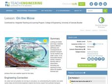
On the Move
Students explore different pathways and consequences of pollutant transport via the weather and water cycles. They observe and record weather information and produce their own weather report for the class.
Curated OER
Discovering the Physical Geography of Washington
Pupils develop a mental map of the state of Washington and draw it on paper. Using the Virtual Atlas, they identify the physical features of the state and draw them on their map. They also examine the populations and diversity of the...
Curated OER
Thematic Unit on Cats
Students discover in which climates the cats of the world live in. They review the different climates of the world and use maps and globes to help them locate continents.
Curated OER
Lesson Plan of a Thematic Project - Water
Sixth graders investigate the properties of water. In this life science instructional activity, 6th graders create a concept map of water. They share their work with the class.
Curated OER
History of Colorado-Migration to the West
Fourth graders identify reasons for people moving to the Colorado Territory and examine how moving in the 1800's is different than moving today. They also practice reading maps and gathering information from maps, as well as, describe...
Curated OER
Texas Week
Pupils explore Texas in the past and present. They pick out cities on a map and find information and analyze an Internet site.
Curated OER
Living With Fire
Students identify effects of treatment weather on behavior of a wildland fire. They view simulation game that predicts effects of forest management on fire behavior.
Curated OER
A Season for Chapters
Art, music, poetry, and the beauty of the seasons is what you'll find in this very nice unit idea. You can use any of the suggested books and activities to engage your second graders in an exploration of the changes that take place...
Curated OER
Science: Hurricanes As Heat Engines
Students conduct Internet research to track the path of Hurricane Rita. They record the sea surface temperature of the Gulf of Mexico during and after the hurricane and draw conclusions about how hurricanes extract heat energy from the...


