Princeton University
Princeton University: Maps of the Islamic Middle East
This site from the Princeton University includes a map collection from Roolvink's "Atlas of the Middle East" with a variety of historical maps on Islam.
University of Oregon
Mapping History: European History
Interactive and animated maps and timelines of historical events and time periods in European history from Greek and Phoenician colonization up to the 20th century.
Other
Islam Project: Maps
A series of historical and near-present-day maps that span Islamic history. Starting with A.D. 750, the maps illustrate both the spread of Islam (from Medina outward to Africa, the Middle East, Europe, and other parts of the world) and...
University of Calgary
The Islamic World to 1600: The Safavid Empire
This page comes from the University of Calgary and thoroughly describes the Safavid Empire as well as provides a clickable map detailing the areas included within their empire.
Khan Academy
Khan Academy: What Maps Tell Us
Maps are subjective, and like any form of art and design they have stories to tell and reveal a lot about the times in which they were produced. Maps involve selections of information, human editing, and a visual language legible to the...
Syracuse University
Syracuse University: The Conquests of Islam
This map illustrates the Islamic conquests from 622AD to 740AD in the two centuries following Mohammed's death.
Israel Ministry of Foreign Affairs
Israel Mfa: Jerusalem in Old Map and Views
Resource provides the contents of an exhibition in Israel on the history of the city of Jerusalem through maps. It starts with the oldest map, a mosaic known as the "Madaba Mosaic," found in Jordan and goes to the 19th century. Click on...
Google
Google Maps: Virtual Tour of Pergamon Museum, Berlin
Take a virtual tour through the Pergamon Museum located on Museum Island in Berlin. This world famous museum has life-size, reconstructed monuments from ancient civilizations, including the Pergamon Altar of Zeus, the Roman Market Gate...
Curated OER
University of Texas: Iran: Ethnoreligious Distribution
This is a fascinating map of Iran showing the religious distribution of the Sunni and Shi'a sects of Islam. It also shows the many ethnic groups that make up this country. From the Perry-Castaneda Collection.
University of California
The Travels of Ibn Battuta: A Virtual Tour With the 14th Century Traveler
Ibn Battuta was a famous Muslim traveler in the 14th century. He began traveling in 1325 at the age of twenty, first as a pilgrimage to Mecca. But he kept on traveling - for about twenty-nine years. He visited what would today be...
United Nations
Unesco: Ancient City of Damascus
Damascus in Syria was founded in the third millennium BC. Its long history reveals the influences of many ancient civilizations, most particularly the Hellenistic, Roman, Byzantine and Islamic civilizations. This World Heritage website...
University of Calgary
European Voyages of Exploration: 15th & 16th Centuries
This award-winning website from the University of Calgary's History Department is both impressive and extensive. It focuses on Portuguese and Spanish expeditions of the 15th and 16th centuries (the sitemap provides a good outline of...
New York Times
New York Times: Attacks in Central London
Provides interactive maps, video, audio, and images of the attack on London's transit system. Presents the location, casualties, and different scenes from the attack on 7/7/2005.
BBC
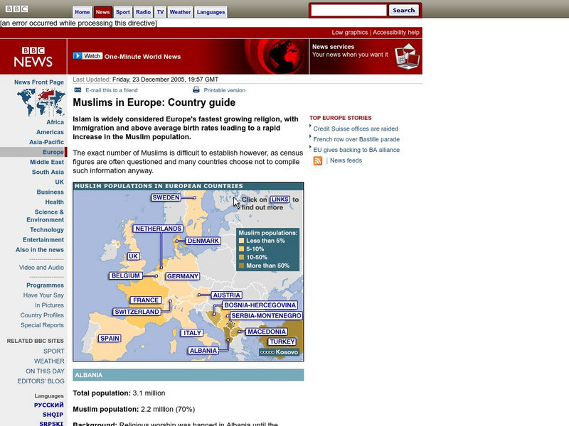
Bbc: Muslims in Europe: Country Guide
Information about the Muslim population in Europe can be obtained by clicking on this interactive map. (23 December 2005)
Friesian School
Friesian School: Sultans of Delhi
This resource provides a brief history of past sultans as well as maps and a complete list.
Annenberg Foundation
Annenberg Learner: Dagestan Timeline
A timeline using historical maps shows the confluence of Islam and Russian rule in the area known as Dagestan. Follow the development of Islamic political entities in the area of present-day Dagestan.
Other
Sejarah Indonesia: An Online Timeline of Indonesian History
This site is a comprehensive timeline of the history of Indonesia from Beginnings to 2003. Includes pictures and interactive map.
Nations Online Project
Nations Online: Pakistan
Useful guide to a country profile of the Southern Asian nation of Pakistan featuring background details and numerous links to extensive information on the nation's culture, history, geography, economy, environment, population, news,...
Climate Zone
Climate Zone: Mauritania
Information on the climate of Mauritania. A map of the country has been provided, as well as a description of the terrain.
Houghton Mifflin Harcourt
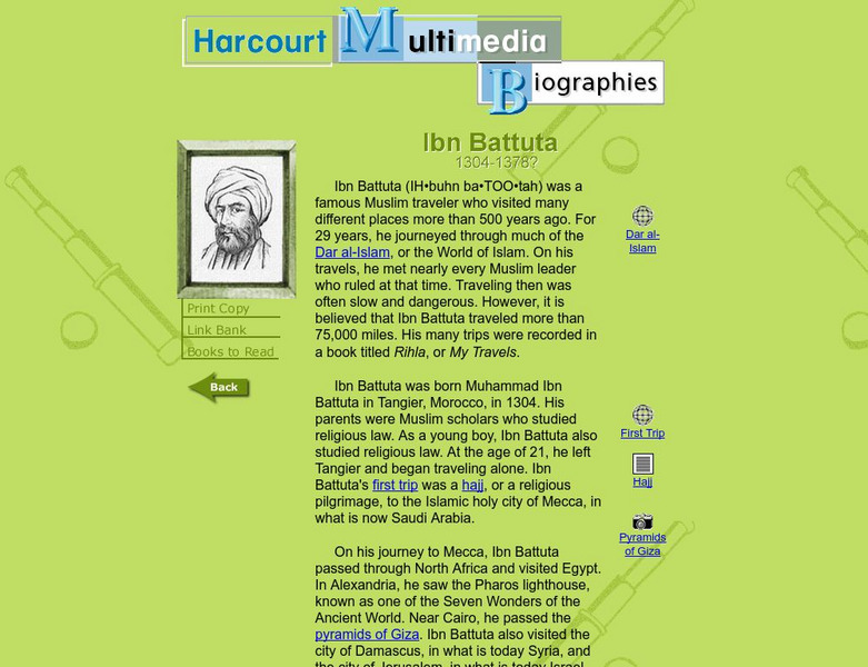
Harcourt: Biographies: Ibn Battuta 1304 1378
Discover some interesting details about the life of this fascinating Muslim leader. Read about his travels as he journeyed around the world and the incredible places he visited. Click on the globes for maps of his journey.
Other
Saudi Aramco World: Keyboard Calligraphy
In a recent exhibition on Ottoman culture held in Amsterdam's Nieuwe Kerk was an unimpressive-looking little 18th-century book, a printed version of a manuscript produced 150 years earlier. Usually a manuscript is more rare than a...
University of California
Ucla: Manas: History and Politics of the Mughal Empire
This article surveys the Mughal Empire of India (1526-1857) and traces its origins, names its rulers, and provides historical illustrations and a map.
CRW Flags
Flags of the World: Iran
This site from Flags of the World provides an image and description of the flag of Iran, including links to a map and other information.
Mariners' Museum and Park
Mariners' Museum: Education: Arab Exploration: Ibn Buttuta
This resources provides brief biography of Ibn Buttuta, the Arab traveler who covered over 75,000 miles during the fourteenth century. Link to map of his voyages provided.


