Curated OER
Country: Italy
Young scholars explore Italy. They visit sites about its culture, history, cuisine, art, cars, and traditions. They take a virtual tour of the Sistine Chapel. They read about the history of pizza. They study Italian phrases and...
Curated OER
Coral Reef Geography
In this coral reef geography activity, students find locations of reefs on a globe or map. There are 10 instructions to follow. There is no map provided--an atlas, globe or map is needed.
Curated OER
Italy and Regional Identities
Learners explore, analyze and study the regional identities of Italy through its accents and local foods. They demonstrate and show similar traits that are found throughout Italy. Each student researches information on an annotative map...
Curated OER
A Month of Mapping Literature
Explore the world through literature! With push pins to mark where each story came from, learners examine cultural differences, geographical location, and how those elements affect story content. This lesson could use deeper development,...
Curated OER
The Ups and Downs of don Pasquale: Mapping the Emotional Journey of Characters in Don Pasquale
Students listen to and retell the story of Don Pasquale. They evaluate the emotions of the main characters. Students create a graph of the emotions of Don Pasquale.
Curated OER
Project Map: Latitude And Longitude Worksheet
In this latitude and longitude worksheet, students find the coordinates of 14 cities around the world and use this information to complete 14 short answer questions. This worksheet includes online atlas web links.
Curated OER
How Has Colonialism Led to Multilingualism in Africa
Prepare yourself for a top-notch presentation on colonialism in Africa! Discussed are the reasons for African multilingualism. Maps and a country-by-country look at various colonists that made their mark on the African continent are...
Curated OER
NATO Geography & Language
The class receives background information on NATO, an atlas, and a blank world map. They color the original 1949 countries in red, the 1952 additions in green, and the 1990 additions in blue. This exercise would be a good starting point...
Curated OER
Roman Republic
Experience the birth and rise of the Roman Empire with these slides, which include explanatory maps and pictures. Details of the Roman government draw an easy parallel to the American government, which could start an engaging discussion.
Curated OER
Italian City-States
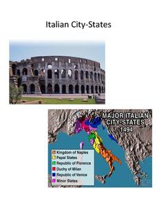
Check out this packet of worksheets involving mapping activities, vocabulary logging, reading and comprehending informational texts, etc., which focuses on Italian city-states during the fourteenth and fifteenth centuries. There are also...
Curated OER
World War II
Offering a comprehensive overview of the beginning of World War II, this resource could be a useful addition to a unit on this topic. It could be used as a way to lead a discussion on the war, or as a review tool before a test. Either...
It's About Time
Present-Day Climate in Your Community
So what exactly is climate? This first installment of a six-part series introduces the concept of climate using real-world data tables and topographic maps. The timely lesson includes a comprehensive overview of climate, as well as...
Curated OER
Victory in Europe, 1944-1945
Students examine the overall strategy pursued by the Allies in the final moths of World War II in Europe by examining military documents and consulting an interactive map of the European theater.
National Endowment for the Humanities
Lesson 1: On the Road with Marco Polo: A Boy in 13th Century Venice
Learners investigate Marco Polo's life as a young boy in 13th century Venice. They analyze maps, explore various websites, complete a chart and answer discussion questions, and create a travel brochure about visiting 13th century Venice.
Curated OER
Volcanoes: Second Grade Lesson Plans and Activities
Young geologists explore volcanoes with a series of engaging geology activities. First, they learn the difference between magma and lava before coloring and labeling the parts of a volcano. During the lab, individuals watch a...
Curated OER
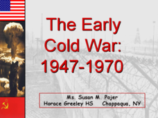
The Early Cold War: 1947-1970
With a combination of images, maps, and valuable information, this presentation is a strong resource for a history class that is coming out of a WWII unit and into a Cold War unit. Some points are outlined for students, while others are...
Alberta Learning
Great City-states of the Renaissance
Acting as journalists on a team to determine the most influential city-state of Renaissance Italy, your young historians will research, discuss, and compare the rise of Venice, Florence, and Genoa, and their influence in shaping a...
Student Handouts
Christopher Columbus Workbook
Youngsters gain ample reading comprehension practice while studying the history of Christopher Columbus with this great workbook! It includes word puzzles and comprehension checks of multiple assessment styles, including multiple choice,...
Curated OER
Mapping Your Neighborhood
Young scholars define and outline their neighborhoods using GIS (geographic information systems) or a regional map and relate their neighborhoods to the principles of Smart Growth.
Curated OER
Immigration: Creating Change
Students explore how immigration has changed the culture of America. After identifying the foods and diets of Europeans and Native cultures, students create a map indicating where foods came from. Students design a restaurant menu,...
Curated OER
The Congress of Vienna
Established to "undo what Napoleon had done," the Congress of Vienna instituted many changes throughout Europe in the early 19th century - the details of which are included in this presentation. Maps and key decisions are outlined in...
Curated OER
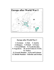
Europe after World War I
In this Europe after World War I map worksheet, students note the 11 regions of the Europe labeled on the map.
Curated OER
Bible: Christian Responsibility
Students read The Yellow Star: The Legend of King Christian X of Denmark and view A Debt to Honor to identify ways that Christians helped the Jewish people during the Holocaust. In this Holocaust lesson, students discuss...
Curated OER
Marco Polo Takes A Trip
Young scholars identify Marco Polo and discuss why he took his trip, indicate on map routes Marco Polo took to China and back, describe challenges of traveling along Silk Road, list several interesting aspects of 13th Century Chinese...
Other popular searches
- Map of Italy
- Blank Map of Italy
- Choropleth Map of Italy
- Choropleth Map for Italy
- Physical Map of Italy
- Landforms Map of Italy
- Map of Renaissance Italy
- Worksheet Map of Italy
- Printable Map of Italy
- Choropleth Maps Italy
- Outline Map of Italy
- Renaissance Italy Maps


