Curated OER
Learning Lesson: Analyzing a Weather Map
Young scholars use weather maps to locate warm and cold fronts. They discover the different types of weather associated with these fronts. They also observe the weather in their local area.
Curated OER
Weather... Or Not
Students observe and discuss the local weather patterns, researching cloud types and weather patterns for cities on the same latitude on the Internet. They record the data for 6-8 weeks on a graph, and make weather predictions for their...
Curated OER
Weather and Climate
Students identify the words plain and climate and discuss what would happen if it never rained. Students identify and interpret the weather in Poland and create a web illustrating various weather patterns. Students write a 4-line poem...
Curated OER
Mars Geologic Mapping
Young scholars identify and interpret photographic details of a Martian surface image, design, and create a simple features map. They identify and interpret the geologic history of a part of Mars' surface and then, analyze and discuss...
Curated OER
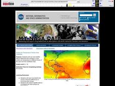
Surface Air Temperature Trends of the Caribbean
Students investigate the seasonal changes to sea surface and near-surface air temperatures near the equator. They use actual satellite data to track and graph the differences in air and sea temperatures during different seasons in the...


