Curated OER
Physical and Human Geography Review Worksheet and Study Guide
In this geography skills activity, students respond to 30 short answer questions pertaining to physical and human geography.
Weebly
Ancient China
From China's physical geography and earliest beginnings of civilization to the Qin and Han dynasties, here is a nicely designed worksheet on ancient China, which includes a graphic organizer and timeline to summarize the reading material.
Curated OER
Folk Dances from Spanish Speaking Countries
Young scholars explore dance activities from three different Spanish speaking countries.
Curated OER
Food and Countries Match
Beijing duck? Italian pizza? Japanese sushi? Language learners match food words with their country of origin. An answer key is included with the colorfully illustrated worksheet.
Curated OER
The Birthplace
Students use a world map, to identify the country of origin of the target language and other countries and areas where the largest language is on e of the principal languages. They complete this assessment orally using a world map.
Curated OER
Made In...
Students investigate where their own items of clothing were manufactured. They read their clothing labels and identify the countries, and plot the locations with pins on a large world map.
American Museum of Natural History
Global Grocery
A walk through the grocery store is like a walk around the world. An interactive activity shows popular grocery items and where the ingredients originate. Perfect as a remote learning resource, the lesson connects groceries to the...
Living Rainforest
Finding the Rainforests
From Brazil to Indonesia, young scientists investigate the geography and climate of the world's tropical rain forests with this collection of worksheets.
Curated OER
Where In the World Are You?
Fourth graders fill in blank copies of the United States Map and then the World Map.
Curated OER
Capitals, Oceans, And Border States
Students investigate geography by completing games with classmates. In this United States of America lesson, students examine a map of North America and identify the borders of Mexico and Canada as well as the Pacific and Atlantic....
Curated OER
Country Capitals
Students define the meaning of country capital. In this country capital lesson, students identify the symbol and find country capitals. Students locate and label capital cities on a map and insert the capital symbol.
Curated OER
Exploring the Variety of World Markets
Students examine the various types of world markets and analyze the differences between developed and developing countries. They watch a PowerPoint presentation and take notes, participate in a role-play that demonstrates supply and...
Curated OER
Learning European Geography
Sixth graders discover locations and countries in Europe by identifying them on a map. In this European geography lesson, 6th graders read the book The Lost Little Elephant, with their class and discuss the geography referenced in the...
Curated OER
Exploring China
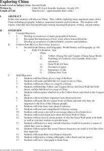
Second graders explore the geography, holidays, important teachers, and inventions from China in the nine lessons of this unit. The results of their inquiries are expressed through a variety of products, writings, and presentations.
Curated OER
Geography Booklet
Sixth graders explore geography terms. Students use resources to find real examples of landforms in the world. They create a map showing the landform. students label the surrounding features, countries and states. Students use each...
Cornell University
Too Much of a Good Thing?
Continuing their study of beneficial insects, young entomologists discover where in the world some of these bugs are. By labeling, coloring, and using the scale on a map, pupils explore the territories and arrival of the Asian lady...
Curated OER
We've got the whole world in our hands
Students explore spatial sense in regards to maps about the globe. In this maps lesson plan, students label oceans, locate the continents and poles, follow directions, and explain the symbols on a map.
Curated OER
Many Uses of Plants
Students research and discuss non-food plant products that are in common use, and mark on a world map the name of the country where the plant is grown.
Curated OER
Living In the UK
In this geography worksheet, learners complete activities on 16 worksheets pertaining to the geography and culture of the countries of the United Kingdom. This is intended for ESL students.
Space Awareness
Let's Map the Earth
Before maps went mobile, people actually had to learn how to read maps. Pupils look at map elements in order to understand how to read them and locate specific locations. Finally, young cartographers discover how to make aerial maps.
Curated OER
Finding Your Spot in the World
Students investigate a world map, a United States map, a state map, a county map and a city map. They locate each student's house on the city map and put a length of yarn from their house to a country of one of their ancestors.
Curated OER
Labeling the World
Sixth graders conduct research on the countries found on the labels on their clothing. They locate the countries on a map, research the labor practices on countries that export clothing to the U.S., and create a graph using the information.
Curated OER
The World At Your Fingertips
In this the world at your fingertips worksheet, students bring in 5 items from home that are not made in the U.S., then complete a chart, indicate on a map and answer 6 questions about imported items.
Curated OER
Population-Building a Foundation
Students research to find information about populations and complete world maps by labeling the current population, and determining the 10 countries with the largest population. They search the "World Population Data Sheet." On the third...


