Space Awareness
Meet Our Home: Earth
Earth is a complex structure. Learners explore their home, the earth, using a fun hands-on activity. They create tactile models of the earth using ordinary household materials that represent some common features: land, polar caps,...
Polar Trec
Where in the World Is Our Teacher?
Kirk Beckendorf, a middle school teacher, joined researchers at the McMurdo Station in Antarctica to help maintain automatic weather stations. The lesson encourages pupils to track his travels around the region. They connect with the...
Curated OER
I Can Find that Where? - A Study of Landforms
First graders make landform maps of the United States. In this landform lessons, 1st graders participate in a discussion of local landforms and make a landform map of the United States. They follow the teacher's directions to add plains,...
Curated OER
Landforms
In this landforms worksheet, students answer 2 questions about the major land forms and types of mountains. They match 10 landforms and types of mountains with their definitions.
Curated OER
Water Works Wonders
Students examine where water is found in the world, how we use it, and the various forms it takes. They observe the refraction of light through a prism, record the day and night sky over a week's time, and create a topographic model of...
Curated OER
Land Elevation
Students investigate land elevation. In this map skills instructional activity, students use a physical map to identify various elevations of the land. Students find landform features such hills and coastlines.
Curated OER
Create a Country
Young scholars work in small groups to list features and elements found on a variety of grade- appropriate maps. They develop a class list of map features and elements to draw from as they create a map of an imaginary country.
Curated OER
How to Use Technology to Teach Landforms
Students create a landform table on the computer. In this geography lesson, students use Microsoft Word to design a 3 column table. They list different landforms, examples, and attach a picture of each.
NET Foundation for Television
1850-1874 Homestead Act Signed: The Challenges of The Plains
Start a whole new life in a land known as the Wild Wild West! Learners analyze maps, personal accounts, the Kansas-Nebraska Act, songs, and video clips to uncover life under the Homestead Act. Using their new skills, class members role...
Curated OER
Wet Water, Dry Land
Students observe and examine relationship between landforms and bodies of water, recognizing differences between them. Students then define island, peninsula, isthmus, archipelago, lake, bay, straight, system of lakes, and identify land...
Curated OER
Matching Worksheet: Geography
In this vocabulary worksheet, students match geography words to their definition. Students identify the definition to words dealing with the physical and human features of land, and terms dealing with interpreting a map. They solve 12...
Curated OER
Sanctuary: Quail Island Banks Peninsula
Students explore world geography by creating a 3D diorama. In this New Zealand land form lesson, students examine color images of New Zealand's wildlife and discuss the different elements inside them. Students utilize these images to...
Ocean Explorer
Easy as Pi
Seamounts are large, extinct volcanoes that rise up from the bottom of the ocean floor. They are a relatively new landform in the scientific community, and this lesson invites students to learn about the amazing diversity of life found...
K5 Learning
Landforms
Valleys, mountains, and plateaus are just a few geographic landforms on our Earth. Read about these types and more in a brief landform passage. After reading, learners respond to six short answer comprehension questions.
Curated OER
Forces of Change
Second graders discuss various ways in which landforms change over time. They, in groups, research and create a reference book about landform change including tsunamis, earthquakes, weathering, erosion and volcanic eruptions.
Curated OER
Geological Features of Latin America
The rainforest, the Andes Mountains, and the Amazon River are all featured in this simplistic slide show. Intended to show the major geological features common to Latin America, this presentation provides only three geological areas and...
Messenger Education
Look But Don’t Touch—Exploration with Remote Sensing
Mars is home to the tallest mountain in our solar system, Olympus Mons. In this set of two activities, learners review geologic land formations through the analysis of aerial maps. They then apply this knowledge to aerial maps of objects...
Curated OER
Surveying the Land
Students explore the different kinds of maps and the purpose of each. In this Geography lesson, students work in small groups to create a map which includes the use of a map key.
Curated OER
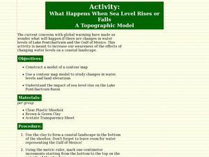
What Happens When Sea Level Rises or Falls
Students examine the impact of sea level on land formations. In this geography and map lesson, students construct a contour map model illustrating how much of the clay "coastline" is covered as water is added. Metric measurement is...
Curated OER
Outlandish Landforms
Seventh graders examine landforms. In this world Geography lesson, 7th graders research and create a physical model of a chosen landform. They then draw a 2-d paper map of that model.
Curated OER
Landforms Slideshow
Students identify twelve different types of landforms, and create a slideshow about each landform that includes a title, pictures, definitions, conclusions and a reference page.
Curated OER
Landforms of Illinois
Students discover the primary landforms of Illinois. They examine how those landforms were formed as well. In groups, they research one of the landforms from their vocabulary list. They create their landform in a shoebox and present it...
Curated OER
Landforms
Second graders identify all the geographical landforms along the pioneer trail. They study, and present to the class, at least one geographical landform along the pioneer trail.
Curated OER
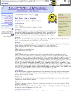
Salt Relief Map of Virginia
Fourth graders create a salt relief map of the four regions of Virginia. They indentify land forms and bodies of water, and summarize how they made their project.


