Curated OER
Landforms Crossword Puzzle
Language learners must complete ten sentences with landform words and then use these words to complete a crossword puzzle. No word list or answer key is included.
Curated OER
Watershed Works: Unit 1
By constructing a watershed model and identifying watershed features in it, they discover how water erosion changes the landscape. As with most watershed modeling activities, this one is costly in terms of time and materials. It is,...
PBS
NOVA Evolution Lab Lesson Plan
It doesn't matter if you look on land, in the air, underground, or in water—evolution is everywhere. Scholars complete worksheets with multiple question types as they progress through six online missions creating phylogenic trees.
Science 4 Inquiry
Atmospheric Layers
Space diving refers to the act of jumping from outer space and falling through Earth's atmosphere before parachuting to land. Scholars learn about this extreme activity and study the layers of the atmosphere they must conquer in the...
Curated OER
Landforms E-mail Project
Learners identify and explain geographic terms. They write descriptions of the terms. Students discuss landforms and draw pictures to illustrate them. Learners compose and present oral reports about landforms.
Curated OER
USA: Physical Map
For this United States physical map worksheet, students investigate the major landforms and bodies of water located throughout the country.
Curated OER
Do Some Research: Earth Science 20
In this universe research worksheet, students read the sentence and then use a library or the Internet to find the answer and write it on the blue line. Students then write a short report about this topic: a flat area high above the...
Curated OER
Landforms
Students study how landforms affect all aspects of a community. Students work in groups to identify landforms from other works of art. In cooperative groups Students select a work of art depicting a particular land form and create a poem.
Curated OER
Georgia's Regions
Students understand that Georgia has 5 main land regions. They are able to identify the geographic regions of Georgia and describe the regions by completing a research project about a given region with 100% mastery.
Compton Unified School District
How Can We Locate Places?
How can we locate places? Maps, of course! Expose second graders to the tools available in maps and discuss how these tools can help people find locations. Students also look at communities, including what makes a community and the...
National Park Service
Weather Patterns of the Pacific Ocean
How do oceans affect weather patterns? Learners define vocabulary associated with dew point, topographical lifting, condensation, and formation of clouds and precipitation as they explore the weather in the Pacific Northwest. They also...
Smithsonian Institution
Eastern Indian Wars
Many know that Native Americans were forced off their lands and moved west, but how did these people react? The Red Sticks faction of the Creek nation opted to defend themselves and their lands in a series of wars called the Eastern...
Curated OER
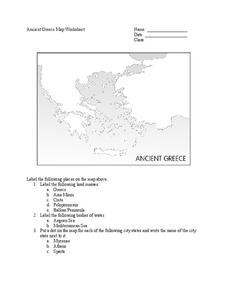
Ancient Greece Map Worksheet
Since the beginning of time, geography has shaped the development of human civilization, and ancient Greece is no exception. This activity supports young historians with exploring this relationship as they first identify key land masses,...
Bowland
Golden Rectangles
Scholars must determine the maximum area for a rectangular plot of land enclosed with 100 meters of rope. As the work they discover patterns and numerical approaches to solve the problem.
Concord Consortium
Area Upgrade
Imagine a world built of triangles. A performance task asks scholars to consider just that. They use their knowledge of special segments of a triangle to make decisions about the area of triangular plots of land.
Curated OER
Explore Surface Types on a Journey Around Earth
Students explore satellite data. In this technology cross-curriculum math and world geography lesson, students locate specific map areas using a microset of satellite data. Students use technology and math skills to determine percentages...
Curated OER
Water Creates a Cave
Students study the role of water in limestone cave formation and create a cave on karst-like grid on paper.
Curated OER
Cause and Effect: Light Clusters and Geography
After viewing a map of lights at night over a variety of geographic formations, young topographers connect the location of light clusters to geographic features that encourage human settlement. They list causes and effects of large...
Curated OER
Sand Art Creation
Young scholars create a model of a geological land-form. In this art lesson, students will create a model of a land-form using sand.
Curated OER
Landforms Crossword
After identifying an illustration and filling in the missing letters, language learners use these landform words to complete a crossword puzzle. No answer key is provided.
National Endowment for the Humanities
On This Day With Lewis and Clark
Walk in the footsteps of Lewis and Clark as they discover the wonders, beauty, and dangers of the American frontier. After gaining background knowledge about Thomas Jefferson and the Louisiana Purchase, young explorers use primary...
Curated OER
War of 1812
Eighth graders locate the major land forms and bodies of water on a map of Louisiana. In groups, they discuss the role of the Mississippi River in the Battle of New Orleans and how land and water affect the outcome of battles. To end...
Curated OER
Satellite Sense
Students look at data to understand how it is interpreted by scientists. In this satellite sense lesson, students complete worksheets based on radar and satellite images. Students work in groups of two to diagram a landform.
Curated OER
Maps and Models
Young scholars study maps of New Mexico examining settlement patterns over time and the location of water sources. They research the history of their community and discover how cultural groups interacted, adapted to their physical...


