K12 Reader
The Metric System
How did the metric system come to be, and why does the US not use it very much? Your class can learn the answers to these questions with the reading passage included here and then respond to the five related questions.
Curated OER
Survey of the Louisiana Purchase in 1815
Learners explore the survey of the Louisiana Purchase by creating their own surveying and mapping techniques such as natural maps, pace maps, and orienting. Other students then try to follow the maps.
Curated OER
Surveying our First President
Students act as surveyors. In this George Washington lesson, students read transcriptions from Washington's surveying journal and then try surveying skills on their own.
Curated OER
Boston Harbor Cruise: A Shoreline Survey
The students take a harbor cruise, photograph, and draw shore line features attending to evidence of human impact/consequences, and its cost on marine/land animal habitats vegetation, weather patterns, signs of erosion, and the water...
Curated OER
Land Use Change Introduction
Pupils discuss the major changes that have taken place in the Hudson Valley over the past 400 years. They use aerial photos to describe major trends in Dutchess County. Students view a PowerPoint presentation. They work in small groups...
Curated OER
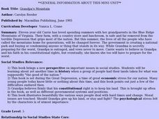
Grandpa's Mountain
Fifth graders read the book Grandpa's Mountain and discuss how land was taken away for "the good of the country". In this social studies lesson plan, 5th graders then create a newspaper, poster, poetry, interviews, surveys, or other...
Curated OER
I Know Where You Are!
High schoolers study what a GPS is and use it to challenge themselves and find positions on a map. In this investigative instructional activity students find various points on a map using a GPS system and answer questions on a...
Curated OER
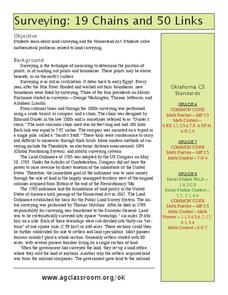
19 Chains and 50 Links
Students investigate surveys as it relates to chains and links. In this math lesson, students relate math to history and surveys done above, below and on the earths' surface. They review vocabulary pertaining to this lesson before moving...
Curated OER
Land of the Rising Sun
Students survey aspects of traditional and modern Japanese customs and beliefs in the seven lessons of this unit. Both the culture and the geography of the country are studied in this unit.
Curated OER
Economics: Property Rights and the Rule of Law
Students examine the economic value of property rights. In a classroom activity, "You're the Economist," they analyze actual research data from establishing land holding titles in Para, Brazil. They assess several case studies about the...
Curated OER
Mystify with the Mathematics of Ancient Egypt
Hieroglyphics, surveying, and the pyramids may all be explored with mathematics.
Curated OER
To Dig or Not to Dig: The Stadium Showdown
Students examine an ethical public dilemma. In this cultural resource lesson, students role play to examine their personal beliefs regarding the protection of cultural resources. They evaluate possible actions they can take to protect...
Curated OER
Trusting Statistics Lesson Plan
Students read a section of the Runaway Journey narrative and conduct a survey. They use survey statistics to question their validity and decide why a respondent might not answer truthfully.
Curated OER
What Can Be Done to Improve Ha'iku Town Shopping Areas?
Second graders examine different areas to determine how they can be improved. They observe and collect data concerning different problems and use a map to record their information. After analyzing the data, they develop possible...
Houghton Mifflin Harcourt
Renaissance and Reformation Test Preparation
This multiple-choice assessment on the Renaissance and Reformation reviews topics from humanism and the protests of Martin Luther to Italian city-states. While this is a traditional assessment designed by a textbook publisher, you can...
Curated OER
Cookie Topography
Learners construct a cross section diagram showing elevation changes on a "cookie island." Using a chocolate chip cookie for an island, they locate the highest point in centimeters on the cookie and create a scale in feet. After tracing...
Curated OER
Problems Encountered by Surveyors of Arkansas
Fifth graders examine the six geographic regions of Arkansas by examining the problems encountered by surveyors in Arkansas after the Louisiana Purchase. They conduct Internet research, create a chart, and write an essay comparing two...
Curated OER
You Gotta Know the Territory
Students examine the relationship between Native Americans and those who settled the Iowa territory. In this Iowa history instructional activity, students investigate the process for settling the territory and how intercultural...
Curated OER
Where Is That Place?
Students determine the difference between a country, state, and a city while recording the weather conditions for their school in Nebraska. They examine weather for another school in the state while practicing using weather equipment to...
Library of Congress
Loc: Map Collections 1500 2002
This collection provides maps dating back to 1500 up to the present. The collection includes: cities, towns, discovery and exploration, conservation and environment, military battles, cultural landscapes, transportation, communication,...


