Curated OER
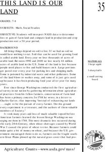
This Land is Our Land
Students interpret NASS data to determine loss or gain of farm land and compare land in production and crop production over a 50 year period.
Curated OER
Mathematical Modeling
Study various types of mathematical models in this math instructional activity. Learners calculate the slope to determine the risk in a situation described. They respond to a number of questions and analyze their statistical data. Then,...
Curated OER
This Land Is Our Land
Learners explore land use. In this land lesson, students examine the use of land and land records. They create a diagram of a specified piece of land and determine the area of the land. Learners discuss their findings.
Radford University
Summer Woes!
Who can afford the computer required to land a summer job? Pupils work in pairs to solve problems related to finding the number of hours needed to work to purchase a given item. Individuals then work on a performance-based assessment to...
Curated OER
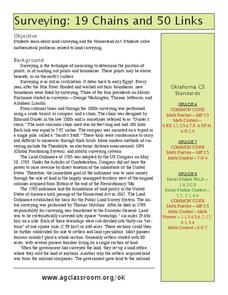
Surveying: 19 Chains and 50 Links
Through an interdisciplinary lesson, emerging engineers explore the history of surveying systems. After discussing various systems, they perform surveys on printable pages. Using their geometric skills, they physically stake out plots...
Curated OER
Third Grade Math
For this math review worksheet, 3rd graders answer multiple choice questions about probability, bar graphs, pictographs, and more. Students complete 25 multiple choice questions.
Curated OER
19 Chains and 50 Links
Students investigate surveys as it relates to chains and links. In this math lesson, students relate math to history and surveys done above, below and on the earths' surface. They review vocabulary pertaining to this lesson before moving...
Firelands Local Schools
Exponential Growth and Decay
How can you safely model exponential growth and decay? A hands-on activity uses candies to model not only exponential decay, but also exponential growth. Exponential equations are fitted by hand and by use of a calculator...
Curated OER
Geometry of Exploration: Eyes Over Mars
Students research how engineers and scientists generate linear and angular measurements with geometry to survey the Earth and Mars. They assess how geometric shapes affect navigation. A surveyor comes to the classroom and explains how he...
Texas Instruments
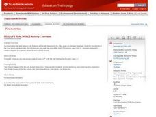
REAL LIFE REAL WORLD Activity - Surveyor
Learners investigate surveying in this secondary mathematics lesson. They will explore a real world application of geometry and trigonometry as they create a plot plan using a geometry utility and calculate the area of the land parcel.
Curated OER
Arthur Young and the President
Students work with NASS data by converting it into prose. In this historical agriculture information lesson, students read about how George Washington communicated information about crop yields, livestock, and land values. They apply the...
Curated OER
Follow the Falling Meteorite
Students use triangulation method to locate meteorite landing site on the map. In this earth science instructional activity, students participate in a meteorite treasure hunt set up by the teacher. They explain how this method is used by...
McGraw Hill
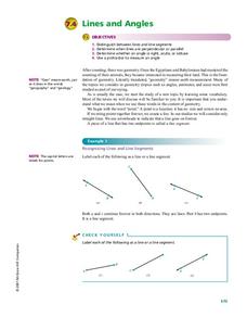
Lines and Angles
Why was the obtuse angle upset? Because it was never right! A valuable resource is loaded with background information on types of angles and lines. Learners review the characteristics of parallel, perpendicular, and...
Curated OER
Worksheet 15
In this math worksheet, students predict the velocity of an object. They also examine the position of the object in relation to the time.
Curated OER
Teachers' Notes: Switch Gets Ready!
Students practice multiplication facts, answer simple math questions from two, five, and ten times-tables, explore concept of halves and quarters, complete worksheet containing range of shapes to make shape picture, and sort data and...
Curated OER
Mystify with the Mathematics of Ancient Egypt
Hieroglyphics, surveying, and the pyramids may all be explored with mathematics.
Curated OER
Chapter 11 What's Your Preference
In this math worksheet, learners record the results of a survey taken from family members about relationships and activities.
Curated OER
Making Sense of the Census
Students problem solve the mean and median of agricultural data by completing a worksheet. They discuss the results of the statistical data.
Curated OER
One Square Meter
Learners examine various ecosystems using scientific inquiry. Using the local area, they assess the characteristics and conditions in one square meter. They report their findings in the form of a survey map and data sheet. They...
Curated OER
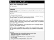
What's Your Favorite Stuffed Animal?
Second graders gather information in a survey and interpret the results using a tally chart, a table, and a bar graph. They' present their results of the during the final group discussion. The subject of the survey is favorite stuffed...
Curated OER
So You Would Like a Wind Farm, Eh?
Students collect and analyze data correctly. In this statistics lesson, students use central tendencies to analyze collected data. They calculate where a wind farm will be placed, based on the data.
Curated OER
Cookie Topography
Learners construct a cross section diagram showing elevation changes on a "cookie island." Using a chocolate chip cookie for an island, they locate the highest point in centimeters on the cookie and create a scale in feet. After tracing...
Curated OER
MAPS AND TOPOGRAPHY
Students analyze the details of a topographic map and create one of their own by utilyzing a map of elevations.
Curated OER
Preparation and Transition to Two-Column Proofs
Students investigate proofs used to solve geometric problems. In this geometry lesson, students read about the history behind early geometry and learn how to write proofs correctly using two columns. The define terminology valuable to...


