Curated OER
How Did That Get There?
Students evaluate the role of government in addressing land use and other environmental issues. They analyze the powers, responsibilities, and limitations of elected and appointed officials in the national legislative, executive, and...
Curated OER
User-friendly rivers
Learners explore and explain their connection to rivers through watersheds. They break into three groups. Each group needs: Blue enamel paint, Miniature objects to simulate a model river system, modeling clay, Tempera paint, Toothpicks...
Curated OER
Is Urban Sprawl Causing Us To Lose More Than Ground?
Students map the changes that occur in the land as a result of urban sprawl. They explore the problems that paving and building have on the watershed and the habitats on the Northshore.
Curated OER
Overland Trails To The West
Consider the political, physical, and geographical factors that led to and marked the Westward Expansion. Learners will track the various routes developed during the 1800's. They create a first person journal describing what they see,...
University of Southern California
Wave Erosion Lab
Using a stream table, erosion enthusiasts examine how the density of sediment and how the slope of land contribute to the amount moved by waves. You will not be able to use this entire resource as is; there are teachers' names and...
Curated OER
Kidney Structure and Function: removing intracellular waste
Your class will learn all about the function of the kidney and how it operates in animals from different habitats. The methods of absorption, filtering and excretion are detailed and pupils will learn of the different disposal methods...
Curated OER
TECH:Flight Simulator (Trans)
Microsoft's Flight simulator is the focal point of this lesson plan. By participating in this activity, teenagers role-play what is necessary for piloting an airplane. They explore the concepts of flight. You will need to familiarize...
Curated OER
Soil Investigations
Learners examine the basics about soil. In this soil lesson students describe the physical properties of soil and explain what soil profile is.
Curated OER
Calculate Your Contribution
Students assess the environmental impact of their transportation choices. They keep a transportation journal and use a website to calculate vehicle emissions for themselves and their class. They evaluate their transportation choices.
Curated OER
Mapping My Community
Ninth graders are introduced to GPS technology. They complete fieldwork as they visit a specific area of their community to identify and map types of land use in the surveyed area. They use the collected data to create a digital map.
Curated OER
Lesson L - Hit The Road Jack (or Jill)
Students discuss forms of transportation in Delaware during 18th Century, find approximate area of court order on current map of state, draw layout of their school, and decide where new hallway or outside pathway would be most needed.
Curated OER
Acid Rain
Students understand the dynamics of acid rain and its impact on the living and non-living environment. They hypothesize how acid rain affects water pH levels in two lake systems with differing watershed features.
Curated OER
Applied Science- Built environment Lab (Trains)
Learners examine transportation. In this train design lesson, students study how trains work and how to efficiently design a track by working with an electric train set. As a class they compare various types of trains and work...
Curated OER
Candy Land Math
Students order numbers and sets of objects from 0 through 10 and organize and interpret information collected from the immediate environment. They read and interpret graphs usin real objects and the computer. Finally, students sort a...
Curated OER
Risk Assessment and Geometry
Tenth graders study the concept of risk analysis as it relates to geometry. For this spatial relationship lesson, 10th graders are provided a set of coordinates to analyze a piece of land described. Students write a description that...
Curated OER
Surface Water Model
Students examine, through demonstration and experimentation, how water moves through watershed, identify pollutants that can enter water system from different land use activities, and discuss ways people can help prevent water pollution.
Curated OER
Rain Shadows and Sea Breezes
Students plot the average rainfall for a variety of cities in the United States. Using the map, they work together to determine patterns on which toxicants are transported through the air. They determine the impacts of various weather...
Curated OER
Development Issues in the Northern Suburbs
Students demonstrate the ability to obtain geographic information from a variety of print and electronic sources. They use a variety of maps and data to identify and locate geographical features of Minnesota and Anoka County. in...
Curated OER
Council Grove: Site of the Hellgate Treaty
Students explore Native Americans and the migration of non native people to Montana. They investigate and interpret maps for information such as location of Indian reservations, transportation routes and important communities.
Curated OER
757 Glider Kit
Students work together to complete a 757 Glider kit. They use a GPS to discover how it operates in all weather landings. They complete different obstacles with the glider as well.
Curated OER
A Victorian Prison
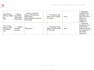
Prisons in Victorian England were miserable places, designed to deter people from committing crimes. To understand why these prisons were so tough, young historians review documents and pictures from Coldbath Fields prison. After...
Curated OER
GPS Scavenger Hunt
Middle schoolers go on a GPS scavenger hunt. They use GPS receivers to find designated waypoints and report back on what they found. They compute distances between waypoints based on the latitude and longitude, and compare with the...
Curated OER
Sustainable Lifestyles vs. Lifestyles of Excess
Students examine the concept of sustainability and Vietnam. They compare/contrast the Vietnamese lifestyles with those in the U.S., and analyze how water, land use, transportation, food systems, and homes effect sustainability.
Curated OER
GPS Art
Students design their own logo or picture and use a handheld GPS receiver to map it out. They write out a word or graphic on a field or playground, walk the path, and log GPS data. The results display their "art" on their GPS receiver...


