Curated OER
MAPS AND TOPOGRAPHY
Students analyze the details of a topographic map and create one of their own by utilyzing a map of elevations.
Curated OER
Going to the Promised Land
Students analyze primary resources and map in order to draw conclusions regarding the migrant-worker experience during the Great Depression. They explain and explain the impact of economic and ecological events on individuals.
Curated OER
MAPPING THE TOPOGRAPHY OF UNKNOWN SURFACES
Students describe in words and graphic displays the elevation or depression profile of sections of Mars' Olympus Mons and/or Valles Marineris. They explain how orbiting spacecraft build up global maps one data slice at a time.
Curated OER
Mapping an Empire
How did the expansion of the Roman Empire during the first century contribute to its downfall? Using a map of the Roman Empire in 44 BC and one of the Roman Empire in 116 AD as references, class member use critical reading skills to...
Curated OER
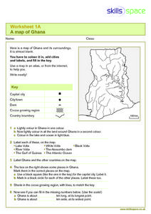
A Map of Ghana
For this Map of Ghana worksheet, students are given a blank map and key. They are told to label major features and color according to directions.
Curated OER
The Marsh Land as a Changing Environment
Sixth graders continue their examination of the state of Connecticut. After taking a field trip, they identify the types of birds, plants, invertebrates and vertebrates who make their home in the salt marshes. In groups, they identify...
Curated OER
Using a Starfinder
In this starfinder worksheet, 5th graders construct a starfinder in order to determine which stars are in the night sky on a given date and time. Students use their starfinder to answer 9 questions about the stars and constellations,...
Curated OER
The Time Has Come: Poetry and Drama Use in the Geography Class
Students use drama and poetry in their Geography class. In groups, they role play an interviewer or the interviewee in various plays that were presented to them. In their role, they must locate and label where the countries mentioned...
Curated OER
Exploring the Hudson in 1609
Learners follow the journey of Henry Hudson down the river with his name. Using journal entries and maps, they learn about its exploration. They use maps to identify stages of the journey, and practice converting distances into miles.
Curated OER
Arsenic and Lead Scavenger Hunt
Health wizards read and discuss an article about lead contamination then come up with a plan to help solve the problem. They get into groups to develop a community solution within the parameters of a budget, feasibility, and the source...
Curated OER
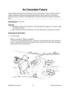
An Uncertain Future
Learners study the distribution of large mammals and carnivores in an ecosystem. Using maps and historical data, they examine areas for these animals such as refuges, untouched forests, prairies and grasslands. Students determine actions...
Curated OER
Agriculture in Canada
Students examine various elements in the physical environment and their relationship to agriculture in Canada. Using the ArcCanada CD-ROM, they analyze maps, and interpret relationships between the physical environment and land use.
Curated OER
Water and Land 207
Students examine maps of different projections, mathematically calculate distortions, and note the advantages and disadvantages of each map. They study the different maps and transfer the map to graph paper.
Curated OER
Finding Longitude and Latitude on Pennsylvania Maps
Students draw the lines of longitude and latitude on a map. Students look at a topographical maps to see how topography relates to land use.
Curated OER
Japan: Land of the Rising Sun
Students locate Japan on a globe, name the major physical features, and describe the physical environment. They survey the differences and similarities between the life and culture of Japanese young people and American young people.
Curated OER
Alberta And Saskatchwan: the View in 1905
Learners analyze the differences between maps 1905 and current maps of Alberta and Saskatchewan. They use maps from the Canadian Council for Geographic Education to complete a guided inquiry. This lesson also has many extension activities.
Curated OER
Of Maps and Worldviews
Students explore Ptolemy's world map as an expression of the Renaissance view of the world.
Curated OER
Mapping the Many Underground Railroads
Students determine the beginning and the end points of the enslaved person's journey to freedom, noting landmarks mentioned along the way such as cities, towns, rivers, mountains, and other geographic features.
Curated OER
Playground Mapping
Students review their physical models of the objects on their playground at school. Using the model, they convert it into a map with a scale and key. To end the instructional activity, they use the map to locate different objects and...
Curated OER
Moving West with the Forts: Using an Interactive Map
Seventh graders practice reading maps and locating the forts stationed in Texas. Using the internet, they analyze westward movements from statehood to the Civil War. In groups, they complete a worksheet about the forts and share their...
Curated OER
Meet You at the Midden: Map Game
Students examine sketch map of Burrets' Trail at the Nightengale Archaeological Center, interpret map symbols to play game, and identify reasons people modify environment to meet their basic needs.
Curated OER
Landscape Picture Map: Natural and People Made Features
Students explore the places and objects that make up the Earth's surface. In this natural and people made features instructional activity, students identify things they've seen that are people made and those that are natural to the...
Curated OER
Bathymetric Mapping
Students draw contour lines based on NOAA soundings on a nautical chart. They color the contours and glue label tags for topographic features. They determine that the floor of the ocean is composed of hills, plains, ridges, trenches,...


