Curated OER
Ocean Currents
For this ocean currents worksheet, students will use maps of the Atlantic Ocean currents and the Pacific Ocean currents to complete 6 short answer questions.
Curated OER
Korean Lesson Plan
Seventh graders are introduced to the history of Korea. Using maps, they identify the reasons why Korea is important geographically. They also research the reasons for the Korean War and how actions of the United States and Korea led...
Curated OER
The Geography of Renaissance
Students use the internet to research the geography of the Renaissance. Using maps of Europe, they identify at least three key cities during the time period and discuss the main types of transportation. They research the various customs...
Curated OER
Getting to Know the Seven Continents
Students are introduced to basic map and globe skills. Using the internet, they identify and locate the seven continents and complete a blank map to reinforce the names of the continents. They also distinguish between land masses and...
Curated OER
Lesson: Journey of a Tree
Third graders explore the operation of a Christmas farm and how trees are shipped. After taking a tour of a Christmas tree farm and researching transportation, location and cost issues, 3rd graders create a map to show the distribution...
Curated OER
A Place Called Fairfax
Students are introduced to the various types of maps of Fairfax County, Virginia. Using the maps, they explain the relative and absolute locations of the county and discuss the importance of both. They also discover how the county is...
Curated OER
Mapping The Way With Lewis & Clark
Fourth graders analyze and compare maps used on the expedition of Lewis and Clark. Students write reports about the geography of the land. They answer questions about Lewis & Clark.
Curated OER
Nature and Place Names in Arkansas
Middle schoolers examine the way that many place names in Arkansas came to be. By looking at Arkansas highway maps, they find names that come from the characteristics of each of the state's six geographical divisions. This interesting...
Curated OER
Energy Resources: Where Are They and How Do We Get Them?
Future energy engineers visit several stations, each one dedicated to a different alternative source of energy. They describe how solar energy is converted into other forms of energy, the patterns of distribution of energy resources in...
Curated OER
Amelia the Pigeon: As a Pigeon Flies
Students follow Amelia's adventure on a satellite image. They use measuring and math skills to determine the distance she traveled.
Curated OER
Force of Habitat
Plants and animals of the desert are the subject of this instructional activity. While the activities involve an exploration involving Nevada, this resource could be altered for use with any area. This detailed instructional activity...
Curated OER
Good Vibrations Remote Sensing data Collection: Thermal Emission Spectrometer
The Mars Global Surveyor spent two years creating a mineral map of the planet Mars using thermal emission spectrometry. To help young astronomers understand this remote sensing instrument, have them simulate how data is collected and...
Curated OER
Wildlife
First, biology pupils research land and marine habitats along the route of skipper Rich Wilson's Great American II. Then, using colored paper clips scattered across a colored paper background, they play the predator-prey game to...
Curated OER
Columbus Day (Native American Perspective)
Teach your class the perspective Native Americans had on Christopher Columbus. They will examine the effects of Christopher Columbus' exploration on the Native Americans using a reading theater and a carousel brainstorming activity. They...
Curated OER
What They Left Behind: Early Multi-National Influences in the United States
Students examine how the European voyages of discovery influence American culture even today. They map eighteenth century Europe's impact on the United States.
Science Matters
Slip Sliding Along
The San Andreas Fault is the largest earthquake-producing fault in California. In the seventh lesson in the 20 part series, pupils create maps of California, focusing on the San Andreas Fault system. The comparison of where California is...
Curated OER
Footprints: Take a Step into Estimation
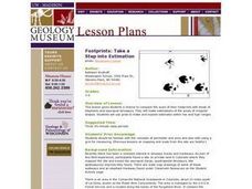
Compare sizes of student footprints with those of elephants and sauropod dinosaurs! Upper graders make estimations of the areas of irregular shapes; students use grids to make and explain estimates within low and high ranges.
Orange County Water Atlas
Location, Location, Location…
Young geographers discover not only how to read and recognize coordinates on a map, but also gain a deeper understanding of latitude and longitude and how climate changes can vary significantly across latitudes.
Curated OER
What They Left Behind: Early Multi-National Influences in the United States
Learners research the impact of European voyages of discovery and colonial influence on different aspects of American culture. They access a number of online sources and reference maps to trace the influences of England, France, Holland,...
Curated OER
Climate Change in My City
Students investigate the climate changes occurring locally, regionally and globally over the last one hundred years. They brainstorm and predict whether the current year's weather was warmer or colder than last year then check the...
Curated OER
The Hundred Years' War (1347-1453)
Detailing the causes, strategies, and effects of the Hundred Years' War, this presentation will interest even the most reluctant historians in your class. Bright pictures and maps help to put the war into context and allow teachers to...
Curated OER
Mystery State #32
There is no better way to start a lesson, than with a good problem-solving activity. Give your class the chance to see if they can use each of the five clues to determine the name of mystery state number 32. Hint: It's the eastern most...
Rainforest Alliance
How Far Away Is a Tropical Rainforest?
If driving to school only takes 10 minutes, then how long does it take to drive to a tropical rainforest in Colombia? Explore the focus question in a lesson that uses measurement tools and formulas to figure out the time and distance...


