Curated OER
Louisiana's Major Folk Regions
Students study the three major folk regions of the state. They break the regions down into smaller folk regions or use the concept of three regions: North Louisiana, South Louisiana, and New Orleans. They identify some of the markers...
Curated OER
Lake Tahoe Then and Now
Students investigate the differences in Lake Tahoe from the past to the present. In this geography instructional activity, students read the book Washoe Seasons of Life and identify the descriptions of the land and lake. Students create...
Curated OER
More Than One Grain of Rice
Students explore mathematics, geography and agriculture by studying world rice production. In this production of rice lesson, students read One Grain of Rice and use a worksheet grid to calculate how much rice was received. Students...
Curated OER
Oklahoma Grown: Discovering Oklahoma's Agriculture
Fourth graders investigate where Oklahoma's variety of crops are harvested, and grown their own plants. A printable map and crop information guide are provided.
Curated OER
Rice Farming in Texas
Third graders explore how rice farming came to Texas. In this rice farming instructional activity, 3rd graders discover the history of how farmers began to grow rice in the United States. Students color code maps and create a timeline...
Curated OER
Dark Days on the Prairie
Young scholars explore U.S. geography by researching agriculture. In this dust bowl lesson, students complete a cause and effect worksheet based upon the dust bowls that covered a large portion of Oklahoma and Texas in the early 1900's....
Curated OER
A Colony is Born : Lesson 3 - Marking Time
Fifth graders refer to text and timeline to fill in a graphic organizer and timeline from 1492-1607. They participate in a class discussion that allows for speedy accumulation of events and fill in their own timelines. They work in small...
Curated OER
The Four Corners Region of the United States Cultures, Ruins and Landmarks
Learners who live in the inner city are introduced to the four corners region of the United States. In groups, they examine how the region differs compared to where they live and their culture. They develop maps of the area and locate...
Curated OER
Watersheds and Wetlands
Students discuss the idea of a watershed. They build models of watersheds using paper and observe what happens to their models when it "rains". In addition, they build a second watershed to compare watersheds with wetlands to those without.
Curated OER
Sunken Slave Ship
Learners investigate shipwrecks. In this marine archaeology lesson plan, students create the site of a shipwreck by using a tub filled with sand and items from a "ship". Learners excavate the site and analyze the findings.
Curated OER
Border to Border
Students use the Internet to gather information on the country of Mexico. They also discover the culture of their people and compare them with the United States population. They take a virtual tour of some of Mexico's most historical ruins.
Curated OER
El Nino
Middle schoolers recognize that El Nino is caused by changes in the atmospheric and ocean content. They conduct a simple experiment, visit websites and create a class poster using individual storyboards.
Curated OER
Thunder and Lightning
In this earth science worksheet, students read and study about the formation of lightning and thunder using online resources. They complete 8 short answer questions that follow.
Curated OER
Third Grade Social Studies-Multiple Choice Activity
In this grade 3 social studies activity, 3rd graders complete a set of 25 questions about a variety of topics including geography, types of communities, map and questions about the environment.
Curated OER
Landforms All Around
Students create a "Landform Dictionary". They develop an overlay map and participate in hands-on activities to identify the key characteristics of landforms. They discuss the plant and animal life of these areas. Handouts for the lessons...
Curated OER
Regions of South America
Students explore facts about South America in the four lessons of this unit. Booklets are created from the materials produced as the class delves into the topic.
Curated OER
Looking at Landforms-Based on the Washington Quarter Reverse
Students use a Washington State Quarter to examine different landforms and discuss natural resources. After a class discussion on the items found on a Washington State quarter, students brainstorm a list of natural resources found in...
Curated OER
Mapping It Out - Great Lessons For Geography
Through geography lesson plans students can learn about history, science, and a variety of other subjects.
Curated OER
Historical Atlas
Sixth graders evaluate how revolutions have affected the world throughout history (i.e. boundaries of nations, culture, economics, etc...) through the research for and creation of a historical atlas for assigned countries.
Curated OER
People and Places
Fifth graders investigate how the geography of the land effected the human experience of the Lewis and Clark Expedition. They research using primary and secondary sources, design a map.
Calvin Crest Outdoor School
Survival
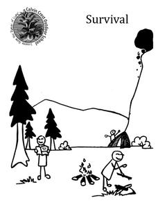
Equip young campers with important survival knowledge with a set of engaging lessons. Teammates work together to complete three outdoor activities, which include building a shelter, starting a campfire, and finding directions in the...
K12 Reader
The Louisiana Purchase
Readers are asked to identify the main idea and two supporting ideas in a brief passage about the Louisiana Purchase.
Curated OER
English Perspectives
To further their understanding of the basis of the conflicts between the Pocumtucks and the English settlers, class members research the religious beliefs and attitudes of the Puritan farmers that settled in Deerfield, Ma.
Boston University
Scramble for Africa
In this fantastic simulation, your young historians take on the roles of imperialistic European countries in the nineteenth century and then "scramble" to carve up the continent of Africa! This is a very hands-on activity that will help...


