Curated OER
Creating a Coastal Area
Students design and lay out a map of a coastal area that includes a bay, an estuary, an ocean entrance, and prime beach lands. They write a plan outlining solutions to the economic problems of their community and present their map and...
Curated OER
Ecological Pyramids
Students apply the ecological pyramids of numbers and biomass with an activity using topographic maps. In this trophic level lesson, students work in groups using a topographic map to determine the number of organisms that can live in an...
Curated OER
Air Masses
Pupils are given maps depicting two or more air masses and they then categorize bodies of air by temperature and moisture characteristics. They recognize large regions of similar type air. Students are given a map of air temperatures and...
Curated OER
Prairie Voices: Community Development, Investigating Local History
Learners investigate local history. In this research skills lesson, students examine historic landmarks, tax records, fire maps, town plans, historic photographs, newspapers, and other primary sources to learn about local communities in...
Curated OER
A Look at the Population Density of the United States
Learners acquire census information and create maps of the population density of the United States on different scales. They role play the roles of workers of a retail company and they use the population data to market to their customers.
Curated OER
Comparative Geography II
Students engage in a research question of finding the effect of population density upon the use of land in a physical area. They also find the effect of how this can effect the lifestyles of the people who live there.
Curated OER
Other Countries
Students select a country and conduct research on the culture, population, geography, and government of their country. They conduct research using the Internet and a variety of resource books, and write and publish a report that...
Curated OER
Water Features of Virginia
Students locate and identify water features important to the early history of Virginia. Thye recognize where most cities developed and locate and label the rivers on a Virginia wall map.
Curated OER
Reptiles
In this reptiles worksheet, students use an idea map to compare amphibian and reptile adaptations. Students complete 2 short answer questions based on the idea map.
Curated OER
Making a Brand for Ourselves the "Cowboy" Way
Students define cowboys and learn about their roles on rangelands. In this rangeland lesson, students define cowboys and cowgirls and complete a KWL chart. Students read Cattle Kids and Til the Cows Come Home. Students visit the...
Curated OER
America the Beautiful
Students analyze the physical geography of the United States and how we have adapted to or altered the land to create the country we know today. Students complete maps with physical features, states and cities of interest.
Curated OER
Early Arkansas Geography
Seventh graders locate and describe historical Arkansas while using a historical map.
Curated OER
Traveling to the Gold Rush
Fourth graders research the experiences the people who traveled to California during the Gold Rush by land and sea. They create a map showing the various routes that individuals took to get to California. Students explain the...
Curated OER
The Great Continental Drift Mystery
Students stud the concept of Pangaea by using Wegener's clues to construct a map of the continents joined together. They determine how fossil distribution can be used to enhance the study of continental drift. They locate the...
Curated OER
Viriginan American Indians
Students complete a KWL chart about the American Indians using graphic organizers from websites. They read a teacher-selected book about the early Virginia American Indians and then read Becoming a Homeplace from the Virginia Historical...
Curated OER
Survey This!
Learners examine biological information about George Washington focusing on his love of surveying. They explore cartography and field of surveying. They write a letter and make a map of Virginia.
Curated OER
Scale Basketball
Students understand that a spreadsheet can be used to find the best scale to use in a model. They place the distances of the planets of the solar system to the Sun in one column of the spreadsheet. Students try different scales so that...
Curated OER
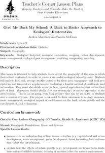
Give Me Back My School: A Back to Basics Approach to Ecological Restoration
Ninth graders research local geography to create successful, ecological school landscaping. They determine soil type, average weather patterns and temperature graphs and use the information to select ideal plants and plant maintenance...
Curated OER
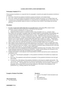
Social Studies: Population Distribution
Students create a population distribution map of Goodland Island indicating where people live by marking the locations with dots. After reading a written description of the island, they write short paragraphs explaining and justifying...
Curated OER
About the U.S.A.
Young scholars research the United States and discover its different climate zones, geographical features, animal life, and various cultures. Students complete a research chart using books, encyclopedias and the internet and present...
Curated OER
Native American Music: Call-and-Response
Students are introduced to call-and-response form of Native American song and dance. They identify and describe a call-and-response form as used in "0 Hal'Lwe."
Male students will perform "0 Hal'Lwe" in call-and-response style with drum...
Curated OER
Acid Rain
Learners use real-time weather maps to determine the likelihood of acid rainfall in a region. Students apply their understanding of interaction between weather systems, land and air pollution, to address acid rain and the effects on...
Curated OER
Scrapbook of Freedom
Third graders create a scrapbook using personal narratives and samples of artifacts to connect to maps of geographical locations of the Underground Rail Road. they describe at least one of the feelings a child slave might have had...
Curated OER
School Yard Park/Ecosystem
Fifth graders observe and categorize different sections of a park and it's ecosystem. For this categorizing lesson plan, 5th graders collect different facets of nature from a nearby park (without disturbing the ecosystem). They map,...


