Curated OER
Why is a salt marsh important?
Middle schoolers discuss the salt marsh. They define the following terms: habitat, water, land and air. Students work in small groups. They are asked why are they going to a salt marsh? Middle schoolers discuss whose habitat is it at...
Curated OER
Exploring the Night Sky: Summer
Students explain how moon phases occur. They describe and explain at least two common misconceptions that people have about the moon. Students explain what a star is. They explain 3 ways that the night sky has been used throughout history.
Curated OER
Maps and Globes: Where in the World are We?
Students explore maps and globes. In this introduction to map and globe concepts lesson, students identify features of physical maps, political maps, and globes. Students locate land and water, and recite a poem about the names of the...
Curated OER
But Where Is It On This Modern Map? A problem-solving, mind-boggling experience!
Trace Columbus' voyages by locating them on 21st Century maps. Using a navigators lesson, 4th graders will examine the Age of Exploration and trace Columbus's routes accurately on laminated world maps using different maps. Note: You...
Curated OER
Sinkholes in a Cup
Learners create sinkholes and learn about the formation of sinkholes by using water, a foam cup, sugar, sand, and a sponge. In this sinkholes lesson plan, students also answer short answer questions.
Curated OER
Water Cycle
High schoolers identify the different stages in the water cycle. In this earth science lesson plan, students calculate the residence time of water in oceans using a mathematical formula. They explain how this cycle regulates the Earth's...
Curated OER
A Nation Counts
Students explore the functions of the U.S. Census. In this civics lesson plan, students understand the origins of the census and its role in U.S. history, recognize the political importance of apportionment based purely on population,...
Curated OER
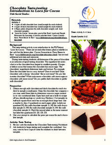
Chocolate Taste-Testing: Introduction to Loco for Cocoa
Students compare chocolates using their five senses and determine the value of the chocolate. In this chocolate lesson, students sample various types of chocolate. Students study the price per ounce of each bar to complete the...
Curated OER
Life Inside Castle Walls
Students use their creativity with the knowledge learned about the Middle Ages. A.D.400-1500. They use their information and creativity to design a castle and a personal coat of arms, then plan a medieval feast.
Curated OER
The Earth Moves Under My Feet
Students study earthquakes, monitor seismic activity using the Web, and plot real-time activity. They examine movement of the Earth's tectonic plates. They create an earthquake preparedness project.
Curated OER
The Population Explosion: Causes and Consequences
Students use this lesson to focus on population growth and the threat of overpopulation. In groups, they analyze the world birth and death rates to determine the growth rate of the population. As a class, they discuss the causes and...
Curated OER
Canadian Conoe Trip
Sixth graders research Canadian geography - the land and the bodies of water. They then plan an imaginary canoe trip through six major water bodies in Canada. They conclude the unit of study with a creative story.
Curated OER
Make Your Own Recycled Paper
Paper Lesson Plan - Students discover how paper is made. Working together, they make their own paper. This activity introduces students to recycling; what it is and its importance. Students study the process of how paper is made, and...
Curated OER
THE TRAVELS OF BABAR: An Adventure in Scales
Young scholars locate and identify the seven continents. They use longitude and latitude in establishing a location. Students enhance the knowledge of geographical location with cultures. Individuals or small groups research multiple...
Curated OER
Geography and Culture in South Carolina
Students explore South Carolina. In this cultural heritage lesson, students investigate the topography of South Carolina using maps. Students are engaged in identifying the different regions of the state and examine the cultural heritage...
Curated OER
Watersheds and Wetlands
Learners discuss the idea of a watershed. They build models of watersheds using paper and observe what happens to their models when it "rains". In addition, they build a second watershed to compare watersheds with wetlands to those without.
Curated OER
Topographic Maps
In this topographic map worksheet, students learn how to read a topographic map and create a topographic map of their own using clay or Play-Doh. Students include contour lines by layering the clay. Students answer 6 questions about...
Curated OER
Numbers Tell a Story
Learners connect census data to historical events. In this civics lesson plan, students understand cause and effect, and how they are reflected in census data and analyze census data for social and economic significance.
Curated OER
19th Century Settlement Houses
Students will take notes on 19th century settlement houses using a four-door book of foldable notes. In this lesson on Settlement Houses, students will analyze the Hull House through a variety of primary sources, then create a list of...
Curated OER
Where Do We Go From Here?
Eighth graders examine the impact of Reconstruction on South Carolina. In this Reconstruction lesson plan, 8th graders use primary documents to research sharecropping and freedman's contracts in the agricultural South following the end...
Curated OER
Compass Rose Tossing
Young scholars use different pieces of equipment to practice throwing and catching. They use the cardinal directions of North, South, East and West in making a compass rose with the equipment. They must use higher order and decision...
Curated OER
Build the Tallest Building
Learners examine the design and construction of skyscrapers. They use the internet to research information about different types of skyscrapers. They create their own building and defend it to the class.
Curated OER
Find Yourself with Global Positioning
Students examine different types of new mapping technologies. They use the internet to gather information about mapping and navigation. They create their own global positioning tool and defend it to the class.
Curated OER
Poly Spot Dribbling
Young scholars perform dribbling activities using a basketball. In this dribbling lesson, students dribble a basketball according to the poly spot number that they land on. This lesson uses kinesthetics to gain knowledge of counting.


