DePaul University
Settlement
Early settlers in the American Midwest experienced constant struggle. This reading passage describes for young learners the hardships of homesteaders as they journeyed west and sought to start a new life. When finished, students identify...
School Improvement in Maryland
Smart Growth
New roads, new businesses, new developments, new mass transit systems. All growth has both positive and negative effects on communities. Government classes investigate the principles of Maryland's 1997 Smart Growth program and...
Curated OER
The Cost of Community Services
Young scholars identify the types of services provided to citizens by local government and evaluate tax revenue versus the costs of delivering these services to developments. They evaluate the advantages of spatial relations to delivery...
Curated OER
What Is Smart Growth?
High schoolers practice planning for the development of an area using the goals of Smart Growth as a guide. They analyze how regions can affect government policies. They role-play citizens who recommend how an area should be developed.
Chicago Botanic Garden
Introducing Ecosystem Services
Ecosystems provide many things humans not only use but also need in order to survive. The last lesson in the series of seven introduces scholars to the idea of ecosystem services, that ecosystems provide humans with many things we need....
Chicago Botanic Garden
Are You Bigfoot?
Scholars independently explore several websites to calculate their ecological footprint. Using their new found knowledge, they answer six short-answer questions and take part in a grand conversation with their peers about how...
Chicago Botanic Garden
Calculating Your Ecological Footprint
You can lower your ecological footprint by recycling! Lesson four in this series of five has individuals, through the use of a computer, calculate their ecological footprints. Through discussions and analysis they determine how many...
Curated OER
Land Use and Nitrogen
Students consider the effects of development on water quality. They test nitrogen levels in waters before and after development, investigate wastewater treatment options and research best management practices to reduce nitrogen loads.
Curated OER
Water Walk
Students conduct a visual survey to discover information about local land use and water quality; document their findings by mapping and profiling the water body; and use this initial investigation to raise questions about local land use.
Curated OER
Mapping My Community
Ninth graders are introduced to GPS technology. They complete fieldwork as they visit a specific area of their community to identify and map types of land use in the surveyed area. They use the collected data to create a digital map.
Curated OER
City Lesson Plan
Students examine the patterns and processes of urbanization and describe patterns of urban land use. They choose one of five cities using riddles and research why this city is desirable. The groups make quizzes for each other on the city...
DePaul University
Egypt
The country of Egypt is more than just big pyramids and ancient pharaohs. After reading a brief overview of this African nation, young learners will demonstrate their understanding of the text by identifying the main idea and supporting...
Curated OER
Selecting Trees for Urban Environments
Students consider the best place to plant a tree. In this environment lesson, students identify urban locations that are compatible with particular tree types. Students decide what trees would go where and why they would survive.
Chicago Botanic Garden
Personal Choices and the Planet
How big is your footprint? Activity three culminates the series by having groups complete carbon footprint audits with people in their schools and/or around the districts. Groups then gather their data, create a presentation including...
Curated OER
"I've Been Working on the Railroad" - Federal Land Grants and the Construction of the Illinois Central Railroad in Mid-nineteenth Century Illinois
Eleventh graders, in groups, design a self-sufficient community. Groups present the communities they've designed. They compare and contrast the communities presented. They research the theories of Johann Heinrich von Thunen online and...
Curated OER
Country Mouse, City Mouse?
Students recognize the characteristics of a rural area. They analyze land use to determine whether the map is of a rural (country) area or an urban (city) area.
Curated OER
Comparing Metropolitan Regions
Young scholars engage in an inquiry that compares and contrasts urban growth in Phoenix, Arizona, the Bay Area, California, and Calgary, Alberta. They compare the metropolitan regions in terms of patterns of settlement, commute times,...
Curated OER
Louisiana Purchase
Students use maps to locate and describe the area purchased by the Louisiana Purchase. In groups, they write a letter to Thomas Jefferson in which they evaluate the topography, climate and geography of the land. They determine the land's...
Curated OER
Annotated, Detailed Example of Socratic Questioning
Students identify and define the main components of the hydrosphere and the ways in which they interact with one another. They explore how changes in Earth's surface materials affect components of the hydrosphere and evaluate the effect...
Curated OER
What Can a Map Tell You?
Learners investigate how maps can provide useful information about health issues. They study a map to draw conclusions about cholera death in London.
Curated OER
A Contouring We Go
Students examine the built environment and infrastructures of their community by constructing contour equipment, using the equipment, and comparing their results to current topographical maps of the same area
Curated OER
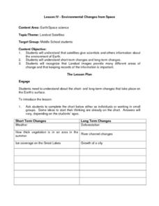
Environmental Changes from Space
Students discuss Landsat Satellites and the use of the images they provide as well as the purpose of keeping records of the information from the satellites. The class works in groups to complete a worksheet on short term and long term...
Curated OER
Good Food Explorers
Students use different food items in order to practice the mathematical concept of shape recognition. At the same time the teacher explains how crops are a source of physical health. They use all five senses to describe each food item...
Curated OER
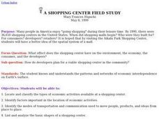
A Shopping Center Field Study
Students analyze how developers plan for a shopping center. They take a field trip to a nearby shopping center. Also students participate in a shopping center scavenger hunt. Students identify factors important to the location of...


