Curated OER
Poetry IV--Similes and Metaphors
Middle schoolers solve and write riddles using similes and metaphors. In this similes and metaphors lesson, students work in groups to solve descriptive riddles for famous landmarks. Middle schoolers are given pictures of...
Curated OER
Plate Tectonics
Students examine plate tectonics and landforms. In this plate tectonics lesson students complete an activity. Students practice drawing maps that show different fault lines and the land formations that were caused.
Curated OER
Water Works Wonders
Learners examine where water is found in the world, how we use it, and the various forms it takes. They observe the refraction of light through a prism, record the day and night sky over a week's time, and create a topographic model of...
Curated OER
Georgia's Regions
Learners understand that Georgia has 5 main land regions. They are able to identify the geographic regions of Georgia and describe the regions by completing a research project about a given region with 100% mastery.
Curated OER
Rocks and Minerals
Students are able to describe earth processes (e.g., rusting, weathering, erosion) that have affected selected physical features in students, neighborhoods. They are able to identify various earth structures (e.g., mountains, faults,...
Curated OER
Haiku Wrap Up
Students create a haiku about the land formations they've studied. In this haiku lesson, students identify the metaphor and meaning of a given haiku, brainstorm comparisons for a landform photo as a class and choose one to use in a...
Curated OER
Surveying the Land
Students explore the different kinds of maps and the purpose of each. In this Geography lesson, students work in small groups to create a map which includes the use of a map key.
Curated OER
Where in the World Is That Volcano?
Identify the Earth's major volcanoes with an earth science lesson. Elementary and middle schoolers locate major volcanoes on a world map. Then, in groups, they research how the volcano affects the region in which it is located.
Space Awareness
Valleys Deep and Mountains High
Sometimes the best view is from the farthest distance. Satellite imaging makes it possible to create altitude maps from far above the earth. A three-part activity has your young scientists play the role of the satellite and then use...
Curated OER
Postcards from California: A Unit on Geography, Social Studies, History and California's Resources
Fourth graders examine patterns that influence population density in the various regions of California. The unit's three lessons utilize graphic organizers for the interpretation and presentation of data.
Curated OER
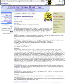
Salt Relief Map of Virginia
Fourth graders create a salt relief map of the four regions of Virginia. They indentify land forms and bodies of water, and summarize how they made their project.
Curated OER
Discovering Places & Regions
Fifth graders research physical and cultural features of a place. They practice skills in gathering information from various sources, using tools such as graphic organizers, word processing, multimedia, and use of the Internet.
Curated OER
Geography of Spain
Students explore Spain. In this geography skills lesson, students investigate a political map of Spain and record the names of states, capitals, and landforms. Students then practice tagging the states, capitals, and landforms on blank...
Curated OER
Where, Oh Where
Students use maps to explore several traditional regions of Native Americans. They research information on the regions' climate, resources, landforms, flora and fauna.
Curated OER
Environment: Just Around the Bend
Students decipher landforms on a map and corresponding satellite imagery. They consider the impact of pollution on agriculture and water. They draw diagrams demonstrating how pollution works its way into the food source.
Curated OER
Los Trenes de Espa¿¿a
Students identify and read correctly the symbols of a Spanish train schedule. Using maps, they identify and locate major cities and landforms of Spain and practice using a twenty-four hour clock. Using the internet, they navigate a...
Curated OER
Paper Mache Globes
Third graders create a paper mache model of the earth. At the conclusion of a discussion about the earth, they are given paper mache materials, they create their globe and appropriately draw and label landforms, bodies of water and the...
Curated OER
Touring the Regions of the United States
Fifth graders explore the regions of the United States. In this geography skills lesson, 5th graders examine the landforms, climates, and economies of the regions of the United States. Students conduct Internet research in order to...
Curated OER
Geography Postcard Podcasting
Learners complete a geography postcard activity using Podcasting. In this geography lesson, students research landforms and climates of various U.S. and Canadian regions. Learners write a description of their travles in the form of...
Curated OER
Go Glacier Go!
Students create a model of a glacier and observe how it moves. In this landforms lesson plan, students learn what a glacier is, build a model glacier and observe how it moves in a manner that more closely resembles a liquid than a solid.
Curated OER
When You're Hot, You're Not!!
Middle schoolers investigate volcanoes. In this landforms activity, students locate two volcanoes on a world map. Middle schoolers compare and contrast the types of volcanoes by using various Internet sites.
Curated OER
A Passport to Asia
Learners explore Asia. In this geography skills lesson, students design travel brochures that market Asia by highlighting its location, population, capital, landforms, famous places, and food.
Curated OER
Settlement Survival
Students fill out worksheets about the landforms and developments needed to form settlements like when the colonists settled. In this settlement lesson plan, students learn about how different land formations played a key role in where a...
Curated OER
Tooling Around Arizona: Reading Arizona Maps
Young scholars research Arizona maps. In this map lesson, students discuss map titles, scales, directions, elevation, and symbols. The class will examine topography, landforms, and rivers found on an Arizona map.
Other popular searches
- Landforms and Water Forms
- Canada Geography (Landforms)
- Earths Landforms
- Landforms Lesson Plans
- Landforms of Colombia
- Ocean Floor Landforms
- Definitions of Landforms
- Different Landforms
- Canada Geography Landforms
- Google Earth Landforms
- Geographic Landforms
- Landforms on Neptune


