Curated OER
The Big Wet
Students research areas of Australia and other parts of the world characterized by a tropical wet and dry climate.
Curated OER
Canada's Landform Regions
Students identify and describe the processes that created the landform regions in Canada. They map the regions and research one region to discover more about it. They present their findings to the class.
Curated OER
Canada's Landform Regions
Students use a atlas to identify and describe Canada's Landform region. Using the information they collect, they create a thematic map of the region and describe all of the physiographic regions and the processes that formed them. They...
Curated OER
What You Can Learn From a Map
Students discover how to interpret maps. In this geography skills lesson plan, students explore geographic themes as they complete worksheet activities regarding road maps, shaded relief maps, and topographic maps.
Curated OER
Geography of Vietnam
Ninth graders examine the geography of Vietnam. For this Geography lesson, 9th graders create a physical and political map of Vietnam.
Curated OER
Create a Planet
Students craft planets from clay. In this geography skills lesson, students create model planets that mimic the geographic features found on Earth as well as the other planets. Students conduct research about characteristics of the...
Curated OER
Glaciers Leave Their Imprint
Students study various types of glaciers and the landforms they create. Working in pairs, they research a type of glacial landform and construct a calendar page illustrating and describing it. The pages be compiled to create a class...
Curated OER
Being Nosy About Our Neighbors
Students use the scientific method to explore the effect of size on impact cratering. They compare images of landforms on Earth to those of other planets to compare surface processes. Students infer the geologic history of another...
Curated OER
Latin American Relief Map
Students, in groups, research, design and construct a relief map of a section of Latin America using papier-mache. They show major landforms, elevations and notable bodies of water. They present their maps to the class.
Curated OER
Geographic Landscapes and Interstate Freeway Development
Students investigate the topography of the United States through a discovery lesson. They create a hypothetical route for a highway across the United States. Students also conduct research major landforms and define geographic terms.
Curated OER
Big Blue Sky- Based on the Montana Quarter Reverse
Students use a Montana quarter to help describe geographical features such as landforms and bodies of water. Students read an article about Montana as a group and discuss examples of landforms and bodies of water. After reading,...
Curated OER
Exploring Nations
Pupils, in groups, research countries in East and Southeast Asia. The group designs an oral presentation and PowerPoint slideshow to showcase research on landforms, political and economic issues, global interaction and special-purpose maps.
Curated OER
Saskatchewan's Population Distribution
Young scholars explore landforms, vegetation, climate and population distribution in Saskatchewan. After discussing an atlas of Saskatchewan, students create their own relief map and climagraphs of Saskathewan. Using specified...
Curated OER
Metropolitan Areas in the USA
Fifth graders explore why people live in certain regions of the United States. They investigate information on specific metropolitan areas such as temperature, population, natural resources, precipitation and landforms. In groups, 5th...
Curated OER
Earth Surface Socratic Questions
Students explore the ways Earth's surface is shaped by hydrologic, climate and tectonic forces by participating in a whole class discussion. They respond to prompts that lead them to conclusions about the relationships between landforms...
Curated OER
Mapping Seamounts in the Gulf of Alaska
Students describe major topographic features on the Patton Seamount, and interpret two-dimensional topographic data. They create three-dimensional models of landforms from two-dimensional topographic data.
Curated OER
Advertise With Geography...it's Free And It's Easy!!
Students establish awareness of how landforms/landmarks produce a visual image of a region and demonstrate how advertisers use the "positive geographical image" to sell their product by creating their own advertisements.
Curated OER
Create A Travel Brochure
Students identify the different landforms in the State of Oaxaca, Mexico and create a travel brochure highlighting Oaxaca's attractions.
Curated OER
What Would Happen If ... A Study of a Scandinavian Glacier
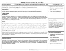
Learners read an article about changes is the landforms in Scandinavia. They identify the main ideas. They eliminate or combine to make 4-7 main ideas. Finally students write about what they predict happen share, and discuss.
Curated OER
Where's the Barbecue?
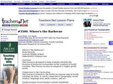
Learners identify the major landforms, regions and rivers on a map of South Carolina. They compare the locations of the major Native American groups in the state as well. They chart where barbecue restaurants are located and write...
Curated OER
Geographical Area Analysis
Students complete this instructional activity before visiting the National Museum of the Pacific War. They examine the patterns and characteristics of landforms, climates, ecosystems and cultures as they interact on areas or regions...
Curated OER
Aqualung , the New Age Garden
Students examine how underwater landscape could be used for food production in the future. They discuss underwater landforms, draw a picture of an underwater landscape and a type of technology to use underwater, and write a description...
Curated OER
Geographical Area Analysis
Student explore the patterns and characteristics of major landforms, climates, ecosystems and cultures as they interact upon specific areas or regions. They prepare a geographic analysis of a given area.
Curated OER
Glacial Geocaching
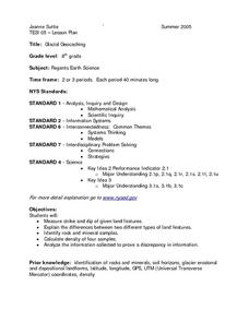
Eighth graders measure strike and dip of given land features and explain the difference between them. They also look at rock and mineral samples for indentification, along with calculating the density. Finally, information is analyzed...
Other popular searches
- Landforms and Water Forms
- Canada Geography (Landforms)
- Earths Landforms
- Landforms Lesson Plans
- Landforms of Colombia
- Ocean Floor Landforms
- Definitions of Landforms
- Different Landforms
- Canada Geography Landforms
- Google Earth Landforms
- Geographic Landforms
- Landforms on Neptune


