CK-12 Foundation
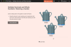
Estimation to Check Decimal Multiplication: Watering a Garden
Mathematicians solve six multiple-choice and true or false questions using their knowledge of estimation and multiplying decimals. The interactive provides a garden-themed tool that creates a visual aid of three watering cans to assist...
University of Waikato
Water Temperature
Water temperatures connect to the movement of the ocean. Pupils read two articles about the temperature and the motion of the oceans before small groups investigate the interaction of hot and cold water. Team members add cold and hot...
University of Waikato
Growing Soil Microbes
View how microbes grow in soil. Class members first create a Winogradsky column to grow bacteria. They then set up the column of mud in a plastic bottle and include a food source for the microbes and observe the column of mud over the...
American Museum of Natural History
Global Grocery
A walk through the grocery store is like a walk around the world. An interactive activity shows popular grocery items and where the ingredients originate. Perfect as a remote learning resource, the lesson connects groceries to the...
American Museum of Natural History
Make Your Own Weather Station
Scholars build a weather station equipped with a wind vane, rain gauge, and barometer. Following an informative page about the weather, learners follow steps to build their pieces then turn into meteorologists to chart the weather they...
NASA
Collecting Light: Inverse Square Law Demo
Light, distance, and mathematics come together to help scientists plan for space missions. Groups examine the relationship between distance from the sun and light availability in a hands-on exploration activity. They model the inverse...
K20 LEARN
Mood and Tone at Owl Creek Bridge: Mood and Tone
Two versions of movie trailers for the film Mary Poppins launch a supercalifragilisticexpialidocious activity about how mood and tone impact a reader's experience of work. Using the provided list, readers identify the words that create...
Curated OER
Nunavut, Our Communities
Students research the Online Atlas of Canada to locate the communities of Nunavut. Students examine the geographic area and characteristics of the communities.
Curated OER
Five Utah Indian Tribes
Fourth graders study the five Utah Indian Tribes being able to identify the tribes by name and location.
Curated OER
Mapping My Trip to the 2002 Winter Olympics!
Eighth graders map their route from their local community to Salt Lake City, Utah for the Winter Olympics. Using atlases, they gather topographical information and use the internet to research any landmarks they might pass on the way....
Curated OER
Information Fluency
Third graders pretend a major trading card company has asked them to help gather information on animals who live in the rainforest. In groups, they select an animal and use the sources given to them to gather the information. They create...
Curated OER
Why Do You Live Where You Do?
Eighth graders identify reasons why settlers bought land from the railroad and not a Homestead grant. Using that information, they compare and contrast the types of land given in each situation. They discuss the reasons why given...
Curated OER
Rivers And Capitals
Students become familiar with the use of GIS for research and become aware of the importance of rivers to cities. They also analyze the placement of cities and learn the names of rivers in the United States.
Curated OER
Indiana Tornado Project
Students become familiar with the use of GIS for research, natural phenomena in Indiana, and analyzing collected information.
Curated OER
Can You Give Me Directions To the Game?
Young scholars become familiar with the use and capabilities of GIS and use it for research and mapping purposes. They heighten their ability to estimate travel times by incorporating distance, mode of travel and urban congestion into...
Curated OER
Exploring the Internet for Information
Pupils identify and use the internet as a resource for information. They integrate the writing process and create a multimedia project using the information from an internet research. Projects can be created from Microsoft Word,...
Curated OER
What Is That Bubblin' In My Back Yard?
Students are introduced to the GIS system. They create a map plotting local sites the Environmental Protection Agency has on its EPA Regulated Sites list. They identify a list of schools that are near potentially hazard sites.
Curated OER
Where to Live?
Students decide where they want to live in US. In this geography instructional activity, students select their residential preferences. Using GIS, they determine the location that meets their preferences.
Curated OER
Where We Live: Homes Near and Far
Second graders explore where they live, and about homes around the world. They explore the different reasons homes differ in a variety of locations.
Curated OER
When You're Hot, You're Not!!
Students investigate volcanoes. In this landforms lesson, students locate two volcanoes on a world map. Students compare and contrast the types of volcanoes by using various Internet sites.
Curated OER
Navigating Nonfiction
Third graders explore the arrangement of nonfiction. In this library skills lesson, 3rd graders examine Dewey Decimal classification as they collaborate to locate nonfiction materials in the library/media center.
Curated OER
Reef Attack
Students identify the locations of coral reefs. In this oceanography lesson, students use the Coral Reefs website to locate the coral reefs on a world map and discuss ways to help protect the coral reefs.
Curated OER
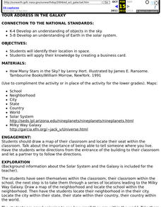
Your Address in the Galaxy
Pupils create a business card after researching their location in space and determining their Galactic Address.
Curated OER
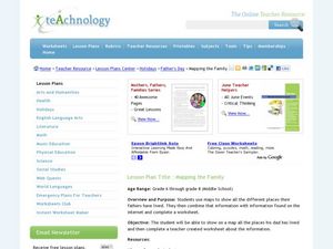
Mapping the Family
Young scholars research the locations where their fathers have lived. In this map skills lesson, students identify the locations their fathers have lived in the world as they create charts and maps that note the information.


