Curated OER
The Mind Map
Learners form a mental map of their residence in relation to school and recreate it on paper showing distance, direction, location and symbols. This instructional activity is designed to introduce students to geographic thinking.
Curated OER
Geography A to Z: Letter O
The world is full of places that start with the letter O. It's true! Your class can use what they know about geography to answer seven curious questions related to world locations that all begin with letter O. Like Ohio, Ottowa, and...
Curated OER
A World of Information
Young scholars analyze data and statistics about countries around the world. They read graphs and charts, color a world map to illustrate the top ten statistics about the world, and write a paragraph to summarize their information.
Space Awareness
Let's Map the Earth
Before maps went mobile, people actually had to learn how to read maps. Pupils look at map elements in order to understand how to read them and locate specific locations. Finally, young cartographers discover how to make aerial maps.
National Center for Families Learning
Hidden Flags
Scholars scour a city landscape to locate twenty-five hidden flags. After each discovery, the narrator offers a piece of information about the American symbol. When all flags are found, a fireworks display appears in...
Curated OER
Folk Dances from Spanish Speaking Countries
Students explore dance activities from three different Spanish speaking countries.
Curated OER
Countries of the World
Students participate in a game to help them locate countries around the world. They identify facts about countries they drew out of hat. They work together in groups to read facts to another group until the correct country is guessed.
Curated OER
El Mundo Hispano
Colorful maps are clearly labeled in this PowerPoint to show viewers where different Hispanic countries are located within Central and South America. Each country is listed on its own slide with a title, the capital, close-up map, flag,...
Space Awareness
Navigating with the Kamal
Historians have proven that as early as 1497 skilled navigators were using a kamal to sail across oceans. Scholars learn about navigation tools and astronomy before building their own kamals. They then learn how to use it to determine...
Curated OER
Create Your Own Country!
Students create their own countries. In this geography skills lesson plan, students establish governments, cultural backgrounds, atlas/geography components, national anthems, and national symbols for a country they create.
Curated OER
Philippines- Neighboring Countries & Water Boundaries
In this Philippines worksheet, students answer multiple choice questions and label the diagram with neighboring countries and water boundaries. Students complete 16 questions.
Curated OER
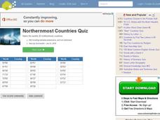
Northernmost Countries Quiz
In this online interactive geography quiz learning exercise, students respond to 20 identification questions about cities located in the northernmost regions of the world. Students have 4 minutes to complete the quiz.
Curated OER
City to Country Quiz
In this online interactive geography quiz worksheet, students examine the chart that includes 20 world cities. Students identify the names of the countries where the cities are located in 4 minutes.
Curated OER
Christmas Around the World
Students produce a factual book about customs in other countries. They produce a poem about a country/custom. They locate countries on a map. They compile and compare data about each country.
Curated OER
Do the Tallywalker
Students study the basics of mapmaking, then make a tally walker, (geographic location device used in secret).
Curated OER
Analyzing the Language of Presidential Debates
Scholars assess how word choice and linguistic patterns affect a presidential debate. They examine candidates' words for repetition and analyze what this repetition means. Then they locate countries that fit the expression free world. In...
Global Oneness Project
Citizen Photojournalism
Matt Black's photo essay, "The Geography of Poverty" provides a shocking reminder of the poverty that exists in the United States. The resource not only focuses attention on poverty but also conditions that have given rise to situation...
Global Oneness Project
A Day in the Life
We often see other countries depicted in movies, but getting a close look at a typical day in the life of a young person from another country isn't as common. Give your pupils such a look with a resource that helps class members...
Curated OER
Country Capitals
Students define the meaning of country capital. In this country capital lesson, students identify the symbol and find country capitals. Students locate and label capital cities on a map and insert the capital symbol.
Curated OER
Locations Of Countries In Europe
In this European geography instructional activity, middle schoolers describe where 12 countries in Europe are located by using directional phrases. Students also practice describing the nationalities of people from each country and how...
Curated OER
The Country of Nigeria - Map Work
In this map worksheet, students label 14 items on a map of Nigeria. They follow directions to label and color Nigeria, and the water-bodies and countries that surround it.
Curated OER
Locate and Name the bodies of water and the continents
Second graders locate the equator, bodies of water, and different continents on a globe. In this globe lesson plan, 2nd graders recall geographical information on a globe.
Curated OER
African Safari
Seventh graders examine different countries in Africa to research. They choose one to concentrate their research on using the five themes of geography. They design a multimedia presentation that will make up the African safari.
Curated OER
Maps
Maps, globes, and computer software aid young explorers as they locate state capitols, major cities, geographic features, and attractions for states they are researching. They then use desktop publishing software to create a map to share...


