Curated OER
Passport to the Eastern Hemisphere
Seventh graders create a time line of significant dates in the history of their nation. This requires students to examine the entire history of a country and make informed judgments based on their historical knowledge.
Curated OER
Great North
Students use maps to locate the Arctic Circle, the North Pole and Northern Europe. They draw and label countries within the Arctic Cirlce and identify the groups of people who live there. They also watch and answer questions about the...
Curated OER
Understanding Cultural Differences
Learners listen to an interview and then write an essay about the life of people in the country as perceived by the person they interviewed.
Curated OER
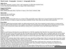
Geography Review
Third graders name the continent, country, state, and community in which they live. They locate Maryland and Baltimore on a map of the United States.
Curated OER
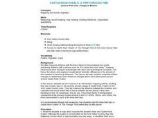
CASTLE ROCK PUEBLO: A TRIP THROUGH TIME
Students use a map to respond to a series of questions. They determine how much time it would take to travel to Castle Rock Pueblo from different pueblos and locate modern pueblos on the Indian Country map.
Curated OER
Exploring Ethnic Groups in Africa
Students research the ethnic groups located in African countries where African Americans immigrated. They view a multi-media presentation imbedded in this plan, then construct posters that represent ethnic groups.
Curated OER
Land of the Rising Sun
Students survey aspects of traditional and modern Japanese customs and beliefs in the seven lessons of this unit. Both the culture and the geography of the country are studied in this unit.
Curated OER
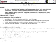
Water, Water Everywhere
Students are introduced to the complex issues of water resources around the globe. In groups, they take on the role of a country and map out the location of water sources. They barter, sell or take over other groups to have access to...
Curated OER
Cross-Cultural Exploration
Students in an ESL classroom identify and locate the states on a United States map. Using the internet, they research to compare the holidays in their home country and the United States. They share their findings in an email to...
Curated OER
What Drives Immigration?
Students research the primary causes of emigration and examine the affects of immigration on a country. They conduct research either individually or as a group and prepare a written report or dramatic presentation of their findings.
Curated OER
War and the Animal
Students analyze the spatial organization of people, places, and environments in a spatial context. They gain personal insight into the horrors of war and the importance of ethnicity. Students define all key terms, analyze a world map...
Curated OER
Understanding Korean Culture
Third graders investigate the meaning of immigration by looking it up in the dictionary and discussing it. They determine the location of Korea on the map and brainstorm ideas about it. They listen to a read aloud of Helen Recorvits, My...
Curated OER
Cyber Vacation
Students will look up information concerning their destination. The information should include their destination; the monetary system of the country; cost of hotels; airplane fares, etc. They look at ways to improve o searches as a...
Curated OER
Korea Cultural Lesson Plan
High schoolers engage in a study of geography and maps of Korea. They examine charts and graphs. Students are expected to interpret the information accurately and completely. The geography skills can be used on other countries as well.
Curated OER
Travel Brochures
Third graders divide into teams and select a country to research. They read and review "Notetaking Skills" and begin their research. Next, they work together and share the information they have located. Each team fills in a template with...
Curated OER
Mi país
Students research Spanish-speaking countries on the Internet and make a presentation.
Curated OER
"Czech It Out" - A Look at Eastern Europe
High schoolers research several countries in Eastern Europe. Students compare and contrast several Eastern European countries and then choose a specific country to research and prepare a class presentation with their findings.
Curated OER
What is Southeast Asia?
Students participate in various classroom activities designed to teach them about the location and cultures of countries in Southeast Asia.
Curated OER
Historical Atlas
Sixth graders evaluate how revolutions have affected the world throughout history (i.e. boundaries of nations, culture, economics, etc...) through the research for and creation of a historical atlas for assigned countries.
Curated OER
Around The World
Young scholars search the Internet through a sequence of steps to reach the country of their nationality. They research and collect information about their country.
Curated OER
Where Did That Come From?
Fourth graders participate in a scavenger hunt. They locate specified items, finding the country origin. Students collect and organize the data, marking each country on a map. After researching the results, 4th graders write an analysis...
Curated OER
United States Climates
Middle schoolers identify regional climates by using weather maps. They, in groups, locate and mark their city on the small map, then go to the larger map to locate and mark their city when they are called upon by teacher.
Curated OER
Cultural Comparison - A Look at Vietnam and the USA
Students identify a map of Vietnam and locate it in Asia. They find the three countries that surround Vietnam. Using a CIA Fact Web site and photographs from Vietnam, students list differences and similarities of these two cultures.
Curated OER
GEOGRAPHY GOES TO THE DOGS
Students use countries and dogs from around the world to answer the questions.


