Curated OER
Longitude & Latitude
Seventh graders role play as ship's captains to study longitude and latitude.
Curated OER
The Longitude and Latitude of the Night Sky: Declination & Right Ascension
In this longitude and latitude worksheet, students identify and write in the correct hours, minutes, and seconds for right ascension. Then they identify and write the correct + or - degree in the space for declination or latitude. There...
Curated OER
Lights, Shoals & Soundings
Young scholars explore nautical charts and their symbols, with a bit of fun thrown in.
Owl Teacher
Latitude & Longitude
Here is a activity activity where learners mark the latitude and longitude coordinates of cities all over the world. There are 15 cities to identify, from Baghdad, Iraq to Warsaw, Poland and Anchorage, Alaska.
Curated OER
Practical GPS Applications in Forestry & Agriculture
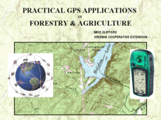
An explanation of the Global Positioning System (GPS) and the Geographic Information System (GIS) is given in this presentation. Uses and applications are considered. How it works and sources of error are also touched upon. A large...
Curated OER
Latitude & Longitude Bingo
Students practice map reading skills through a reinforcement game of bingo. They select any 24 of 30 listed cities to write on blank bingo cards. Then using atlases, locate a city based on the latitude and longitudinal coordinates...
New York Times
New York Times: Crossword Puzzle: Latitude & Longitude
Here is an interactive & printable crossword puzzle developed by the New York Times Learning Network. The theme of this puzzle is Latitude & Longitude.
NSTATE
Net State: The Geography of North Carolina
Here at NetState you will find a variety of facts about the geography of the state of North Carolina. Find out the geographic center, total area, elevations and much more.


