Curated OER
Westward Expansion
Students locate California and New York on a map and explore available means of travel in the 19th century. Students explore the role of trade in pioneer America and simulate various barter transactions.
Curated OER
"Where in the World is my School?"
Students learn new vocabulary and discuss what GPS is and does. They locate their school using the equipment.
Teach Engineering
What's Wrong with the Coordinates at the North Pole?
Here is an activity that merges technology with life skills as individuals use Google Earth to explore the differences between coordinate systems and map projections. The self-guided worksheet is the fourth segment in a nine-part unit....
Teach Engineering
Searching for Bigfoot and Others Like Him
Individuals create a GIS data layer in Google Earth that displays information about where one might find seven different cryptids. The class members research to find data on cryptid sightings they can include in their data...
Curated OER
Making a Map of the Classroom
Students create a map of the classroom using the computer programs AppleWorks and iChat in this math-based technology lesson. Lesson extension ideas include a scavenger hunt and maps of other school buildings.
Curated OER
Where is Here?
Young scholars are shown the very basics of navigation. The concepts of relative and absolute location, latitude, longitude and cardinal directions are discussed, as well as the use and principles of a map and compass.
Curated OER
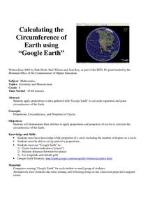
Calculation the Cricumference of Earth using "Google Earth"
Eighth graders investigate properties of circles. In this eight grade mathematics lesson, 8th graders apply proportional reasoning to data gathered with “Google Earth” to calculate equatorial and polar circumference of the...
Curated OER
Analysis of Atmospheric Conditions for a High Mountain Retreat
Students examine the relationship between altitude, atmospheric pressure, temperature and humidity at a particular location. They practice science and math in real world applications. They write reports detailing their scientific...
Curated OER
GPS Treasure Hunt for Knowledge
Students examine themselves as being part of a global community. In this global community lesson, students investigate GPS systems. Students gain knowledge on how the device works. Students discover that satellites provide information...
Curated OER
Graphing on a Coordinate Plane
Eighth graders explore the coordinate system. They identify the x and y-axis, parts of the coordinate plane, and discuss the process of plotting points. To emphasize the process of plotting points, 8th graders play an ordered pair...
Curated OER
Mapping Natural Disasters
Pupils use Cartesian coordinates to plot current natural disasters. They relate location of natural disasters to their specific major project countries. Students tie in geometry within this lesson as connected to spatial relationships...
Curated OER
Osprey Journey
Students investigate the migration route of one bird, Osprey B4, using information gathered from satellites to track birds over a two-year period. They coimpare their graphs with maps of B4's migrations that have been plotted by...
Curated OER
'Tis a Long, Long Way to Tipperary!
Students practice finding the location of cities across the world by using an interactive Web site, and figure out the world's time and the value of time zones the world over.
Curated OER
What A Tombstone Can Tell Us
In this coordinates worksheet, students determine the coordinates to visit a cemetery. Students determine 18 coordinates on this worksheet.
Curated OER
Principles of Flight: Where are We?
Students explore the concept of topographical maps. In this topographical map lesson plan, students discuss how airplanes know where to fly. Students use topographical maps to simulate a field trip on the computer.
Curated OER
Anything I Can Do You Can Do Better
Students complete a two-week unit involving design and construction concepts. They watch a PowerPoint presentation about geometric shapes, draw the fourteen shapes incorporated in bridge construction, and in small groups design, build,...
Curated OER
Understanding Hurricanes and the ER-2
Young scholars study hurricanes; in particular, what they look like, how they are formed, how they are categorized, how they are named, and how they are tracked. They examine the science of hurricanes as well as the mathematics of...
Curated OER
High Mountain Retreat
Students explore and analyze atmospheric conditions for a high mountain retreat. They examine the relationship between altitude, atmospheric pressure, temperature and humidity at a particular location. In addition, they write reports...
Curated OER
Make Your Own "Weather" Map
Students develop and apply a variety of strategies to solve problems, with an emphasis on multi-step and non-routine problems. They acquire confidence in using mathematics meaningfully.
Curated OER
Simple Angles
Third graders identify and construct right, acute and obtuse angles and begin to appreciate the degree and unit of measurement of angle. They know the degree value of angles that are simple fractions of a whole turn know that the angle...
Curated OER
U Boat Hunt
Pupils recognize patterns and sequences in numbers. In this geometry instructional activity, students create rules to define the sequences and patterns they obsere. They translate coded messages as they dicuss navigational terms.
Curated OER
Typhoon Project
Students graph and outline the path of a typhoon. In this algebra instructional activity, students measure the path of the typhoon and create a graph with their data. They analyze the data and make predictions.
Curated OER
Charles Lindberghs's Flight to Paris
Students practice map skills. In this map skills lesson, students locate the cities of New York and Paris on a map. Students read about the flight made by Charles Lindbergh in May 1927 from New York to Paris. Students answer 8 questions...


