Curated OER
We've got the whole world in our hands
Students explore spatial sense in regards to maps about the globe. In this maps lesson plan, students label oceans, locate the continents and poles, follow directions, and explain the symbols on a map.
Curated OER
Maps
Maps, globes, and computer software aid young explorers as they locate state capitols, major cities, geographic features, and attractions for states they are researching. They then use desktop publishing software to create a map to share...
Curated OER
Where in the World Is…
Students identify countries, oceans, states, and more on a globe and on a flat map. In this geography lesson plan, students also locate places around their school.
Curated OER
Leapin' Landmarks: Locating 10 Man-made Landmarks Around the World
Third graders label continents, oceans, and major mountain ranges on maps and use the maps to write an informational report about landmarks. In this landmarks lesson plan, 3rd graders write about 1 major landmark.
Curated OER
The Exploration and Settlement of North America
Young scholars locate place in Canada and explore highlights of early of early American exploration and settlement. In this North American history lesson plan, students locate provinces, major cities, and physical features of...
Curated OER
The Restoration Colonies
Explore the earliest American cities in this presentation, which details the demographics, geography, and characteristics of New York, Pennsylvania, and the Carolinas, among others. These slides help to fill in the gap between the...
PBS
Make a Balloon Globe
"We've got the whole world in our hands," is what your students will be singing after completing this fun geography activity. Using the included templates for the seven continents and a balloon, they create their very own globes.
Curated OER
Ocean Currents
Fourth graders work in groups to research ocean currents and create posters with their findings. They locate the patterns and names of major ocean currents and identify them on a map. Students also use red pencil to show ocean currents...
Curated OER
Mapping West Virginia
Fourth graders explore West Virginia. In this Unites States geography instructional activity, 4th graders discuss the type of land and the cities in West Virginia. Students create two overlays, with transparencies, that show the natural...
Curated OER
The 50 States and its Holidays
Though the format of this ELL lesson is confusing (the standards listed are for plate tectonics, yet the objectives are for American geography and holidays), a teacher could glean some ideas from the main idea. Here, pupils complete a...
Curated OER
Where in the world is...
Students identify locations around the world. In this mapping lesson plan, students place tag board pieces with names of locations on a wall map of the world. Initially, students identify states, then cities, then continents,...
Curated OER
Hemispheres & Continents
Students learn in cooperative learning groups to determine how the equator and the Prime Meridian divide the earth into hemispheres and use Venn diagrams. Students will locate and label the hemispheres, continents, and oceans.
Curated OER
Getting to Know My World
Students participate in hands-on activities using maps and globes to identify geographical features. Students use map legends to identify direction. Students locate oceans, continents, countries, states and cities. Handouts and...
Curated OER
Latitude and Longitude
Fifth graders study latitude and longitude. They estimate the latitude and longitude of their hometown and find the latitude and longitude of other cities using a map. They use a website to find out the cities' actual latitude and...
Curated OER
Sharing The Land
Students investigate different geographical terms and concepts. This is done with practicing with maps of the United States to find major coasts, lakes, and rivers. They also put together a floor map of the United States. Students create...
Curated OER
Important Rivers of the World
Third graders become familiar with names of the different parts of a river, define and locate drainage basins, locate six of the continents and explore the major rivers on each one, conduct research on a river of their choice.
Curated OER
Bottled Water Ban
Convenience, taste, portability ... what's not to love about bottled water? Apparently, a lot. Scholars analyze the four main arguments supporting and opposing the sale of bottled water. They explore the health, environmental, and...
Curated OER
Geographic Features and Human Settlements
Third graders examine geography and settlements. In this geography lesson, 3rd graders participate in classroom activities that center on the idea that people settle where there are geographical features that sustain life.
Curated OER
India and Its Climate
The climate found in different regions of India is the focus of this brief presentation. Learners discover that India has three main seasons; winter, summer, and monsoon. There isn't a lot for pupils to do with this PowerPoint, but it...
Curated OER
Sacred Places
Students examine places considered sacred in both India and the U.S. They read and discuss a website on the Ganges River, discuss places considered sacred in the U.S., and write an essay comparing/contrasting personal sacred places and...
Curated OER
A Study of Panama
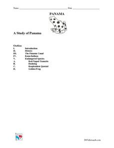
In this worksheet on Panama, students read an introduction about Panama, then read about its history, The Panama Canal, the Kuna Indians and the Endangered Species of Panama. After each selection, students answer a set of related questions.
Curated OER
Of Maps and Worldviews
Young scholars explore Ptolemy's world map as an expression of the Renaissance view of the world.
Curated OER
Getting to the Core of World and State Geography
Students create topography relief maps. In this geography skills lesson, students review geography core knowledge skills, design and make a state relief map, and compile a student atlas.
Curated OER
Travel to Mesoamerica
Students research books, watch movies, and look on the internet to find information on ancient America, Mexico, and Central America. In this Mesoamerica lesson plan, students participate in a social studies unit on North America of the...


