Curated OER
Latin American Relief Map
Students, in groups, research, design and construct a relief map of a section of Latin America using papier-mache. They show major landforms, elevations and notable bodies of water. They present their maps to the class.
Curated OER
Mapping La Salle's Travels
Students use the internet to create a map showing the path of La Salle through North America and the Caribbean. They identify the main geographic features of the two areas and the main French forts. They also complete a timeline.
Curated OER
WWII: On The Homefront and Abroad
Students explore World War II from the perspective of both the sides. They research the changes that occurred on the homefront during 1942-1944. Students prepare and conduct an interview with a local veteran or spouse of a veteran...
Curated OER
Mongolia Geography
Students examine the geography and culture of Mongolia. Individually, they cut out cut-outs of animals to place on their maps and label the grasslands and desert areas. They locate major cities and rivers along with vegetation.
Curated OER
Splendid China
Sixth graders gain an appreciation for the traditions and vast contributions of the Chinese culture in this unit of lessons.
Curated OER
The 1927 Flood
Upper elementary and middle schoolers examine the Great Flood of 1927 in the state of Arkansas. They each prepare an oral report about this flood and the huge impact it had on the economics of that time. Additionally, learners research...
Curated OER
Geography of the Study of the Spanish-speaking People of Texas
Students identify the physical features, demographic characteristics, and history of the four Texas towns featured in Russell Lee's photo essay, "The Spanish-Speaking People of Texas." They conduct Internet research, and create a travel...
Curated OER
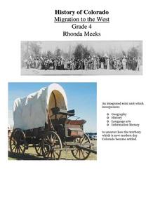
History of Colorado-Migration to the West
Fourth graders identify reasons for people moving to the Colorado Territory and examine how moving in the 1800's is different than moving today. They also practice reading maps and gathering information from maps, as well as, describe...
Curated OER
African Safari
Sixth graders gain an appreciation for the different cultures that inhabit the Earth by focusing on the people of Africa
Curated OER
The Road to World War II
Middle schoolers research the orgins and early events of World War II using online and off line resources. They conduct an interview with a local World War II veteral and present their findings to the class.
Curated OER
World War II: Bombs and Peace
Students explore the final events and end of World War II. They examine the community impact of such events as the dropping of the dropping of atomic bombs, and President Roosevelt's death. Students prepare a presentation.
Curated OER
Decision Making, Take a Seat or Get off the Bus
Fifth graders explore the positive and negative consequences of choosing to fight against discrimination. They read the story of Rosa Parks. Students discuss the movement against segregation. Students read other books about...
Curated OER
Diary of a Worm Secret Agents
Second graders explore the geography of Washington D.C. and President Bush's hometown of Crawford, Texas. They read the book, Diary of a Worm, determine the best route to go to Texas from Washington D.C., and throw a birthday party for...
Curated OER
"Across Oregon On The 45th N Parallel" A Transect of Oregon
Students explore the physical geography of Oregon. In groups, students collect weather and elevation information on Oregon. They organize the data and create maps and graphs of the information. Afterward, students compare the...
Curated OER
Northern Neighbors
Fourth graders research a province in Canada in order to compare and contrast Canada to our country. They create a HyperStudio production to display their findings.
Curated OER
Deforestation
Learners identify the different tropical rainforests in the world using a map. In this ecology instructional activity, students describe the different methods of deforestation. They create a memo and present it to class.
Curated OER
The Tilting Earth
Fourth graders use a styrofoam ball on a stick to represent earth and a light bulb in the center of the room to represent the sun. They walk around the light, holding their sticks at an angle to show the tilt of the earth's axis. They...


