Curated OER
Carve That Mountain
Students investigate major landforms (e.g., mountains, rivers, plains, hills, oceans and plateaus). They build a three-dimensional model of a landscape depicting several of these landforms. Once they have built their model, they act as...
Curated OER
Erosion: Slip Sliding Away
Fourth graders investigate the causes of erosion. Through several demonstrations including one using sugar cubes and warm water, they observe the effects of erosion. In groups, 4th graders conduct similar experiments and record their...
Curated OER
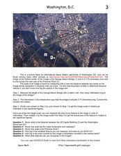
Washington D.C. from Space
In this Washington D.C. from space learning exercise, students use a picture generated by the International Space Station and they find the scale of the image. They determine the actual size of features in the image, they find the...
Curated OER
Grade 8 Unit 4
Eighth graders analyze aspirations and ideals of the people of the new nation, in terms of its physical landscapes and political divisions, and the territorial expansion of the United States during the terms of the first four presidents.
Curated OER
U.S.-Cuba Relations
Students study the history of United State/Cuba relations. In this diplomacy activity, students research selected websites to gather information regarding various topics of significance between the U.S. and Cuba since 1868. Students...
Curated OER
Surfin' the U.S.A. with Road Rabbit
Students take virtual field trips to places in the U.S.A. in conjunction with the stops made by the class mascot, Road Rabbit. As Road Rabbit
travels to his destination(s) via snail mail, so do the students via the Internet.
Curated OER
Sedimentary Rocks
High schoolers discover how sedimentary rocks form. They identify different examples of sedimentary rocks. They also discover what types of rocks are in Illinois soil.
Curated OER
The First Americans
Students participate in theatre activities to study American history. In this American history and theatre instructional activity, students work in groups to research a specific Native American group to investigate their lifestyle....
Curated OER
Europe To The Max DVD: Four Great Cities of Europe Questions
In this geography skills worksheet, students watch the video "Europe to the Max." Students then respond to 18 short answer questions about London, Amsterdam, Brussels, and Paris.
Curated OER
North Dakota Reading Comprehension
In this North Dakota reading comprehension worksheet, students read a 2-page selection regarding the state and then respond to 10 true or false questions.
Curated OER
The 50 States
Fifth graders use maps and music to learn the 50 states. In this US Geography lesson, 5th graders map out a region of the United States and practice singing the song, The 50 States that Rhyme.
Curated OER
Famous Hoosiers
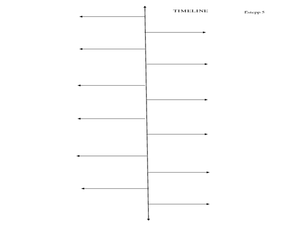
Fourth graders make a timeline about a famous person from Indiana. In this famous Hoosiers activity, 4th graders watch a PowerPoint presentation about David Letterman's life. They make a timeline using information from the presentation...
Curated OER
Comparison of American Colonies
Students explore the lifestyles of the American colonies. They conduct various activities according to their grade level including jigsaw research and creating a poster. Lesson includes primary source readings related to the topic.
Curated OER
Mississippi Under British Rule
Students construct appropriate maps to depict the following information: changes in European territorial claims as a result of the French and Indian War; boundaries of British East and West Florida; significant rivers and settlements of...
Curated OER
Wetlands/Watershed Model
Students make a model that will demonstrate the flow of surface water across the land in Texas and how materials that originate many miles away can end up in the wetland along the coast.
Curated OER
Wetlands/Watershed Model
Pupils work together to create a watershed model. They discover the flow of surface water on different topography. They examine how materials originate from miles away and end up in a different wetland.
Curated OER
Cities as Transportation Centers
Middle schoolers work in small groups to identify some of the major transportation centers, recommending two as possible sites for a national political convention, based on population density and the travel networks available in 1835.
Curated OER
Learning to Read a Regional Map
Students locate the local community, surrounding communities and major geographic features of the SE Utah and the Four-Corners region on a map, after receiving direct instruction.
Curated OER
Wetland Adaptation
Students participate in a simulation to investigate the impact of the wetland environment on the migration of birds. They discuss the patterns of migration they took and why they avoided certain wetlands.
Curated OER
Mexico: Introduction to History and Literature
Students study the geography of Mexico (i.e. major cities, surrounding countries and bodies of water, mountain ranges, rivers, volcanoes), They take turns reading aloud information provided (xerox copies) about Mexico. After each...
Curated OER
Silk Roads Big Map
Students create an oversized map from Europe to East Asia. They include information such as Silk Roads, geographical features, major cities and cultural information on their map.
Curated OER
Land Use and Nitrogen
Students consider the effects of development on water quality. They test nitrogen levels in waters before and after development, investigate wastewater treatment options and research best management practices to reduce nitrogen loads.
Curated OER
Mussel Movements
Students consider the impact of invasive species on local environments. In this ecology lesson, watch the video, Arizona Wildlife Views, which focuses on invasive species. Students develop vocabulary, relate to meaningful comprehension...
Curated OER
Water: The Liquid of Life
Sixth graders complete a lesson on the properties, types and amounts of water on Earth. In groups, they travel between stations to identify water resources in Illinois and pollution sources. They complete the lesson with a field trip...


