Curated OER
Elements of Civilization
Students create their own ancient civilizations based off of topographical maps of Egypt, Mesopotamia, the Indus Valley, and the Yellow River. In this social studies lesson, students are assigned one topographical map to use to create...
Curated OER
Mancos River Walk Newsletters
Sixth graders create newsletters of the Mancos River Walk. They gather information from the Mancos River Walk and create a newsletter detailing sections of trees, shrubs, river studies, and wildlife studies. They write stories and...
Scholastic
Perfect Postcards: Illinois
Connect the geography and history of Illinois using an art-centered lesson on the railroads. The railroad connected once-distant places, particularly in the Midwest. Using research, class members create postcards of fictional cross-state...
Curated OER
Leapin' Landmarks: Locating 10 Man-made Landmarks Around the World
Third graders label continents, oceans, and major mountain ranges on maps and use the maps to write an informational report about landmarks. In this landmarks lesson plan, 3rd graders write about 1 major landmark.
Curated OER
Civil War: Generals at the Battle of Stones River
Students explore U.S. history by creating a computer presentation in class. In this Civil War battle lesson, students read assigned text about the Battle of Stones River and research individual generals from the battles. Students utilize...
Curated OER
Erosion in Freshwater Ecosystems
Students explore the concept of sediment pollution. In this erosion instructional activity, students discuss the process of erosion and determine how sediment pollution affects animals that live in freshwater ecosystems. Students respond...
Curated OER
The Carter Center’s Work in Sub-Saharan Africa
Students explore the state of Sub-Saharan Africa. In this geography skills lesson, students examine the work of the Carter Center in Africa as they investigate the strengths and weaknesses of linguistic, tribal, and religious...
Curated OER
Ethnic Culture and Identity in the Columbia River Basin, 1850-1950
Students explore cultural history of immigrant groups that settled in the Columbia River Basin from 1850 to World War II, and examine various primary sources to explore role cultural and social customs played in keeping alive immigrant...
Curated OER
African Americans in the Columbia River Basin
Learners research the Columbia River Basin Ethnic History Archive (CRBEHA) and use a variety of primary sources to explore the history of blacks in the region.
Curated OER
Maps
Maps, globes, and computer software aid young explorers as they locate state capitols, major cities, geographic features, and attractions for states they are researching. They then use desktop publishing software to create a map to share...
Curated OER
On the Surface
Students draw and label the 15 major rivers in Texas. They then draw and label another map with the major lakes and reservioirs of Texas. Students use the maps and locate and label the location of the following major Texas cities:...
Curated OER
Natural Disasters and the Five Themes of Geography
Have your class do research on natural disasters and create a presentation using this resource. In completing this activity, learners apply the five geography themes to their research. They write a paper describing their results. It's a...
Owl Teacher
Teach Ancient Civilizations: Africa
Amazing! Teach learners about the wonders of ancient Africa and Asia with a comprehensive set of teaching tools. You'll click to find a well-constructed presentation, a worksheet that has kids compare and contrast ancient alphabets, a...
Curated OER
Map on the Wall
Students examine the Ogallala aquifer water storage facility, identify rivers that refill the aquifer, and locate major cities near by. Students make maps of the area.
Curated OER
Three Mapping Activities
Students label three maps of China after being introduced to background information about the country. For this geography lesson, students color two maps and label various points of interest in China. Finally, students draw...
Curated OER
Where in the World Is ...
Students locate and place countries and continents on a large map using tag board and yarn. They locate a new geographic location on the map each morning.
Tech Know Teaching
6th Grade Constructed Response Question
Graphs, charts, maps, diagrams. Reading and comprehending informational text is far more than just decoding the words on a page. Here's a packet that provides young readers with practice answering constructed response questions using...
Global Oneness Project
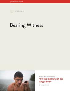
Bearing Witness
A controversial construction project in South America, the Belo Monte dam, is endangering local cultures, ecosystems, and communities. High schoolers create a concept map based on an online article they read before engaging in...
Curated OER
Microscopic Water Life
Students use a light microscope to observe the organisms living in a sample of ocean or fresh water. Students create a drawing of the organisms that they observe. Students then discuss the different body plans of the organisms and the...
NOAA
Ocean Geologic Features
Sediment samples from the ocean bottoms tell scientists about climate change, pollution, and changes in erosion for the area. Groups of learners focus on sediments and their movement through water. During a hands-on activity, they...
Curated OER
T3 Lesson Plan: Number 3
Sixth graders investigate local water. In this water cycle activity, 6th graders take samples from surrounding water sources. Students record data from the samples, compare and graph the results.
Curated OER
We've Gotcha Covered: The Iowa Insurance Story
Analyze the relationship between financial risks and the growth of the insurance industry in Iowa. Learners work in groups to analyze the major catastrophic events that occurred in their community. Several worksheets are included.
Curated OER
My Water's Place in Space
Pupils discover their absolute and relative place in space relative to water and create a book sequencing that space from most specific to most general.
Curated OER
Of Maps and Worldviews
Young scholars explore Ptolemy's world map as an expression of the Renaissance view of the world.


