Curated OER
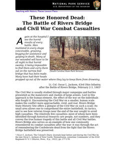
These Honored Dead: The Battle of Rivers Bridge and Civil War Combat Casualties (94)
High schoolers write creative accounts of the Battle at Rivers Bridge after studying historic accounts and looking at images in this series of activities.
Curated OER
Sharing The Land
Students investigate different geographical terms and concepts. This is done with practicing with maps of the United States to find major coasts, lakes, and rivers. They also put together a floor map of the United States. Students create...
Curated OER
Civil War: Generals at the Battle of Stones River
Students explore U.S. history by creating a computer presentation in class. In this Civil War battle lesson, students read assigned text about the Battle of Stones River and research individual generals from the battles. Students utilize...
Curated OER
What is the history of rice in the United States?
Fifth graders become familiar with the history of rice and create a board game. In this rice lesson, 5th graders understand the history of rice through the playing of a game. Students use vocabulary words related to the...
Curated OER
Add and Subtract with Hudson River shipping
Rivers aren't just a place for animals to live, they also provide industrial transportation. The class will examine the Hudson River on a map, discuss all the commercial vessels that use the River to transport materials, then complete a...
National Wildlife Federation
Hot, Hotter, Hottest: Extreme Weather's Impact on Our Resources
How dry is it? It's so dry, the river only runs twice a week! Through an analysis of maps and discussions, pairs learn about droughts across the United States in the ninth of 12 lessons. They then read about, answer questions, analyze...
Curated OER
Finding River Cities
Using a wall map, students will find major rivers in the four regions of the United States. Then they answer questions about how people use natural resources, such as rivers.
Curated OER
Major American Water Routes
Sixth graders locate and identify the major bodies of water and waterways in the United States. Through a simulation activity, they describe how early explorers would have described their surroundings. Working in groups, they create...
Curated OER
Grade 8 Unit 4
Eighth graders analyze aspirations and ideals of the people of the new nation, in terms of its physical landscapes and political divisions, and the territorial expansion of the United States during the terms of the first four presidents.
Curated OER
Indiana Travel Guide
Fourth graders share their information about their home state. In this research lesson plan, 4th graders use graphic organizers to make a travel guide about the state of Indiana. This lesson plan could be modified for use with any state,...
Curated OER
Using Different Kinds of Maps
Third graders explore the landforms and population diversity. They read maps and examine geographic terms. Students create their own map of the United States and answer questions about the location of people. After exploring the map, 3rd...
Curated OER
Zebra Mussels
In this zebra mussels worksheet, 7th graders read an article about zebra mussel populations in United States' lakes and rivers. Students read about the negative effects and some positive results and then answer several questions about...
Curated OER
Maps
Maps, globes, and computer software aid young explorers as they locate state capitols, major cities, geographic features, and attractions for states they are researching. They then use desktop publishing software to create a map to share...
Curated OER
The Mighty Mississippi River
Students acquire in-depth knowledge of the geographic significance of the Mississippi River. They identify and expand their knowledge of the role of the river in the development of cities. Finally, students gain insight into the ways...
Curated OER
Do You Really Know What Wealth Is?
Students explore what it means to have wealth in Mali and in the United States. In this economics lesson, students read "Music in the Fields." Student groups answer discussion questions. Students reflect on the purpose music serves...
Curated OER
State Poster Fair: US Geography, Social Science, Art
Students research a US state, design and construct a state 'poster' to display important facts about that particular state. They present their work to the class.
Stanford University
Chinese Immigration and Exclusion
The Chinese Exclusion Act was the first race-based restriction on immigration in American history. Why was the act passed after Chinese immigrants helped build the Transcontinental Railroad? A series of documents, including speeches and...
Curated OER
Mapping West Virginia
Fourth graders explore West Virginia. In this Unites States geography instructional activity, 4th graders discuss the type of land and the cities in West Virginia. Students create two overlays, with transparencies, that show the natural...
Curated OER
Indiana Travel Guide
Fourth graders, after exploring and researching the state of Indiana, create a travel guide about the state of Indiana including its capital, major rivers, governors and two famous people from the state. They utilize a variety of art...
Curated OER
Coasts
Students explain the different types of marine coasts and where they are located in the United States and its territories. They explain and identify some of the life forms that inhabit different marine coastal regions.
Curated OER
Chesapeake Bay
The Chesapeake Bay is the largest estuary in the United States. Explore its origins, organisms, and contributing rivers with this PowerPoint. It opens with several slides of general information on the formation of estuaries, then it...
Curated OER
Second Graders Create Their Own Social Studies Book (Part I, The 5Ws of the Constitution)
Students study the United States Constitution and create a year-long cumulative activity for social studies. In this social studies lesson, students complete activities throughout the year to learn the 5Ws for the United States...
Curated OER
North Carolina Salt Dough Map Social Studies Project
In this lesson, North Carolina Salt Dough Map, 4th graders create a salt dough map of North Carolina, Students use dough to form the shape of the state of North Carolina. Students label the three regions of North Carolina and all of...
Curated OER
Do You Really Know What Wealth Is?
Young scholars examine what it means to have wealth-a concept that turns out to be philosophical as well as economic-and examine the importance of music. They examine the concepts of wealth in Mali and in the United States and consider...


